Active Archive of Large Floods, 1985-Present
Master Index of Inundation Maps
Satellite River Discharge Measurements

Recent Mapping Work (2011-2012)
Birecik Dam, Euphrates River, Turkey
Zambezi River - Modis 250 change
detection
Source Data from The European Space Agency ERS SAR
-
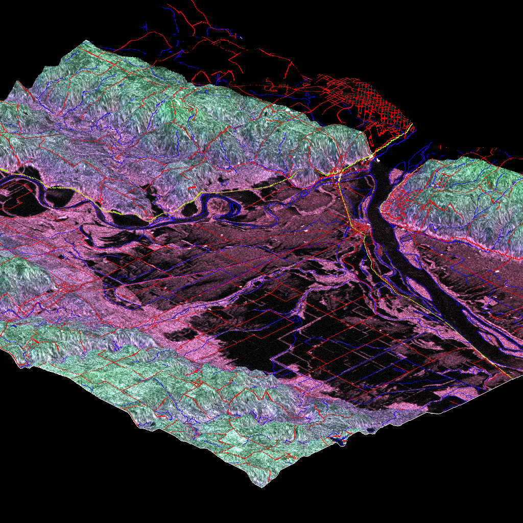
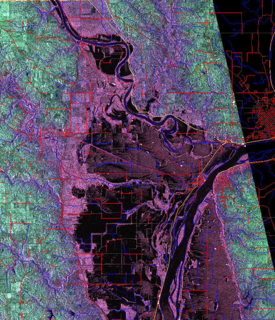
Des Moines River - Mississippi River, 16 July 1993 (Keokuk, Iowa, USA) - Enhanced Radar Images of the Midwest USA Great Flood of 1993. Views of the confluence of the Des Moines River with the Mississippi at Keokuk, Iowa. The images were processed by Emily Bryant.
3-dimensional image
Planimetric image -
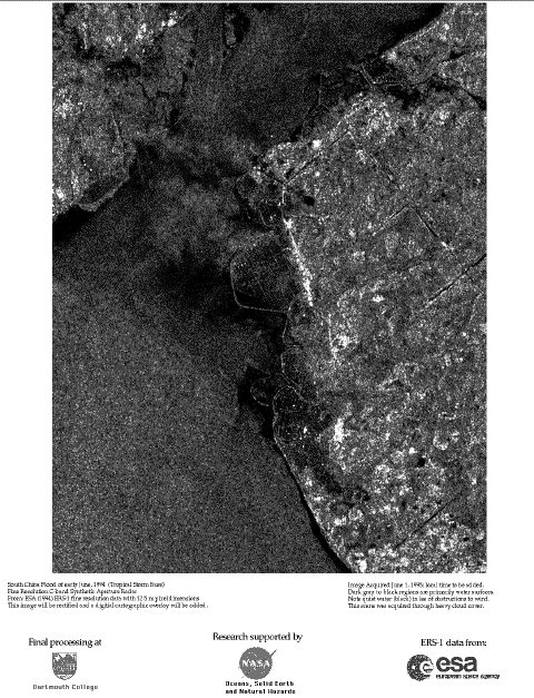
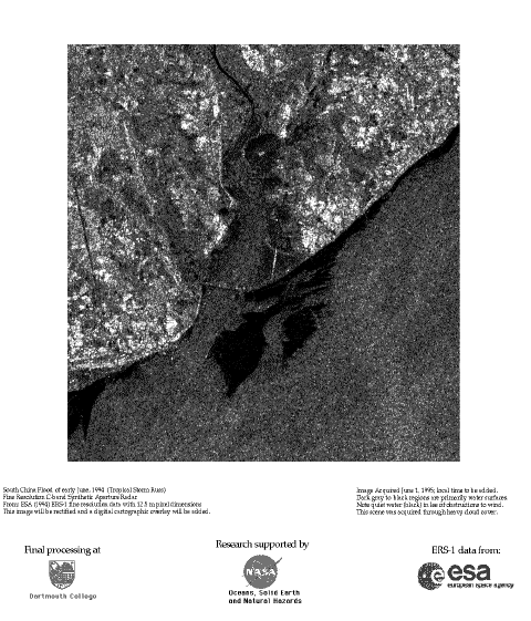
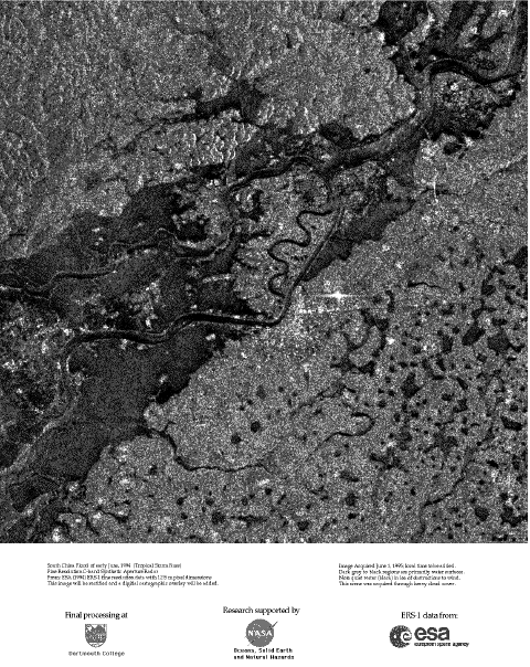
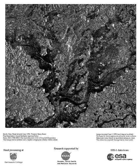
Tropical storm Russ, June 1994 (Southern China coast) - SAR Images (Large Area and Detail) of Coastal Flooding
Subscene 1
Subscene 2
Subscene 3
Subscene 4
-
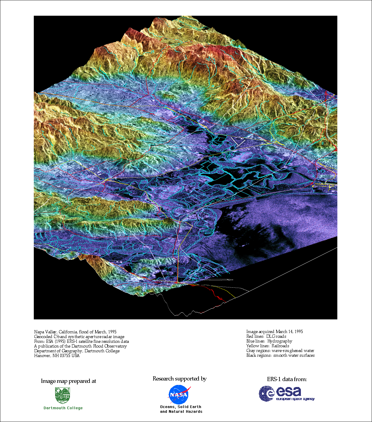
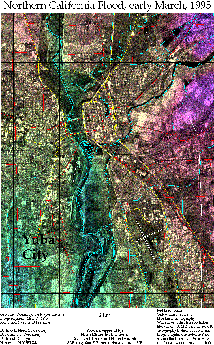
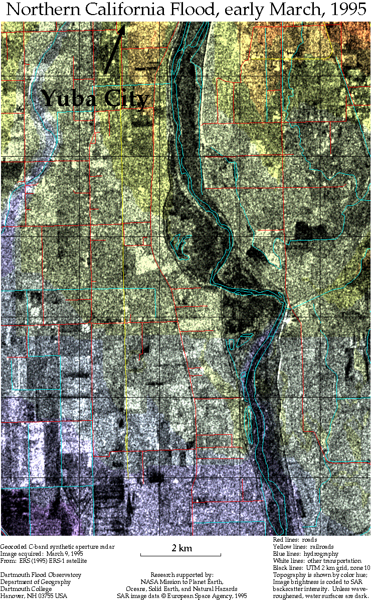
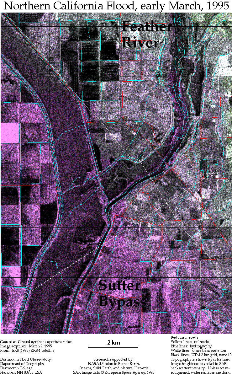
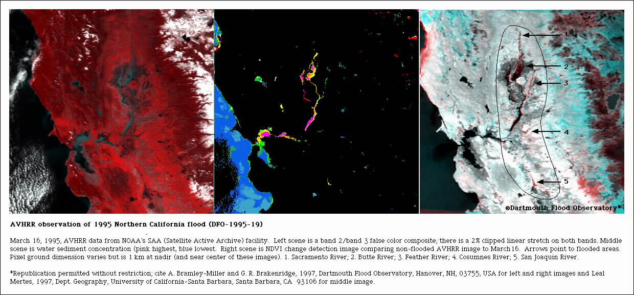
DFO1995-019, March 1995 (Napa and Sacramento Rivers, Northern California, USA) - Enhanced ERS-1 Radar Images (3-D and Planimetric) of Northern California Flooding, 1995. The images were processed by Emily Bryant.
Napa River (3-dimensional)
Napa River (planimetric)
Sacramento River (north part of Yuba City, CA)
Sacramento River (south part of Yuba City, CA)
Sacramento River (Feather River and Sutter Bypass, CA)
-
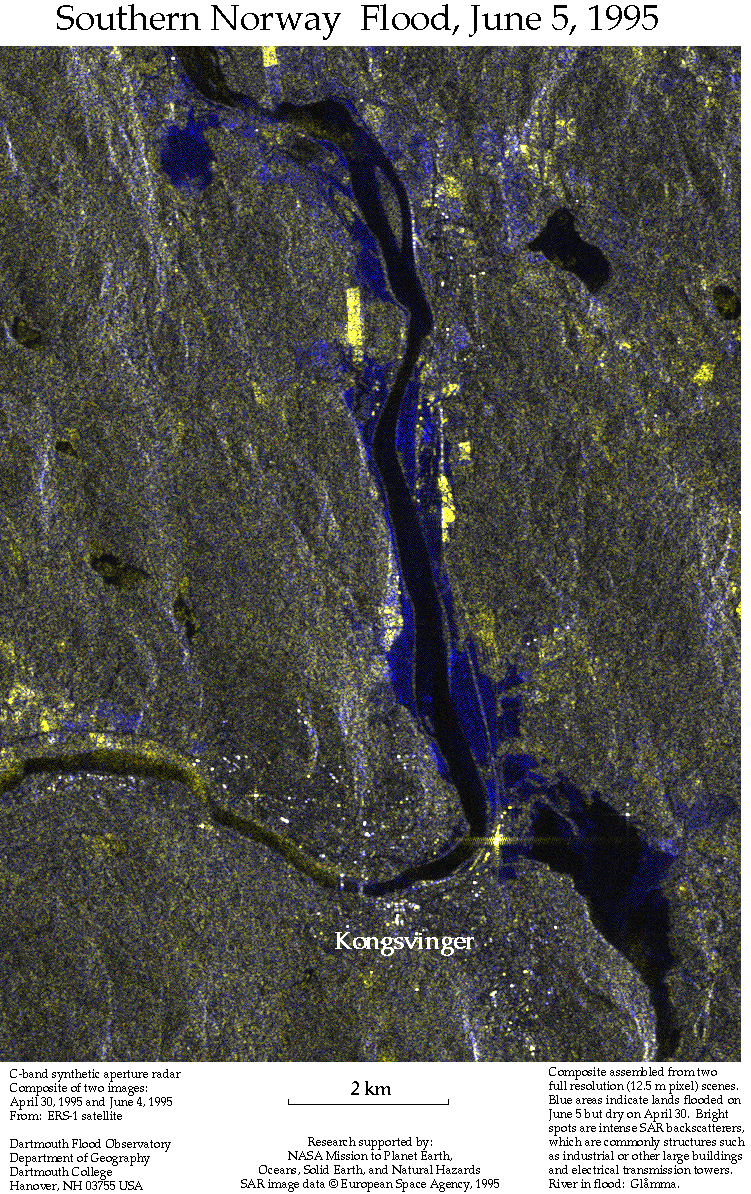
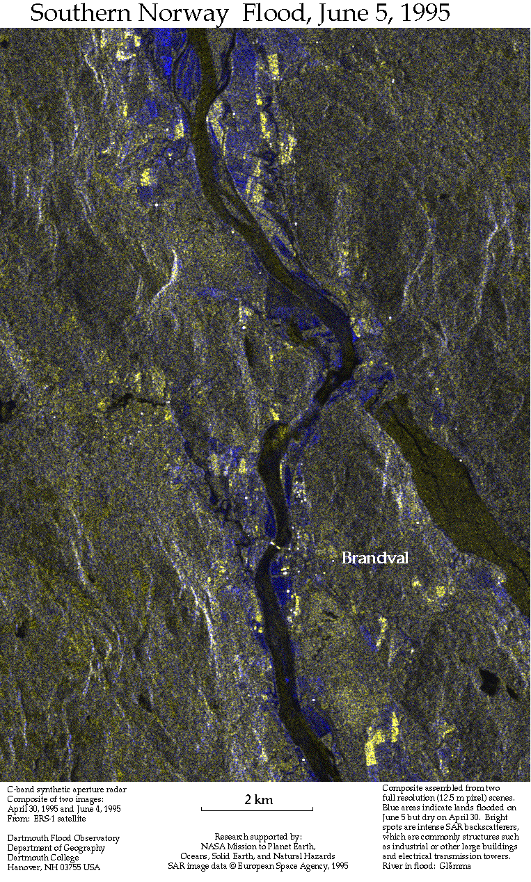
DFO1995-055, June 1995 (Glomma River basin, Norway) - ERS-1 SAR images used in a paired image, change detection: before and during the Great Flood
-
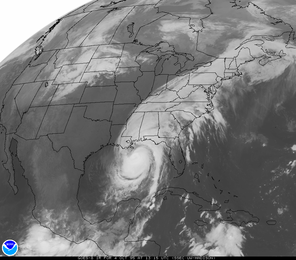
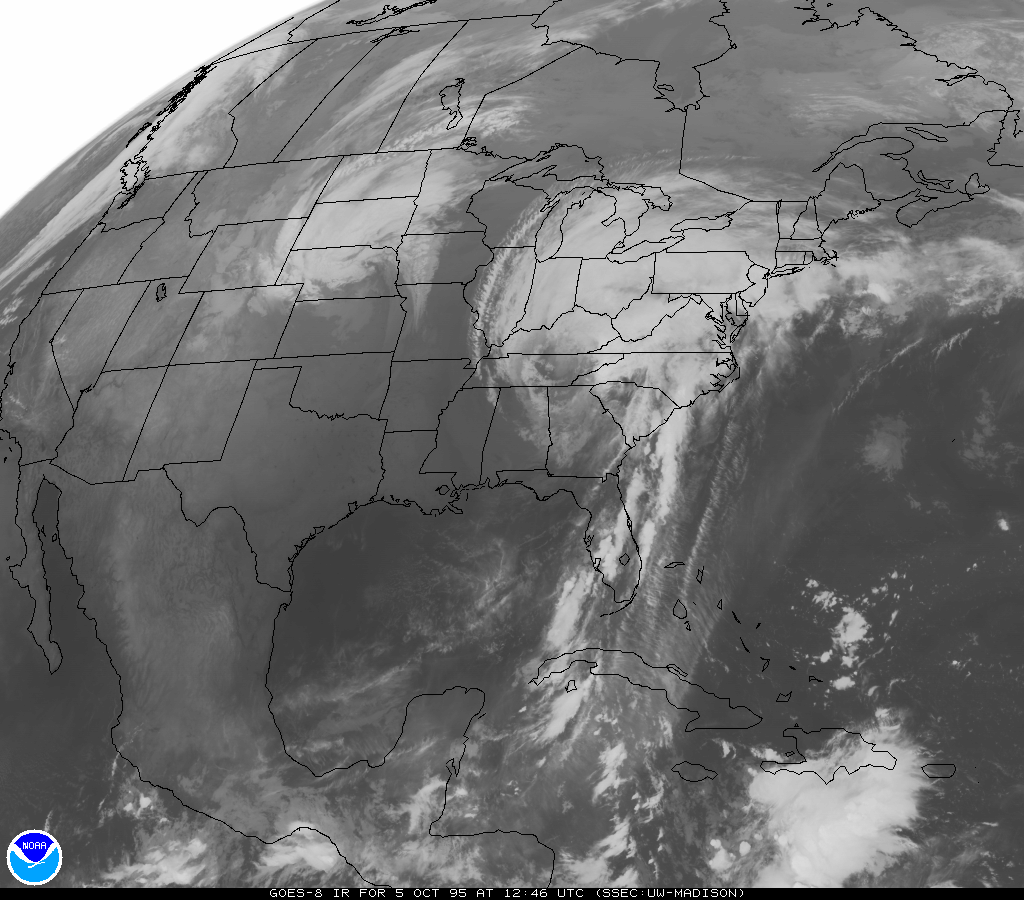
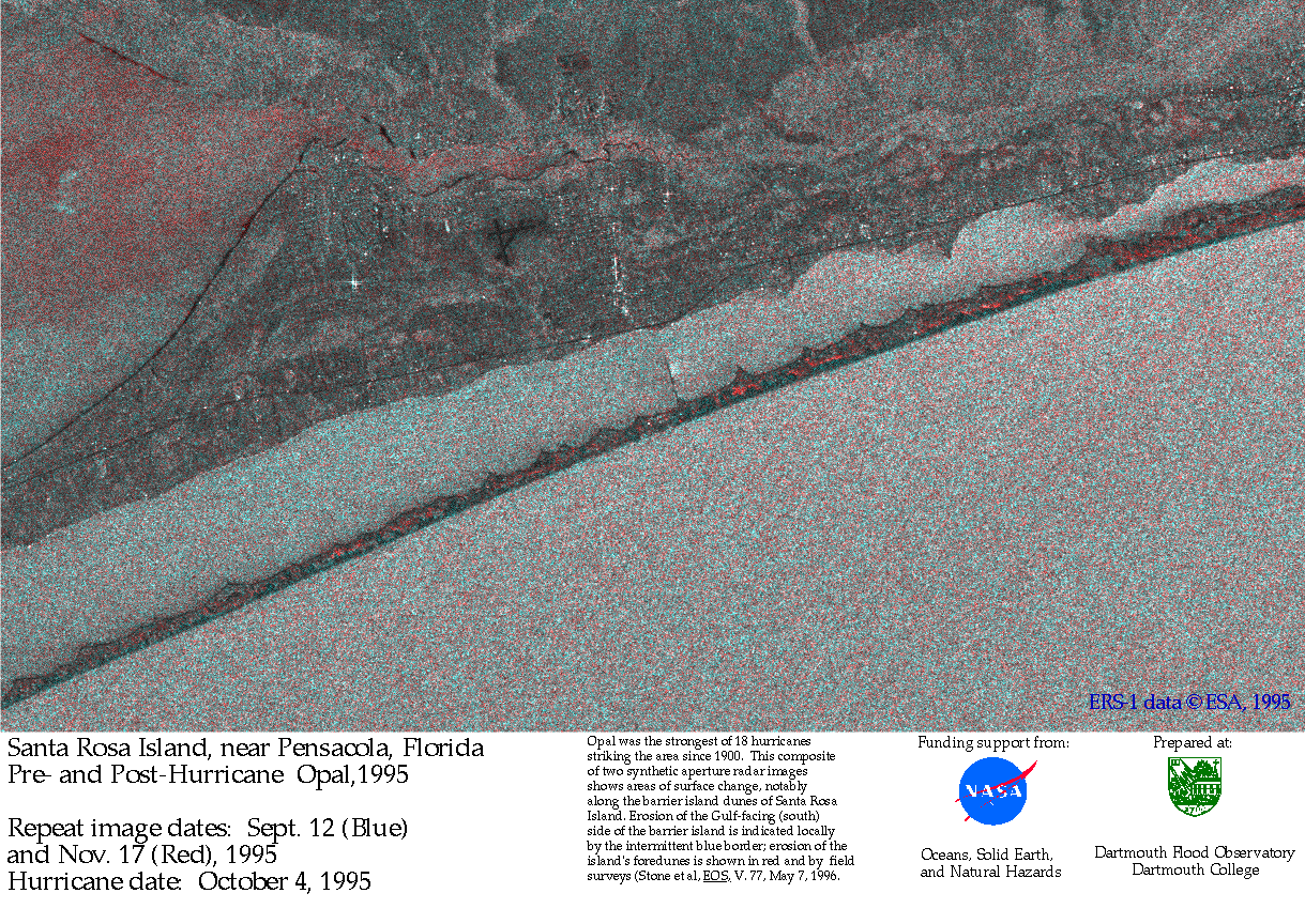
DFO1995-134, October 1995 (Hurricane Opal, southeastern USA) - GOES (Weather Satellite) Infrared and ERS SAR Change Detection Imagery of Hurricane Opal, 1995
GOES image 4 October 1995
GOES image 5 October 1995
Change detection image, Pensacola FL -
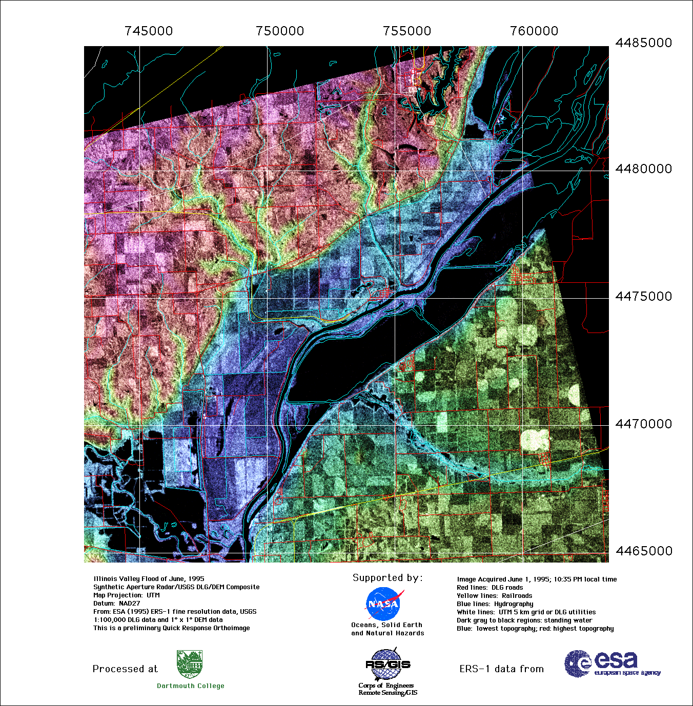
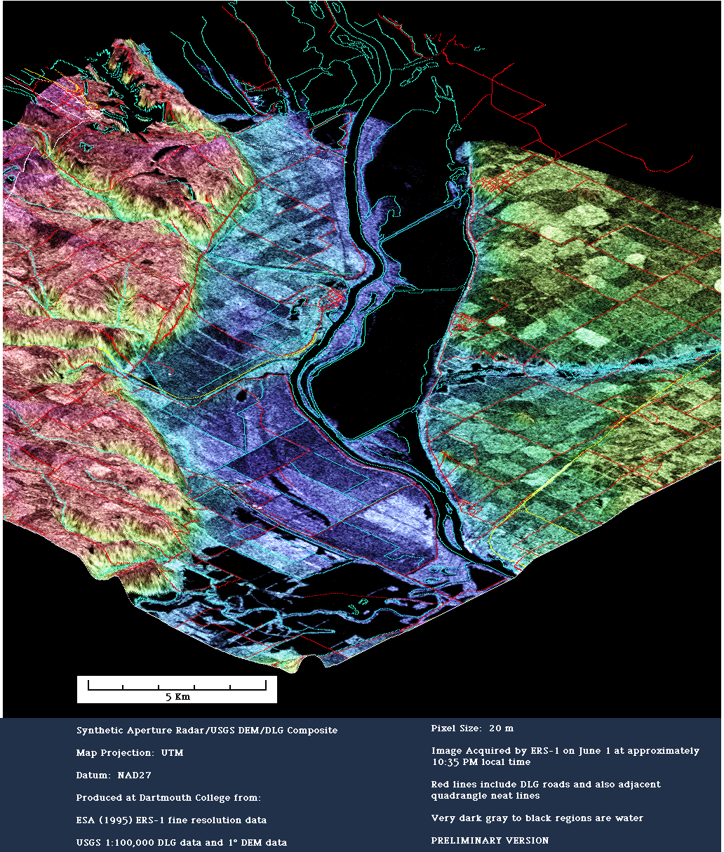
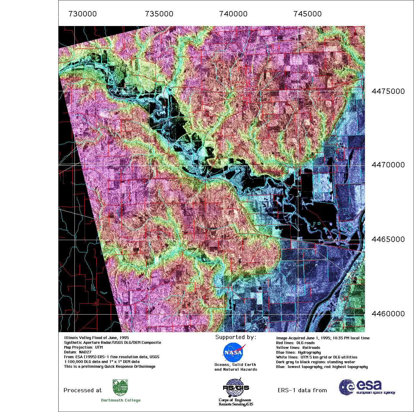
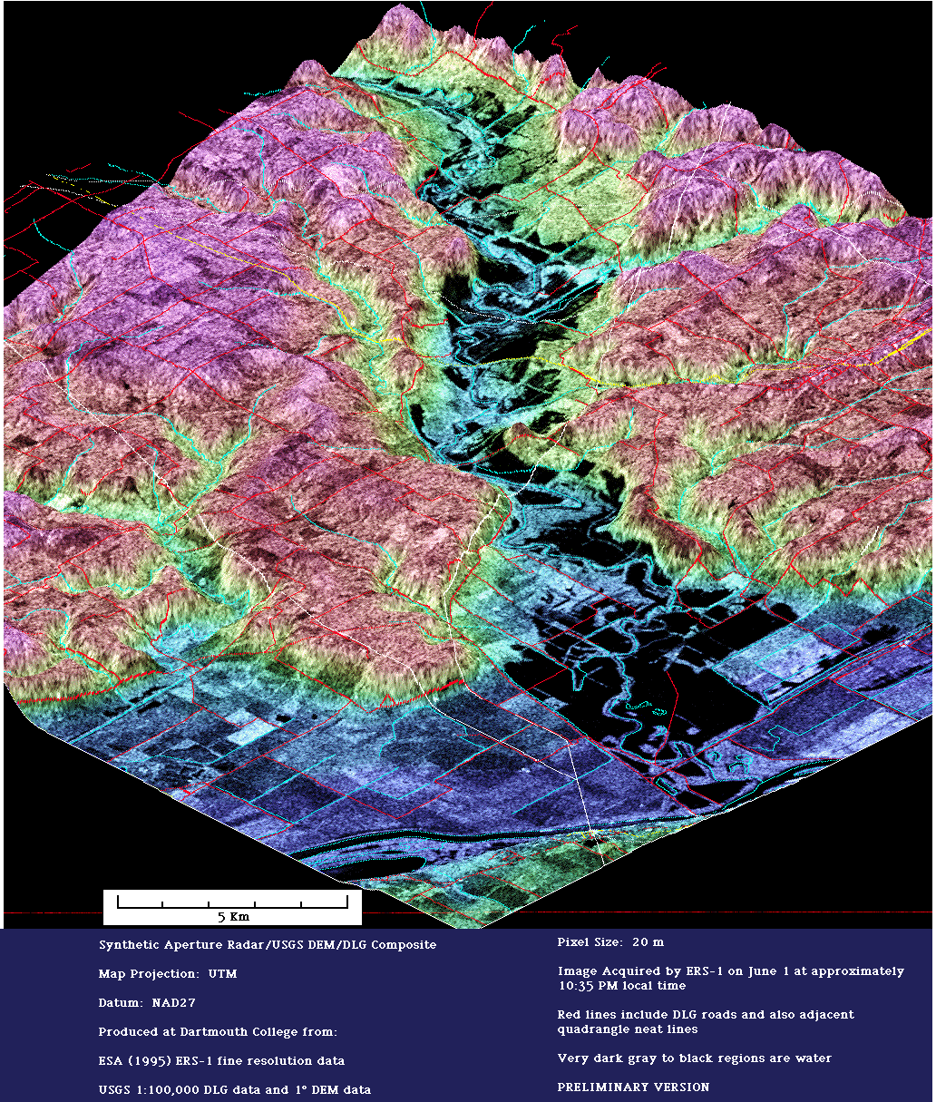
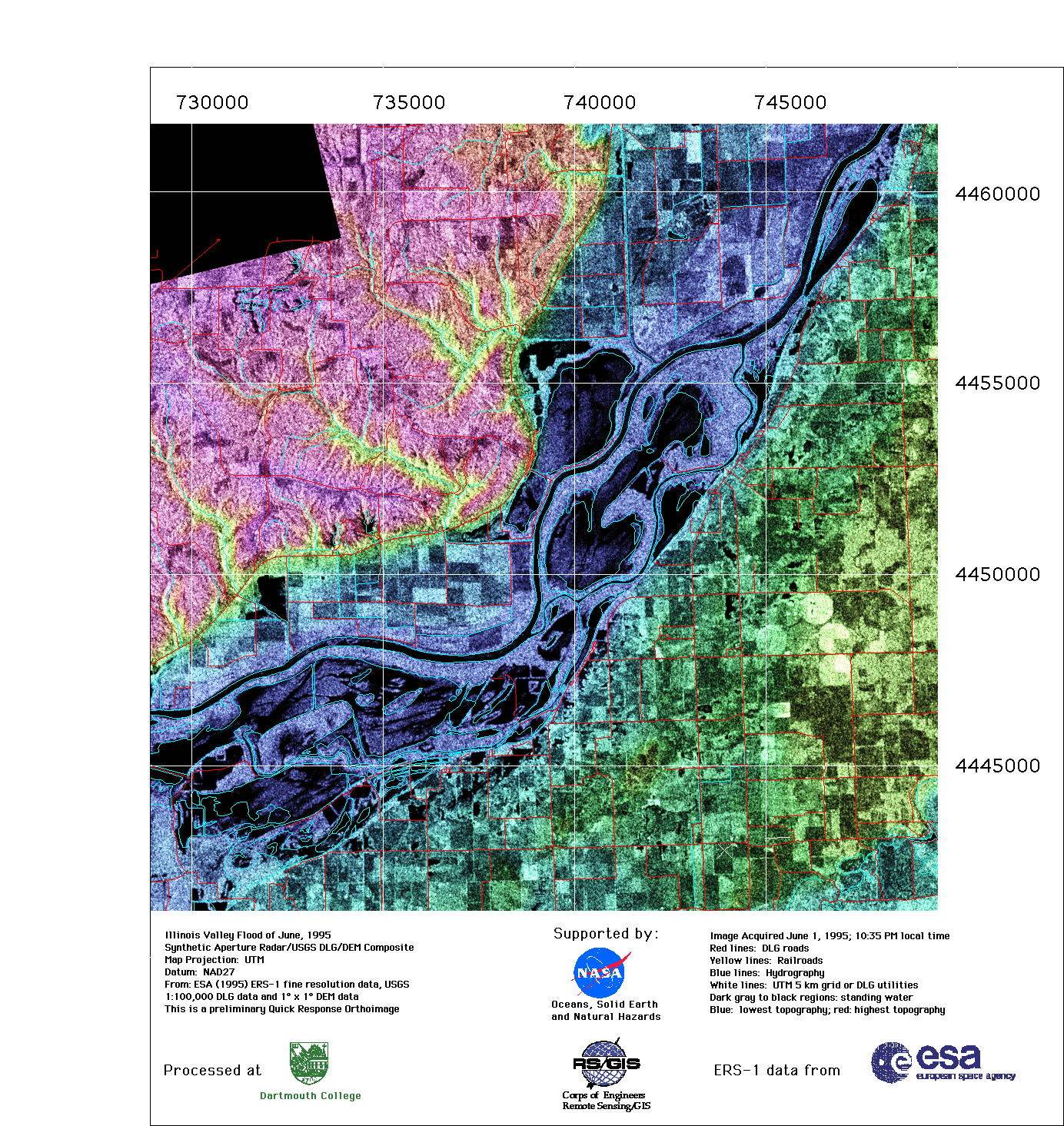
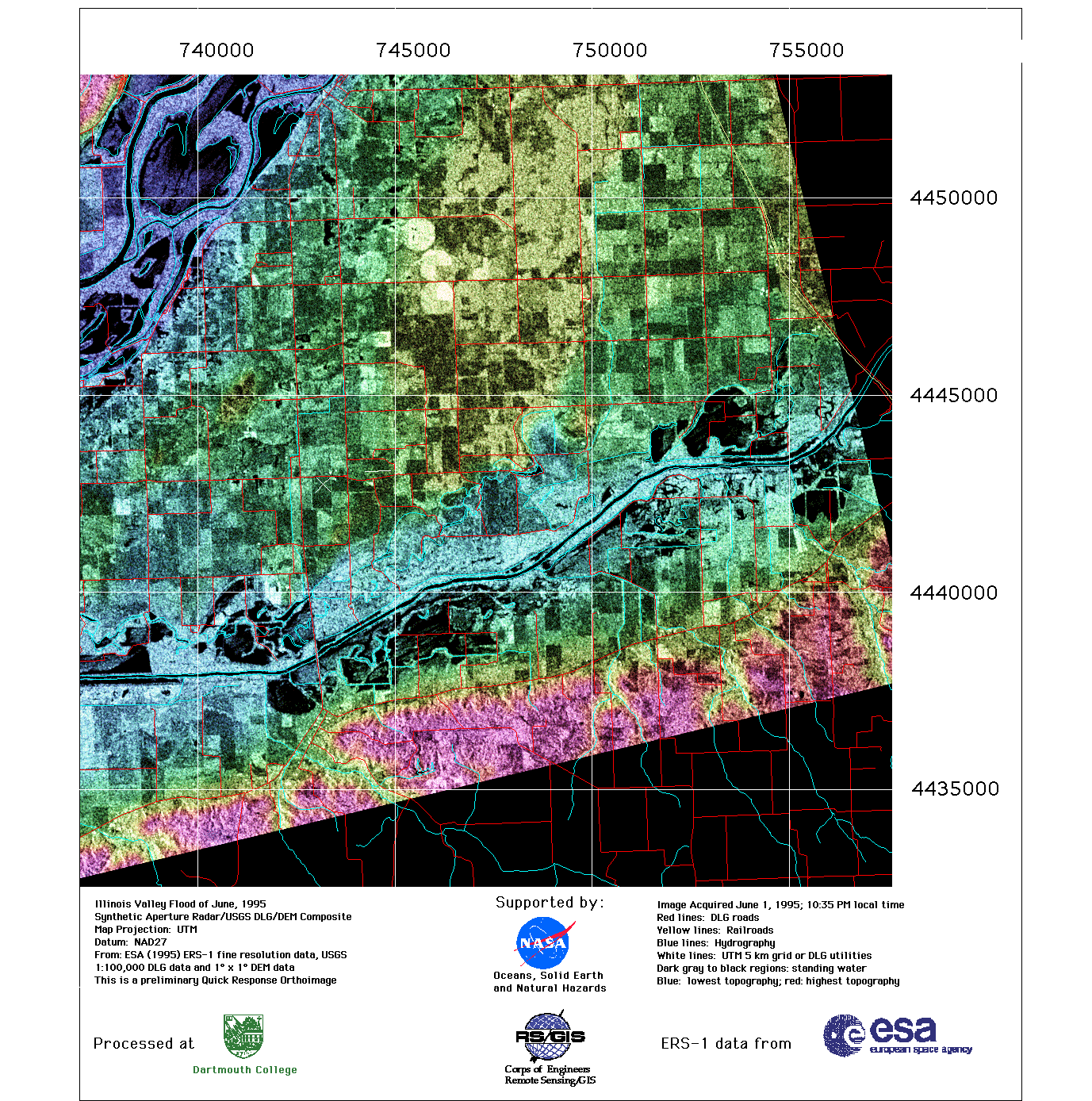
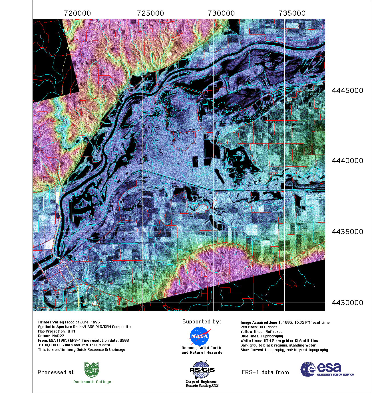
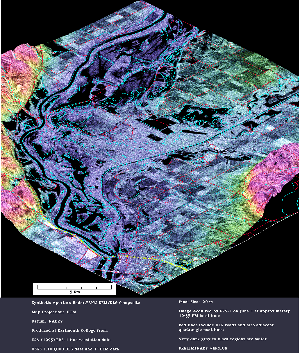
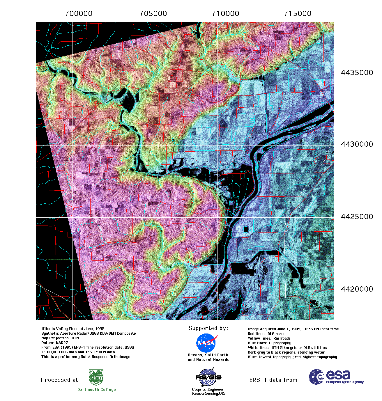
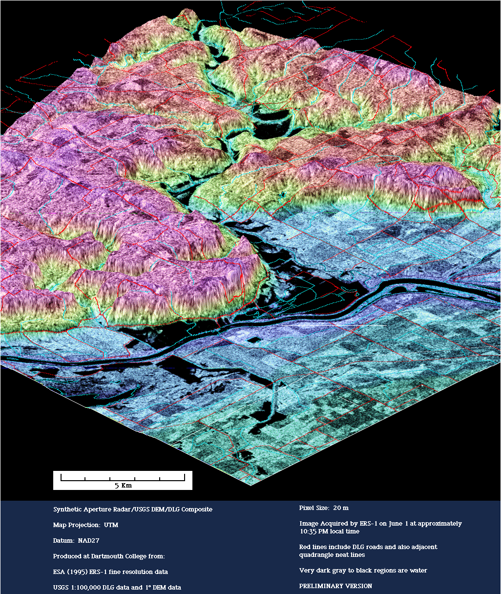
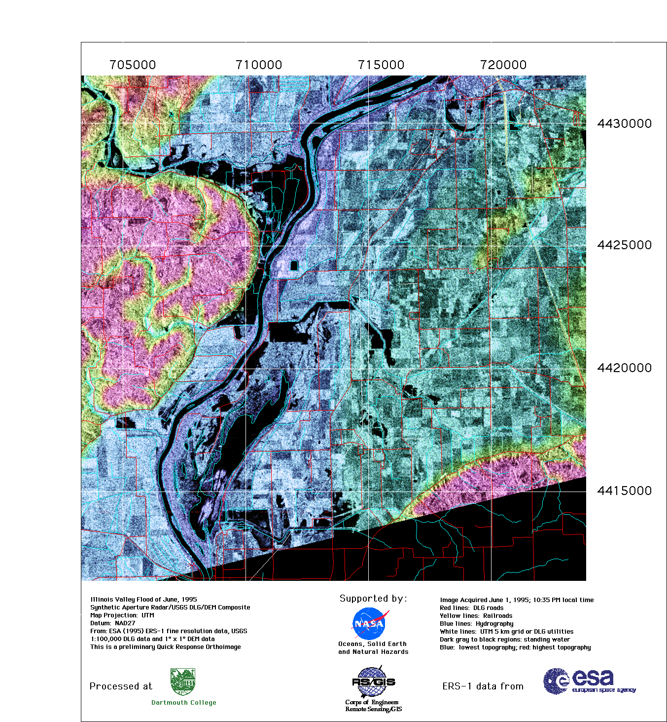
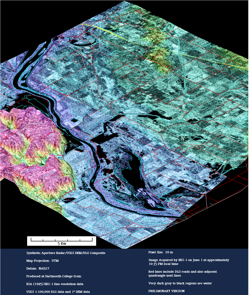
Illinois River near Beardstown, 1 June 1995 (Illinois, USA) - Enhanced Radar Images of Midwest Flooding. ERS SAR data of the Beardstown Illinois area (orbit 20290, frame 801) were acquired June 1, 1995 at 10:35 pm (local time). The images were processed by Emily Bryant. ERS SAR data are copyright ESA, 1995.
The following scenes of the Illinois River are in downstream order.
Illinois River at Chautauqua, Illinois, June 1, 1995
Illinois River at Chautauqua in 3d, June 1, 1995
Spoon River-Illinois River at Havana, Illinois June 1, 1995
Spoon River-Illinois River in 3d, June 1, 1995
Illinois River at Bath, Illinois, June 1, 1995
Illinois River at Bath in 3d, June 1, 1995
Sangamon River-Illinois River at Browning, Illinois, June 1, 1995
Sangamon River-Illinois River in 3d, June 1, 1995
Sangamon River, June 1, 1995
Sangamon River in 3d, June 1, 1995
LaMoine River-Illinois River downstream of Beardstown, Illinois, June 1, 1995
LaMoine River-Illinois River in 3d, June 1, 1995
Illinois River at Meredosia, Illinois, June 1, 1995
Illinois River at Meredosia in 3d, June 1, 1995
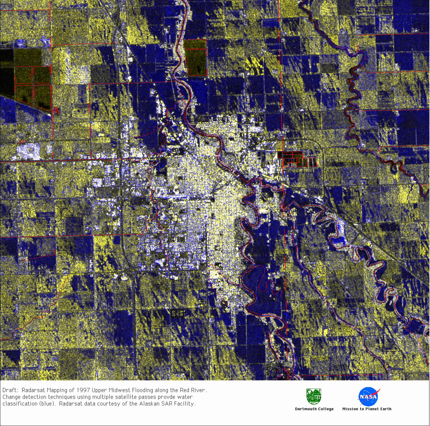
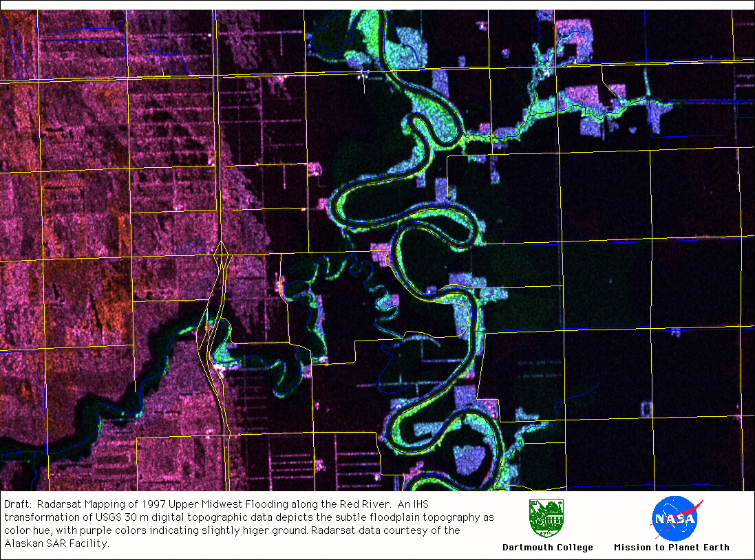
Source Data From the Canadian/American Radarsat SAR
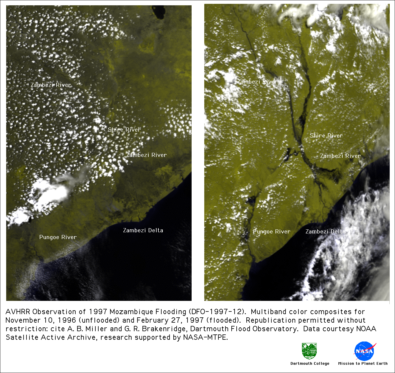
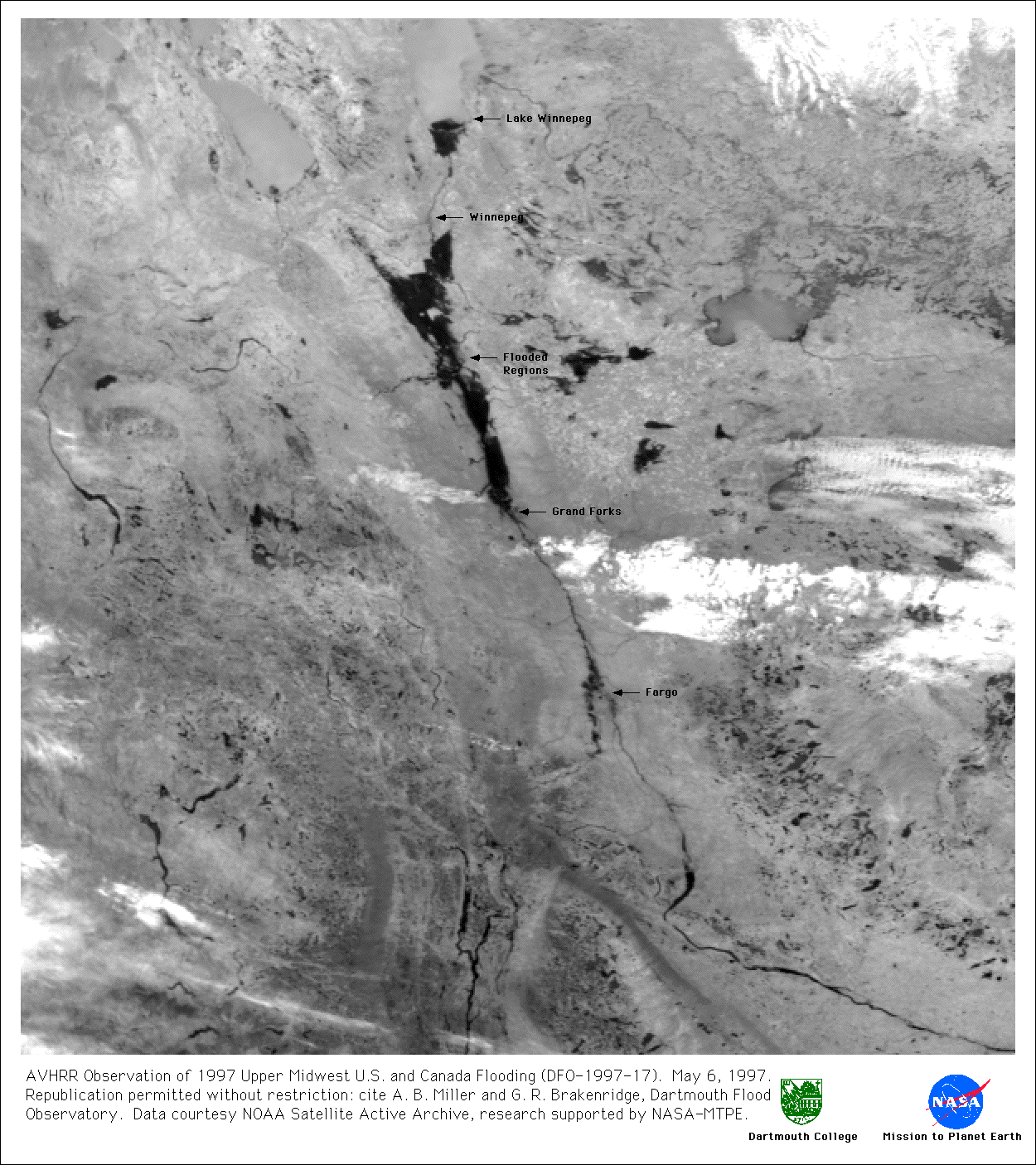
Source Data From NOAA AVHRR
This work is made possible by data acquired by NASA, the Japanese Space Agency, and the European Space Agency, and funding support from NASA and the European Commission, through the Global Disaster Alert and Coordination System (GDACS) project, Joint Research Centre, Ispra, Italy. The Observatory was founded in 1993 at Dartmouth College, Hanover, NH USA and moved to the University of Colorado, INSTAAR, CSDMS in 2010. The institutional support of both universities is gratefully acknowledged.
http://floodobservatory.colorado.edu/Flood Observatory