Discharge:Station 000254: Difference between revisions
From DFO – Flood Observatory
DFO Kettner (talk | contribs) No edit summary |
DFO Kettner (talk | contribs) Update discharge for AreaId=2041 |
||
| Line 5: | Line 5: | ||
|AreaId=2041 | |AreaId=2041 | ||
|LongTermDischarge=33.7 | |LongTermDischarge=33.7 | ||
|LastObservationDateDischarge= | |LastObservationDateDischarge=01-12-2025 | ||
|LastObservationDischarge= | |LastObservationDischarge=160.2 | ||
|DischargeFlowStatus= | |DischargeFlowStatus=2 | ||
|DischargeDataLink=https://hallo.com | |DischargeDataLink=https://hallo.com | ||
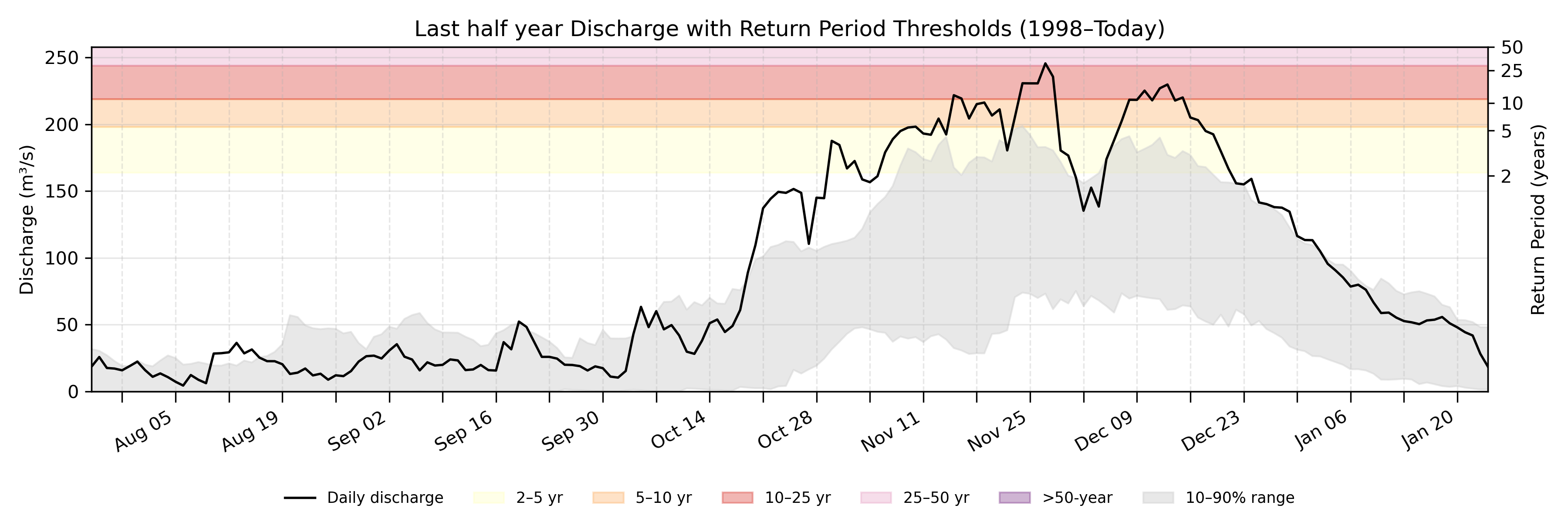
|DischargeDailySummary=On | |DischargeDailySummary=On December 01, the historical discharge typically ranges from 75.2 m<sup>3</sup>/s to 159.8 m<sup>3</sup>/s (between the 10<sup>th</sup> and the 90<sup>th</sup> percentiles). Today's discharge is 160.2 m<sup>3</sup>/s. | ||
|DischargeCoordinatesPoint=14.0, 79.8 | |DischargeCoordinatesPoint=14.0, 79.8 | ||
|DischargeGEOJSONpoly= | |DischargeGEOJSONpoly= | ||
|DischargeNotes= | |||
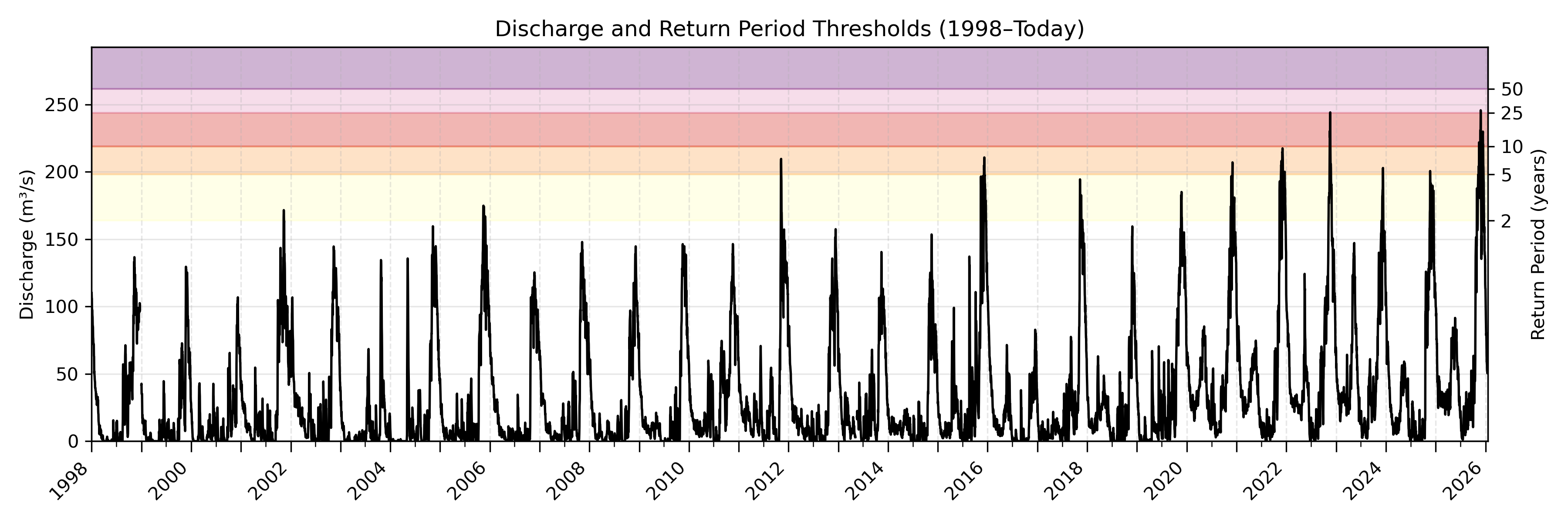
|DischargeDetailPlot=2041_halfyeardischarge.png | |DischargeDetailPlot=2041_halfyeardischarge.png | ||
|DischargeEntirePlot=2041_entirerecorddischarge.png | |DischargeEntirePlot=2041_entirerecorddischarge.png | ||
}} | }} | ||
Revision as of 19:04, 1 December 2025
| River | Swarnamukhi |
| Country | India |
| AreaId | 2041 |
| LongTermDischarge | 33.7 m3/s |
| LastObservationDateDischarge | 01-12-2025 |
| LastObservationDischarge | 160.2 m3/s |
| DischargeFlowStatus | 2 |
| DischargeDataLink | download data |
| DischargeDailySummary | On December 01, the historical discharge typically ranges from 75.2 m3/s to 159.8 m3/s (between the 10th and the 90th percentiles). Today's discharge is 160.2 m3/s. |
| DischargeGEOJSONpoly | |
| DischargeNotes |
Location where discharge is determined.