Discharge:Station 000074: Difference between revisions
From DFO – Flood Observatory
DFO Kettner (talk | contribs) Update discharge for AreaId=233 |
DFO Kettner (talk | contribs) Update discharge for AreaId=233 |
||
| Line 4: | Line 4: | ||
|AreaId=233 | |AreaId=233 | ||
|LongTermDischarge=100.8 | |LongTermDischarge=100.8 | ||
|LastObservationDateDischarge= | |LastObservationDateDischarge=29-11-2025 | ||
|LastObservationDischarge= | |LastObservationDischarge=191.4 | ||
|DischargeFlowStatus= | |DischargeFlowStatus=3 | ||
|DischargeDataLink=https://hallo.com | |DischargeDataLink=https://hallo.com | ||
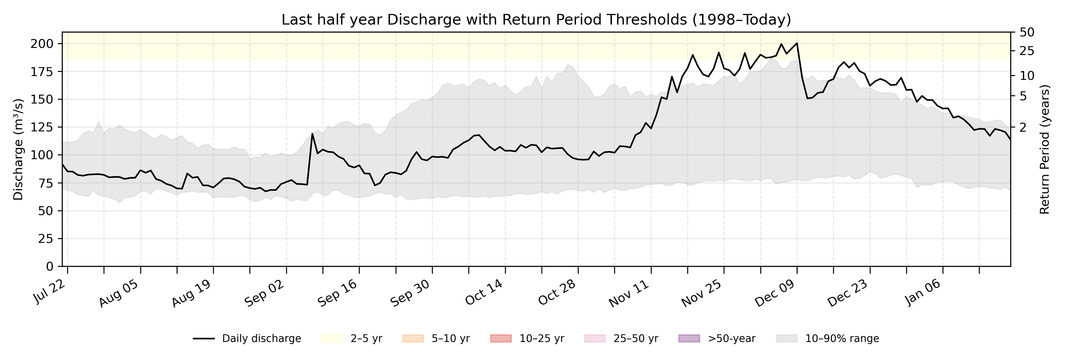
|DischargeDailySummary=On November | |DischargeDailySummary=On November 29, the historical discharge typically ranges from 77.2 m<sup>3</sup>/s to 167.3 m<sup>3</sup>/s (between the 10<sup>th</sup> and the 90<sup>th</sup> percentiles). Today's discharge is 191.4 m<sup>3</sup>/s. | ||
|DischargeCoordinatesPoint=15.2, 102.4 | |DischargeCoordinatesPoint=15.2, 102.4 | ||
|DischargeGEOJSONpoly= | |DischargeGEOJSONpoly= | ||
|DischargeDetailPlot=233_halfyeardischarge.png | |||
|RiverName=Mun | |||
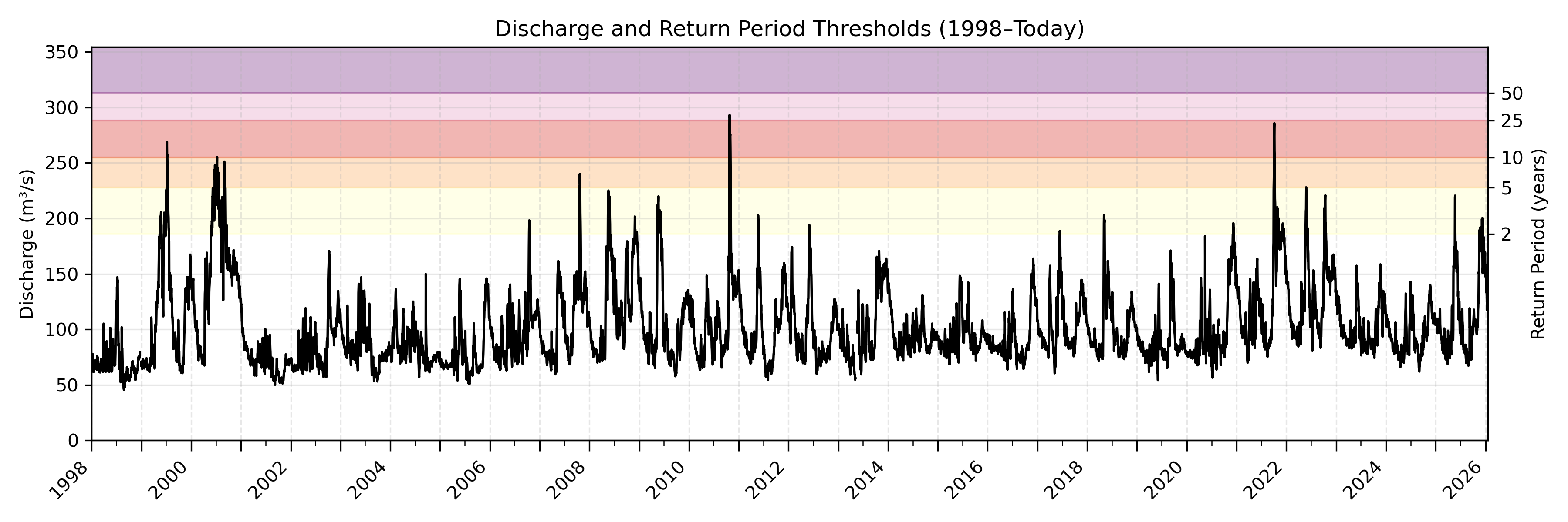
|DischargeEntirePlot=233_entirerecorddischarge.png | |DischargeEntirePlot=233_entirerecorddischarge.png | ||
|DischargeNotes=}} | |||
| | |||
Revision as of 09:46, 29 November 2025
| River | Mun |
| Country | Thailand |
| AreaId | 233 |
| LongTermDischarge | 100.8 m3/s |
| LastObservationDateDischarge | 29-11-2025 |
| LastObservationDischarge | 191.4 m3/s |
| DischargeFlowStatus | 3 |
| DischargeDataLink | download data |
| DischargeDailySummary | On November 29, the historical discharge typically ranges from 77.2 m3/s to 167.3 m3/s (between the 10th and the 90th percentiles). Today's discharge is 191.4 m3/s. |
| DischargeGEOJSONpoly | |
| DischargeNotes |
Location where discharge is determined.