

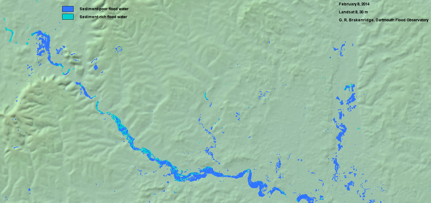
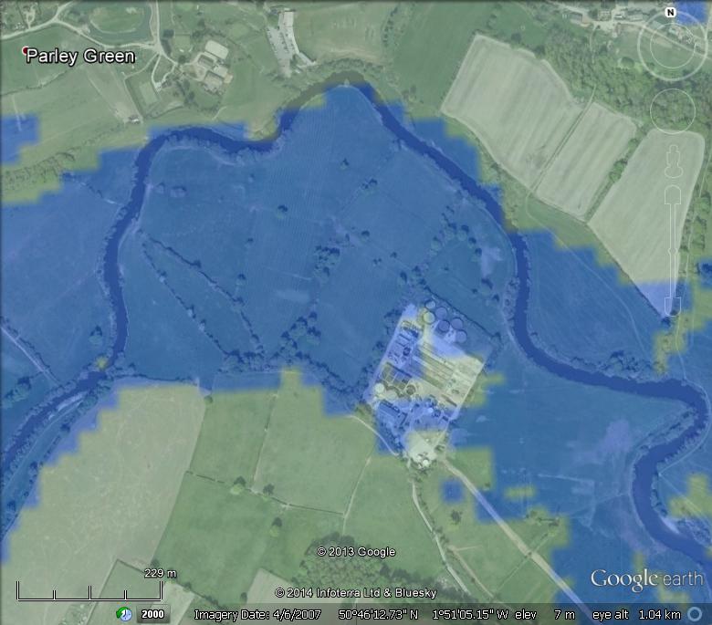
Bands 6, 5, and 3 of Landsat 8 at 30 m spatial resolution were used to map flooding February 8, 2014 near Bournemouth, UK. Above, the complete area mapped. Below, a saved enlarged view from the results in Google Earth format, showing invasion of sewage treatment facilities south of Parley Green.
Retrieve Google Earth kmz file to view entire area
Return to Flood Event Home Page