Citation: Brakenridge, G.R., Kettner, A.J., Slayback, D. and Policelli, F., DFO Rapid Response Maps for Event #4111, Dartmouth Flood Observatory, University of Colorado, Boulder, CO, USA (http://floodobservatory.colorado.edu/index.html).Maps and associated data are available for public use and licensed under a Creative Commons Attribution 3.0 Unported License,
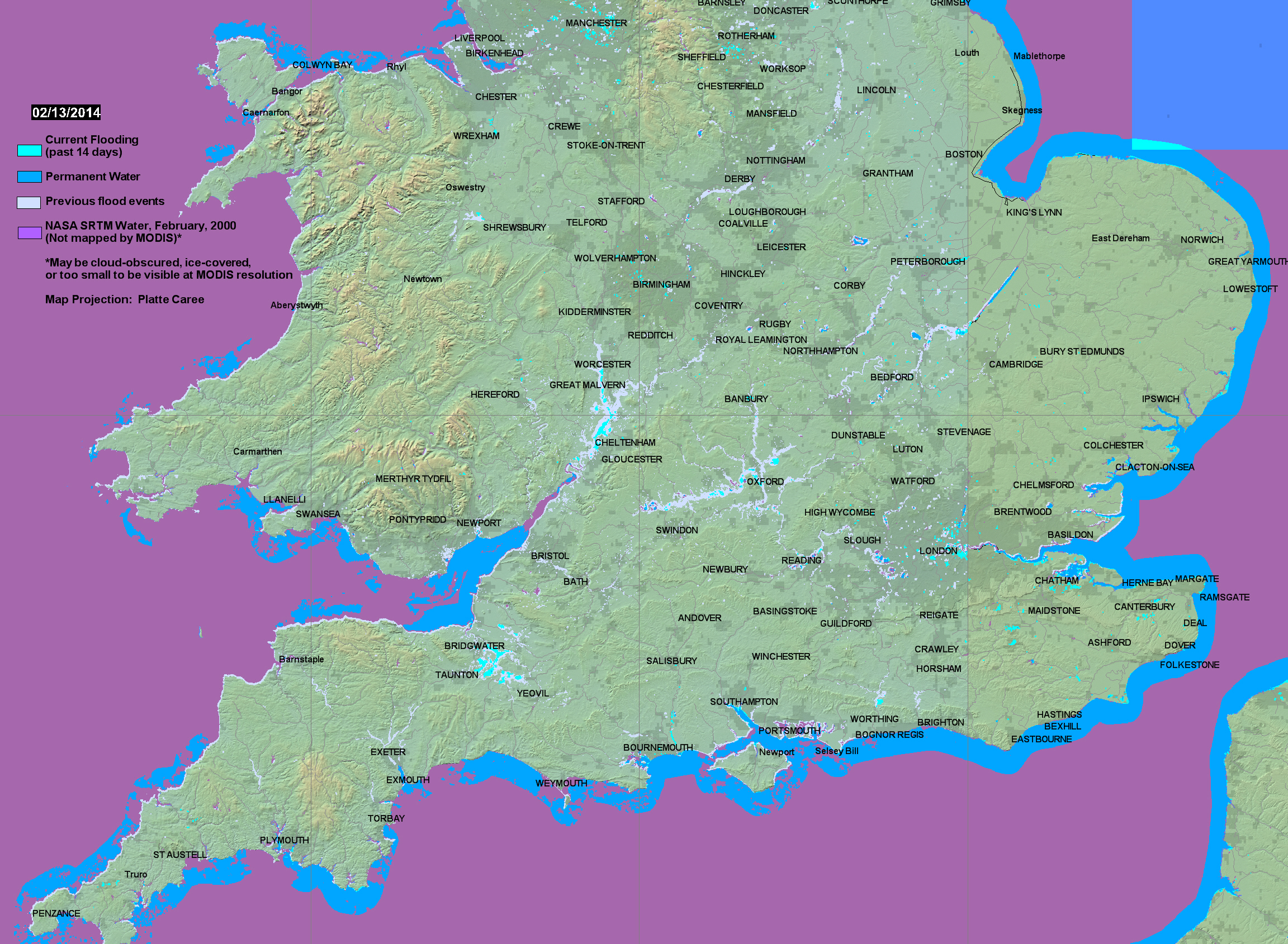
Below is current surface water extent based on NASA MODIS data at a spatial resolution of 250 m, and the observed flood history (2000 to present).Please see the Guide for detailed examples.
Twice-daily imaging (Terra-MODIS and Aqua-MODIS) of surface water is accumulated over 14 days to remove nearly all cloud obscuration. The map date refers to a two week period ending on that date.
Data Access: A daily-updated 14-day accumulation .shp (and associated GIS files) is named "current" and is provided in the MODISlance_2wkpro directory. Also, Click here for access to the automated daily .shp file GIS record (record commences in 2011). Choose map sheet directory and appropriate dates to retrieve surface water changes of interest. See also NRT Global MODIS Flood Mapping from NASA, and other technical information.
Notes for this display: 1. Despite the filtering process developed for "daily" (actually, running forward daily, three day, six image data are used, cloud shadow noise persists in this high latitude area in winter. This noise can be identified as scattered water pixels outside of drainage ways and lakes. 2. The 14 day compositing process in this region is also not enough to remove cloud cover obscuration entirely; for example, along much of the coast.