

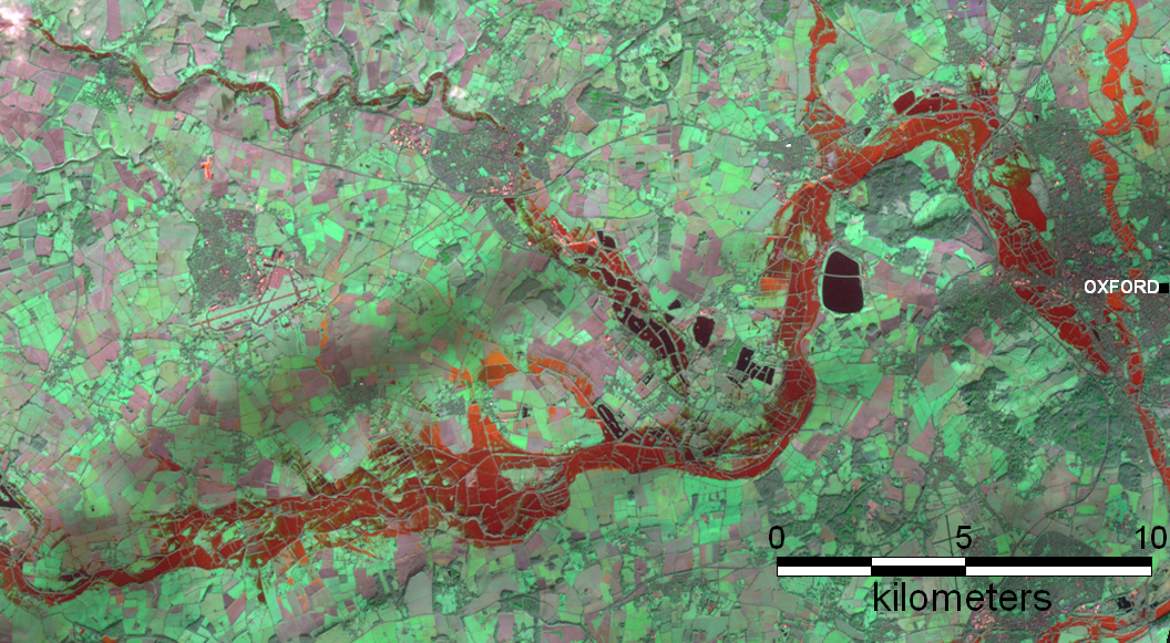
Bands 4, 3,and 2 at 30 m spatial resolution were used in this subscene from a Landsat 8 image acquired January 7. Red is water along the Upper Thames. See slides also.
From January 7, 2014:
Upper Thames
Middle Thames
Upper Cherwell
Lower Cherwell
Return to MODIS Rapid Response Map