

Data Credits: Landsat 8 data are provided by the United States Geological Survey Hazards Data Distribution System (http://hdds.usgs.gov/hdds2/). Landsat 8 is jointly managed by NASA and the United States Geological Survey.
Method of water/land classification and map production.: 1) Landsat bands 3 (green), 0.53-0.59; 5 (near infrared), 085.-0.88; and 6, (short-wave infrared), 1.57-1.65, of the Operational Land Imager (OLI) sensor were used. 2) The following processing steps are performed to produce classified water pixels: a) Using Envi™, the three channels are read into a multispectral display, as blue, green, and red, respectively, b) The image is interactively "stretched" to produce the qualitatively most clear depiction of clear water, sediment-rich water, and land; that on-screen image is saved into a three band tif file (examples provided for each area display), c) The isodata unsupervised classifier is applied to that tif file, using 3 iterations, and 7 to 13, minimum and maximum, number of classes. Commonly, this results in a clear water class, including also (misclassified) dark cloud shadows and some urban areas, and a sediment-rich water class (as validated by visual comparison of the source image to the classification product). d) GIS (.shp files) are then produced within Envi™ and outline the preliminary clear water and sediment-rich water areas. e). Within GIS software, the polygons are displayed over the tif image, and, when time permits, evident cloud shadow-sourced and other error polygons are deleted. This method is designed for rapid, operator-assisted transformation of Landsat image data into map information.
Citation: Brakenridge, G.R., Kettner, A.J., Slayback, D. and Policelli, F., DFO Detailed Rapid Response Maps for Event #4111, Dartmouth Flood Observatory, University of Colorado, Boulder, CO, USA (http://floodobservatory.colorado.edu/index.html). Maps and associated data generated at DFO are available for public use and licensed under a Creative Commons Attribution 3.0 Unported License,
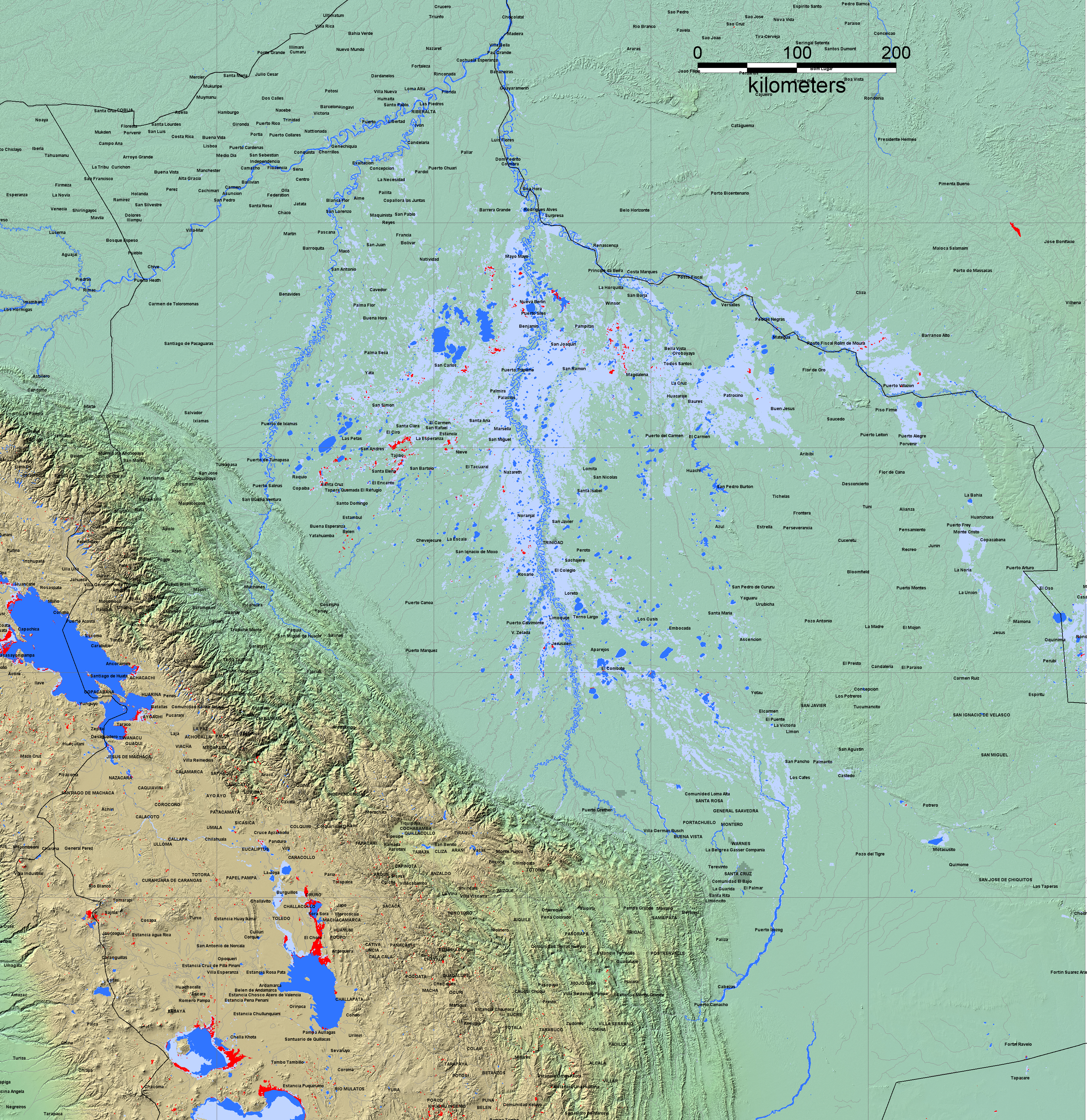
Pending addtion of a map key: Light blue gray: previously mapped flooding, 2000 to present; blue, permanent water; red, new water observed by MODIS during period January 1, 2014-February 14, 2014.
Return to MODIS Rapid Response Map