Active Archive of Large Floods, 1985-Present
Master Index of Inundation Maps
Dynamic Atlas of the Earth's Surface Water
Ganges/Brahmaputra Regional Flood Management Information System

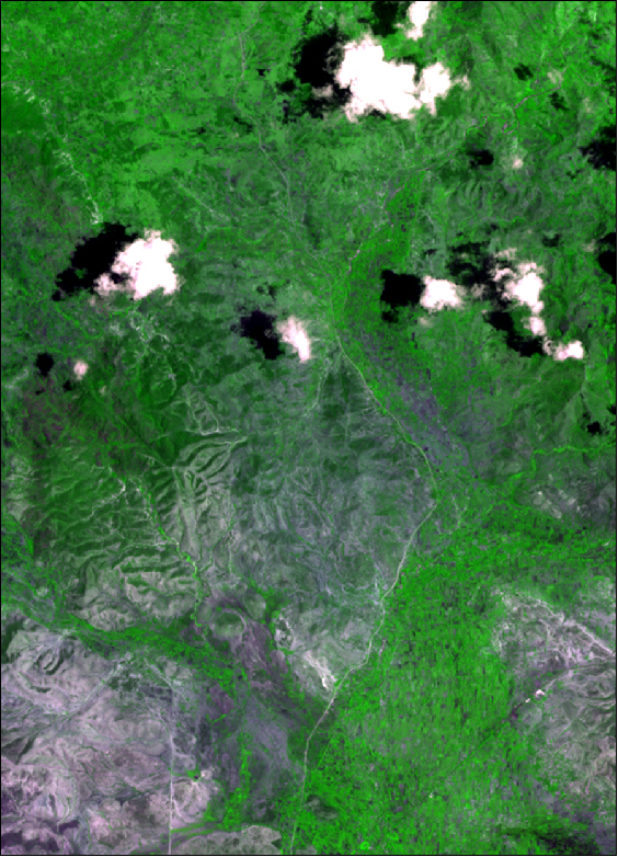
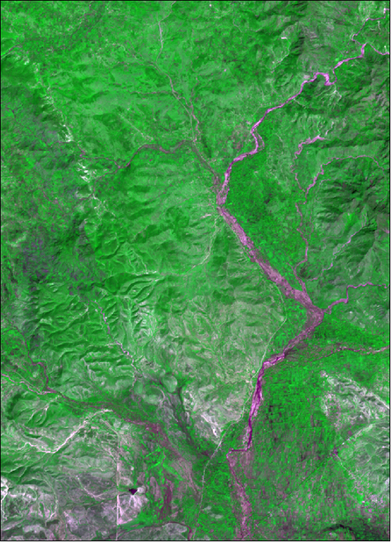
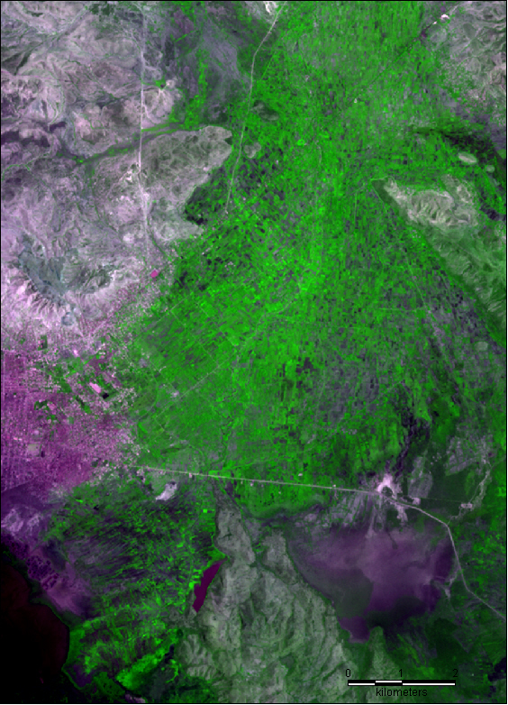
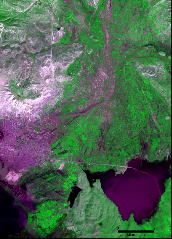
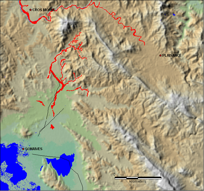
The following pairs of images illustrate a major drainage upstream of the heavily damaged city of Gonaives, Haiti that was responsible for catastrophic flooding in this coastal town. On the left is shown pre-hurricane conditions (8-August-2001) and on the right those following Tropical Storm Jeanne (image is for 26-September-2004).
The flooding originated in the highlands, and scoured a new channel as wide as 500 m (.3 mile) over a length of approximately 15 km (9 miles), upstream of the city. The comparison images downstream clearly show the path of the water and sediment into the city. See also http://earthobservatory.nasa.gov/Newsroom/NewImages/images.php3
Click and download images to acquire full resolution jpeg files.
New maps will be posted here soon.
ASTER image data provided courtesy Jesse Allen and based on expedited data provided through NASA/GSFC/MITI/ERSDAC/JAROS, and the U.S./Japan ASTER Science Team. We thank also Holli Riebeek, NASA's Earth Observatory
Upstream
Downstream
Location map showing post-storm erosion (red) and selected roads and water.
This work is made possible by data obtained by NASA, JAXA, ESA, and other space agencies. Funding support is from the Earth Surface and Interior Focus Area and the Applied Sciences Program, Science Mission Directorate, NASA, and from the European Commission, through the GDACS project, Joint Research Centre, Ispra, Italy. We acknowledge Dartmouth College, Department of Geography, and the CSDMS Facility, University of Colorado, Institute for Arctic and Alpine Research (INSTAAR) for office and computer support.
http://floodobservatory.colorado.edu