


![]()
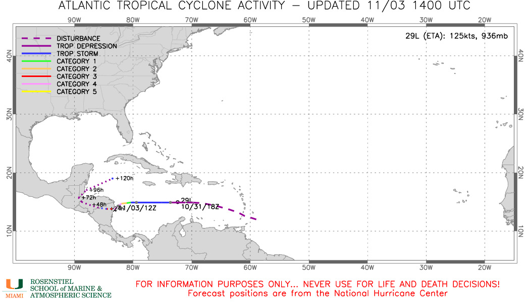
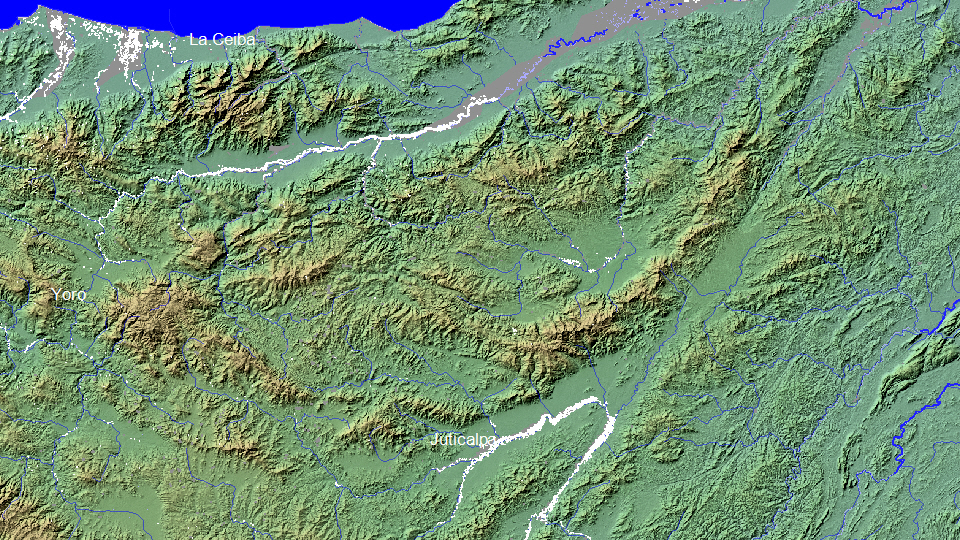
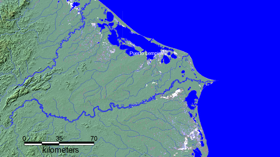
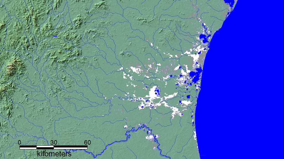
"Central America – Dozens Feared Dead as Hurricane Eta Triggers Landslides and Floods 6 November, 2020 by Richard Davies in Americas, News Rain brought by the remnants of Hurricane Eta continues to caused destructive flooding and landslides in Central America, with dozens of people feared dead. Heavy rain and wind damage was previously reported in Nicaragua and Honduras after Hurricane Eta made landfall on 03 November 2020. Guatemala’s Instituto Nacional de Sismología, Vulcanología, Meteorología e Hidrología (INSIVUMEH) reported heavy rain on 04 November, in particular in Puerto Barrios in Izabal department which saw 296.4mm of rain fall in 24 hours. Over half of the city is thought to have been flooded as a result. The country’s disaster authority CONRED reported around 100 incidents of flooding and landslides as of 05 November, affecting 55,000 people and displacing 2,277. According to a report of 05 November by the UN’s Office for the Coordination of Humanitarian Affairs (OCHA) most of the incidents are due to flooding in Alta Verapaz, Izabal and Petén. A state of emergency has since been declared in 9 of the country’s 22 departments: Izabal, Petén, Chiquimula, Quiché, Alta Verapaz, Zacapa, El Progreso, Jutiapa and Santa Rosa. CONRED reported 5 fatalities and 3 people missing as of 05 November. However, the death toll is likely to rise further after landslides in Huehuetenango, where at least 12 people reportedly died, and in San Cristóbal Verapaz in Alta Verapaz Department, where 25 people are feared dead. CONRED reported over 55,000 people were affected by Hurricane Eta Honduras The UN’s Office for the Coordination of Humanitarian Affairs report that 360,000 people have been affected in Honduras and at least 3,600 displaced, as of 05 November. Flooding has left dozens of villages cut off after bridges and roads were destroyed. One of the worst hit areas is San Pedro Sula, capital of Cortés Department, where hundreds of people were rescued from flooding. Associated Press, quoting figures from Honduras National Police, reported 13 people had died in Honduras as a result of Hurricane Eta. OCHA said that, although Eta has left Nicaragua, several areas including the capital of Managua are still experiencing persistent rains. Over 30,000 people had evacuated their homes during the storm. Media in Nicaragua reported 2 people died in a mudslide in an artisanal mine. Costa Rica In Costa Rica, the government said authorities had received more than 600 reports of flooding and 304 landslides or collapses on roads. A total of 1,361 people woke up in 38 temporary shelters for safety. A red alert has been issued for the cantons of Golfito, Parrita and Quepos which are said to be among the worst hit. Two people are feared dead after a house was buried by a landslide in the Concepción de Agua Buena sector in Coto Brus. In Panama, The National Civil Protection System (SINAPROC) said around 300 families have been displaced by flooding and landslides in the province of Chiriquí. A least 8 people were reported missing in the province. Over 40 people were rescued after being trapped by a landslide near Gualaca in Bocas del Toro Province. Around 55 homes were damaged by flooding in the province. Flooding also damaged 20 homes in the province of Veraguas and 4 in Coclé. .” Quoted from Flood List
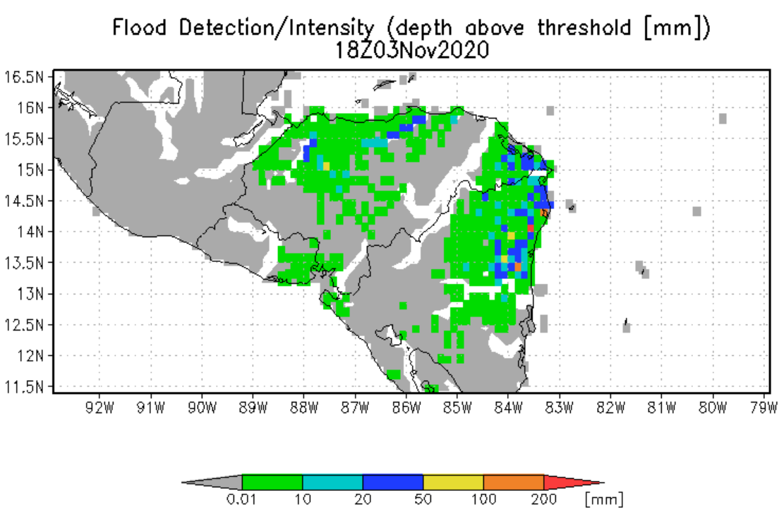
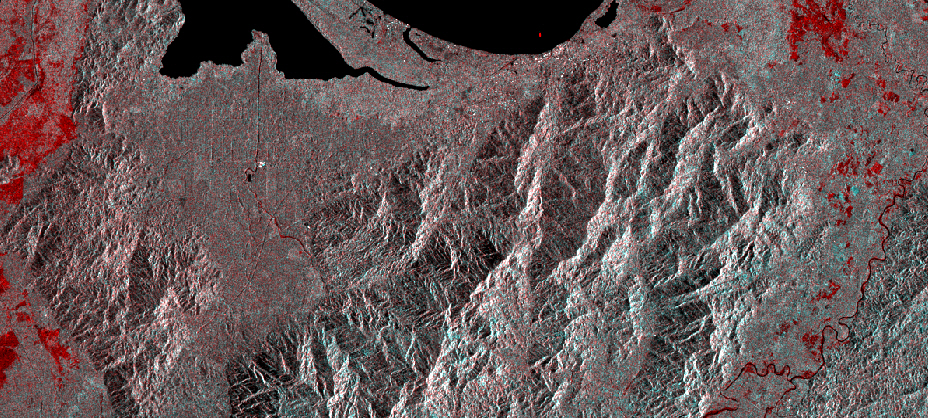
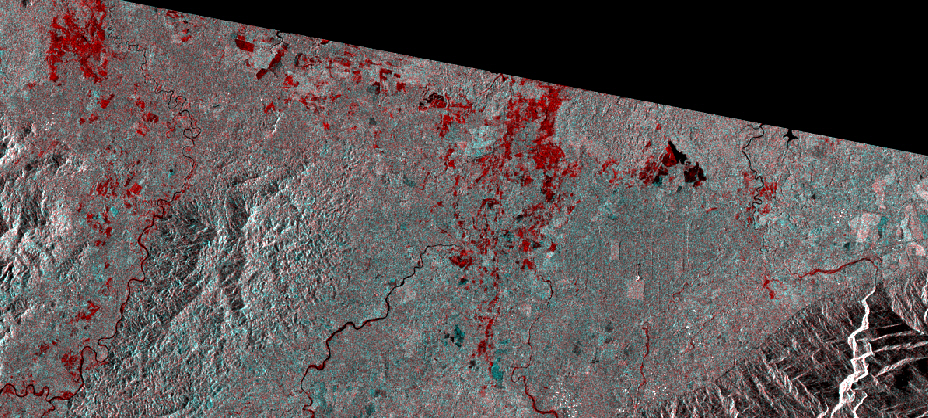
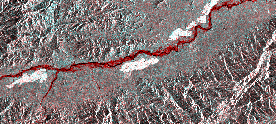
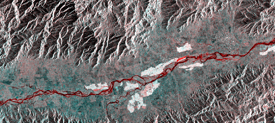
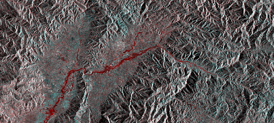
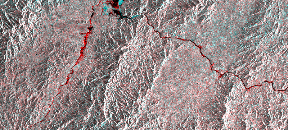
Results from the Global Flood Monitoring System (GFMS) at ESSIC, University of Maryland, courtesy of Dr. Robert Adler. Date and UTC time is shown. This is flooding as modeled from input precipitation data, topography, and flow routing computations.
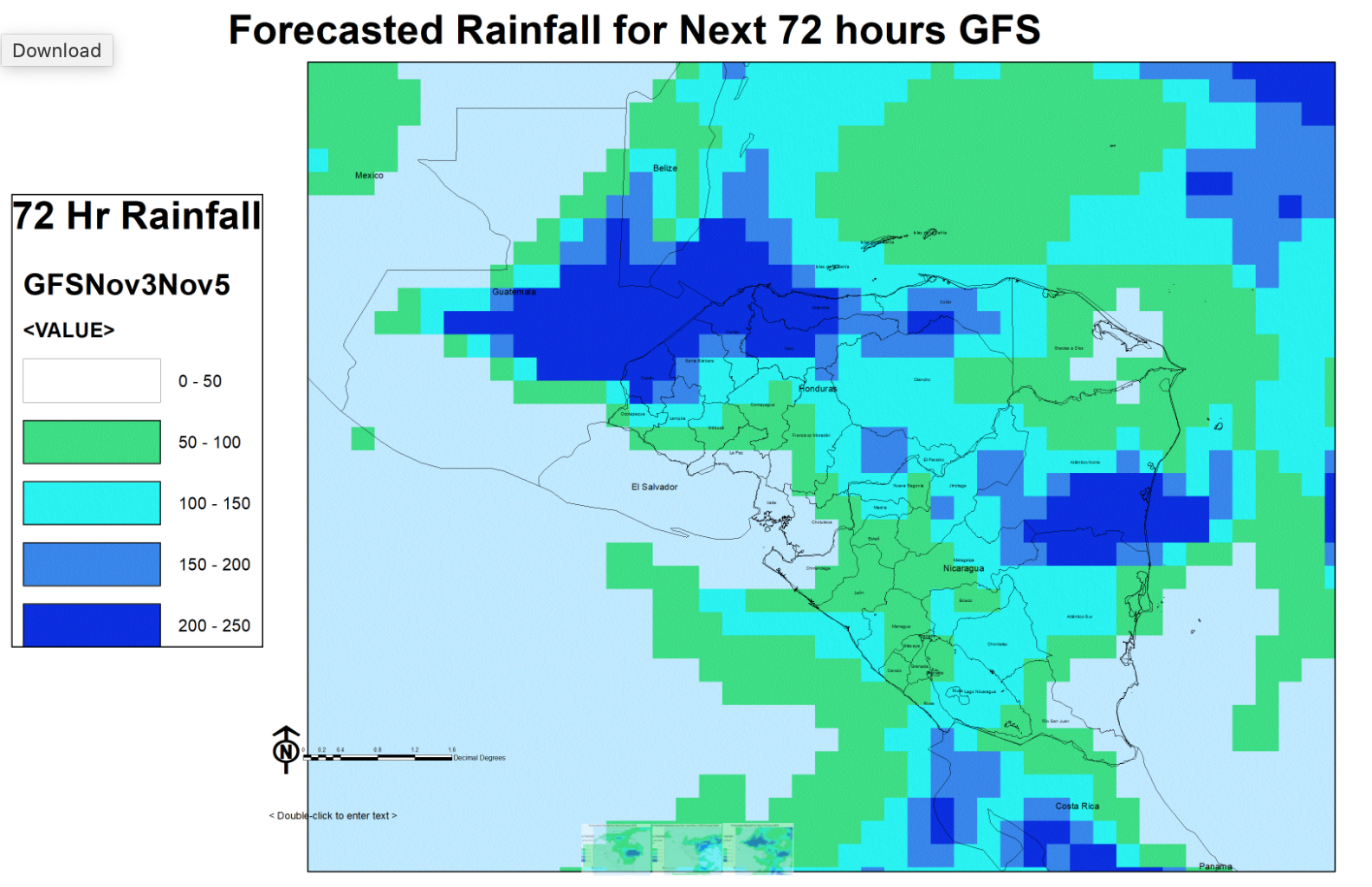
Results below are courtesy Dr. Emily Niebuhr.
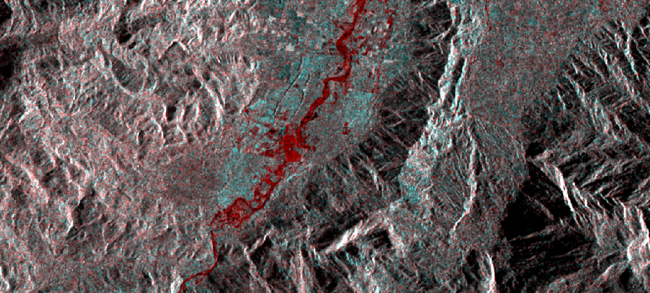
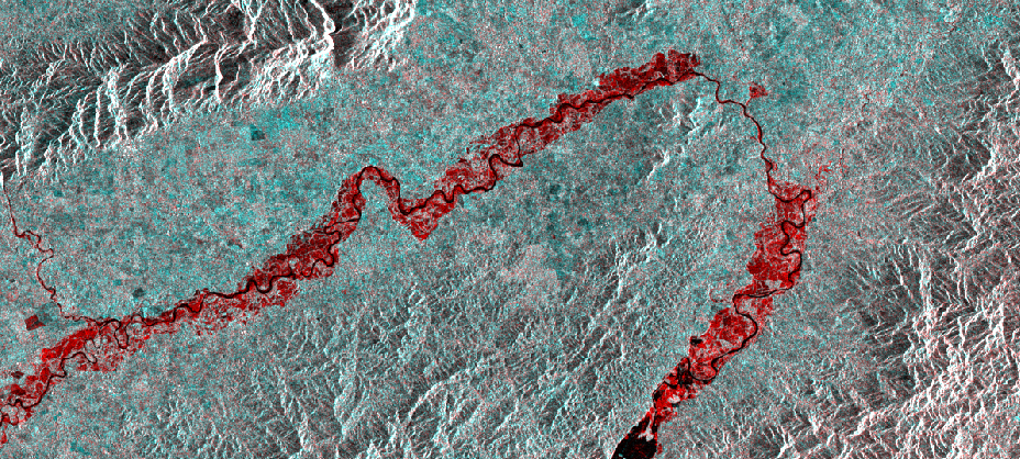
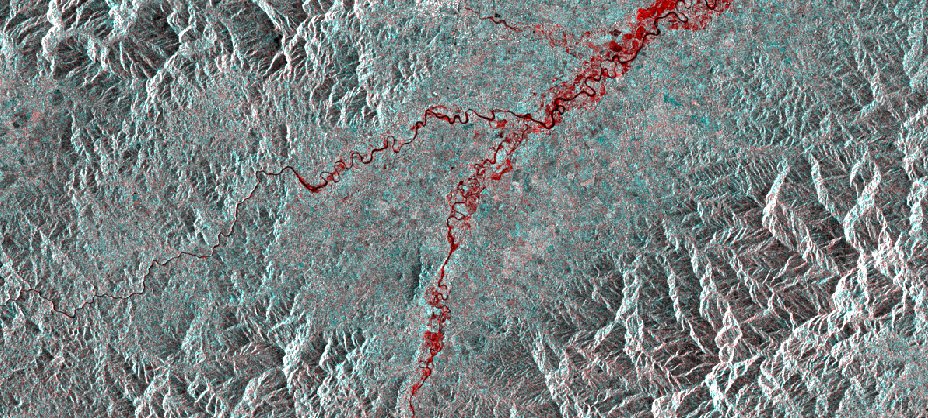
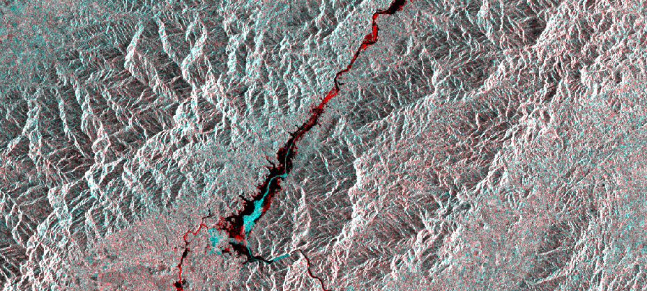
The Flood Observatory maintains a Global Active Archive of large flood events, 1985 to present. New major flood events are entered into this archive each week. A hand-drawn GIS polygon for each event outlines the region affected.
This event was selected for Observatory production of map and GIS data products.This web page and associated image and map (GIS) files become the permanent Flood Observatory record of the flood.
As part of collaborations with other organizations, including
GEO and the Global Flood
Partnership, the Observatory's maps are made available here to the public.
Geotif versions and GIS files are also available. With attribution, maps and
data can be used freely for non-commercial purposes. With permission, they can
be used for commercial purposes. Consult the Creative Commons Attribution-NonCommercial-ShareAlike 4.0
International License and Robert.Brakenridge or Albert.Kettner (at
Colorado.edu) if questions. Attribution for this map when Sentinel SAR data are
used: "Dartmouth Flood Observatory at the University of Colorado, from satellite
data provided by NASA and Copernicus/European Space Agency". When using GIS data
(see below) provided to DFO from other sources, please acknowledge original
source.
NASA Landsat 8 and Copernicus/ESA Sentinel SAR data if used in this map were obtained from the the U.S. Geological Survey Hazards Data Distribution System. and the Sentinels Science Data hub, respectively. Landsat 8 is jointly managed by NASA and the United States Geological Survey. Copernicus is supported by the European Commission. MODIS data are obtained from the NASA NRT Global Flood Mapping facility (surface water extents) and from NASA Worldview (image files); SUOMI/VIIRS image data are also retrieved from NASA Worldview.
Flood extent files (Shp or Mapinfo) supporting this Flood Event Map are located here.
These files may include high spatial resolution mapping such as from Sentinel or Landsat, or lower resolution files from MODIS. File names commonly include the sensor source (e.g., S1 for Sentinel 1, LS8 for Landsat, MODIS, Aqua, or Terra for MODIS) and the image date.
The NASA Earth Sciences Program, the Latin American Development Bank, the World Bank, the European Commission's Global Disaster Alert and Coordination System, GDACS, and Copernicus Emergency Management Service, the Google Earth Engine research awards program, the Committee on Earth Observation Satellites (CEOS) Disasters Working Group-Flood Pilot, the Japanese Space Agency, and the European Space Agency all have supported the Observatory's work via research grants and contracts or free satellite-derived data.
The Dartmouth Flood Observatory was founded in 1993 at Dartmouth College, Hanover, NH USA and moved to the University of Colorado, INSTAAR, CSDMS in 2010. The institutional support of both universities is gratefully acknowledged.
(counting since November 3, 2020)