


![]()
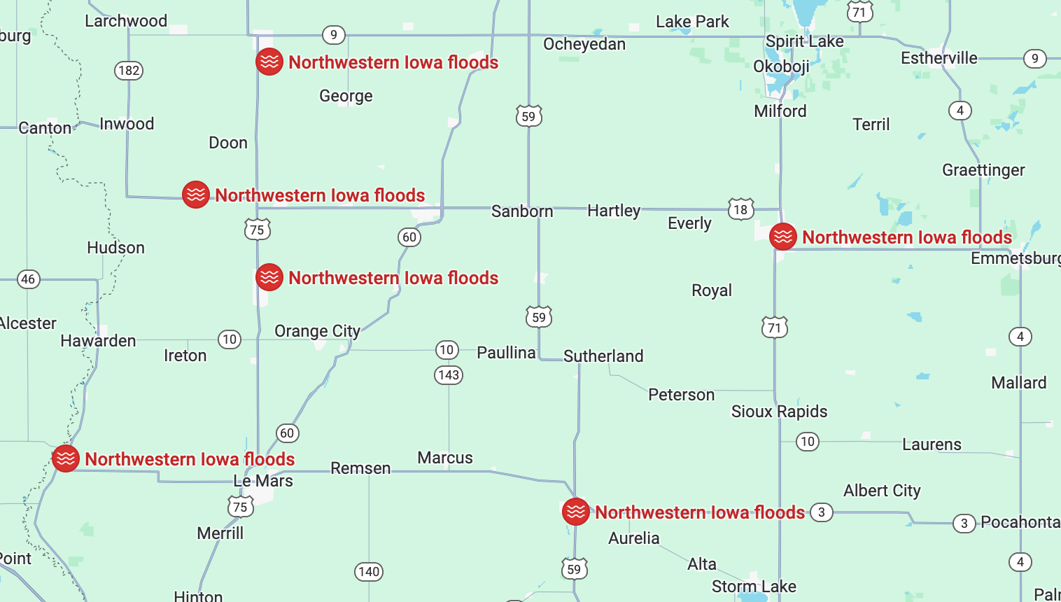
Sample of news:: https://www.kcrg.com/2024/06/24/cedar-rapids-taking-protective-action-river-levels-rise/
This event is on-going.
Also see Flood List (not yet covering this event)
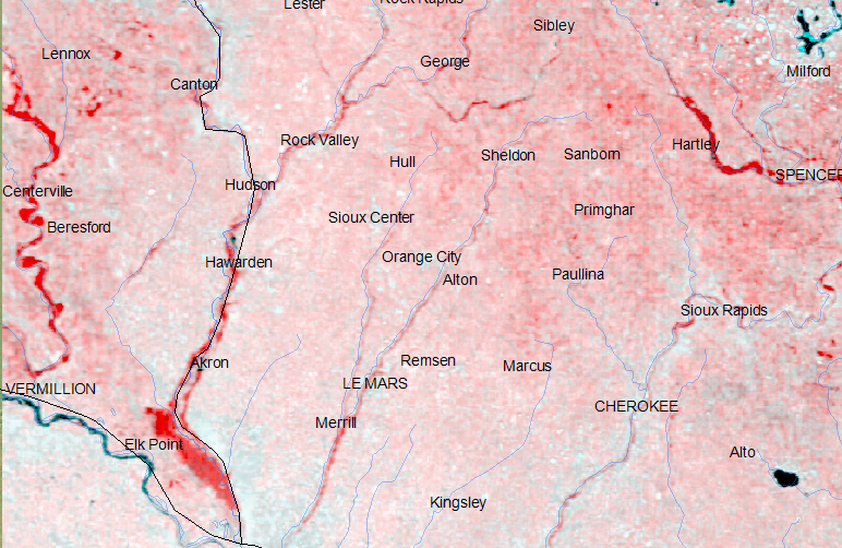
Multi-temporal color composite, showing flooding in red. Flood image date: June 24, 2024; comparison image June 29, 2023. This NASA MODIS Terra Band 2 false color composite was produced from Worldview 721 images retrieved as GeoTiff files. the RGB composite uses band 2, "before" on the R channel and band 2 (flood scene) on the G and B channels.

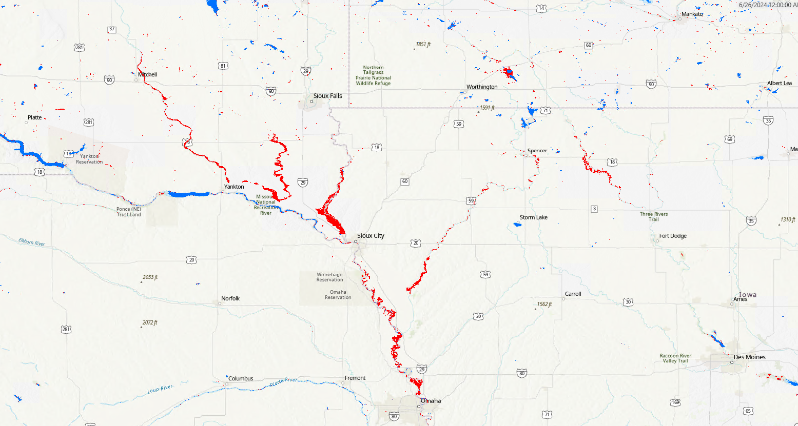
NASA MODIS Terra/Aqua Near Real Time Flood Mapping from Worldview. Courtesy Dr. Dan Slayback at NASA GSFC. The 1-day product (not yet available through the online browser) mapped the flood on June 26, 2024 (below).
The Flood Observatory maintains a Global Active Archive of large flood events, 1985 to present. New major flood events are entered into this archive each week. A hand-drawn GIS polygon for each event outlines the region affected.
This event was selected for Observatory production of map and GIS data products.This web page and associated image and map (GIS) files become the permanent Flood Observatory record of the flood. Updating of the Archive has been discontinued; events are designated by year and geographic area.
We anticipated adding further maps. NASA Landsat 8 and Copernicus/ESA Sentinel SAR data if used are obtained from the the U.S. Geological Survey Hazards Data Distribution System. and the Sentinels Science Data hub, respectively. Landsat 8 is jointly managed by NASA and the United States Geological Survey. Copernicus is supported by the European Commission. MODIS data are obtained from the NASA NRT Global Flood Mapping facility (surface water extents) and from NASA Worldview (image files); SUOMI/VIIRS image data are also retrieved from NASA Worldview.
Flood extent files (Shp or Mapinfo) and geotif files supporting this Flood Event Map can be located here after user request.
These files may include high spatial resolution mapping such as from Sentinel or Landsat, or lower resolution files from MODIS. File names commonly include the sensor source (e.g., S1 for Sentinel 1, LS8 for Landsat, MODIS, Aqua, or Terra for MODIS) and the image date.
The Dartmouth Flood Observatory was founded in 1993 at Dartmouth College, Hanover, NH USA and moved to the University of Colorado, INSTAAR, CSDMS in 2010. The institutional support of both universities is gratefully acknowledged. The present work is supported via a NASA grant to F. Policelli, Principal Investigator, NASA GSFC.
(counting since July 25, 2024)