River and Reservoir Watch Version 4.6
Satellite-based River Discharge and Reservoir Area Measurements, 1998-Present
In 2024, all Satellite Gauging Reaches are being revised to Version 4.6
Updated Twice-daily at 2:30 and 14:30 Local Denver Time
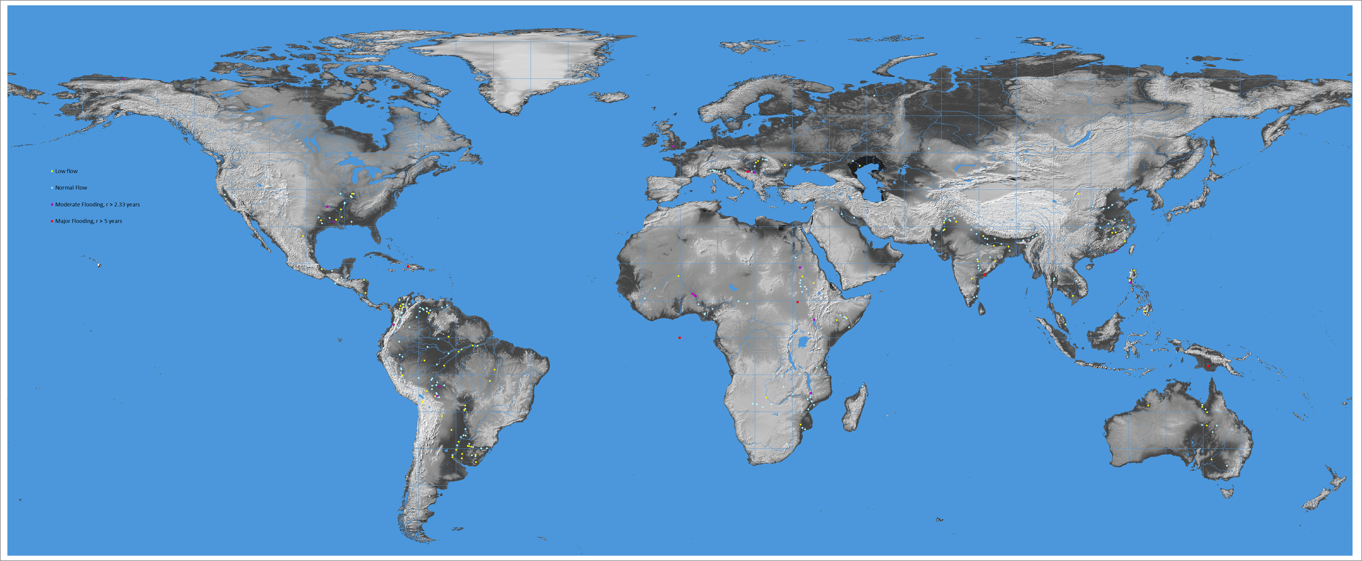
Yellow: low flow or area (<20th percentile for this day). Blue: normal flow or area. Purple: moderate flooding (>2.33 y recurrence interval or area between 70th and 90th percentile). Red: major flooding (> 5 y recurrence interval or area >90th percentile.
Accessing the discharge and runoff data: The daily discharge and runoff data are provided in html format. Click on dots, view displays, then select "Access to Data" link in each display.
Sample Citation: "Brakenridge, G. R., Kettner, A. J., Paris, S., Cohen, S., Nghiem, S. V. , River and Reservoir Watch Version 4.6, Satellite-based river discharge and reservoir area measurements, DFO Flood Observatory, University of Colorado, USA. http://floodobservatory.colorado.edu/ SiteDisplays/ 20.htm (Accessed 8 May 2024)."
Help us make this information as useful as possible. We will be adding more measurement locations in 2024. Points of Contact: Robert.Brakenridge@Colorado.edu and Albert.Kettner@Colorado.edu
Flag Counter Display, below, was initiated March 10, 2023.