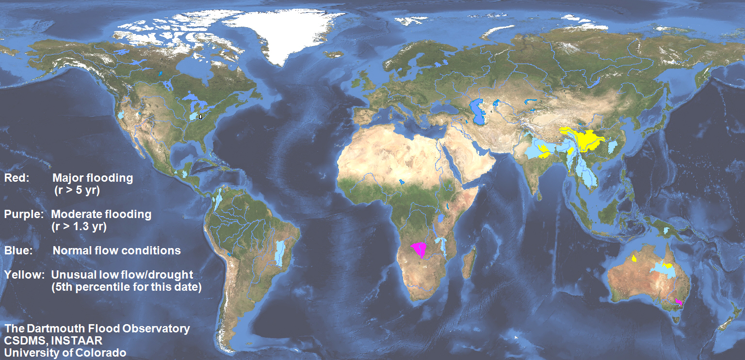
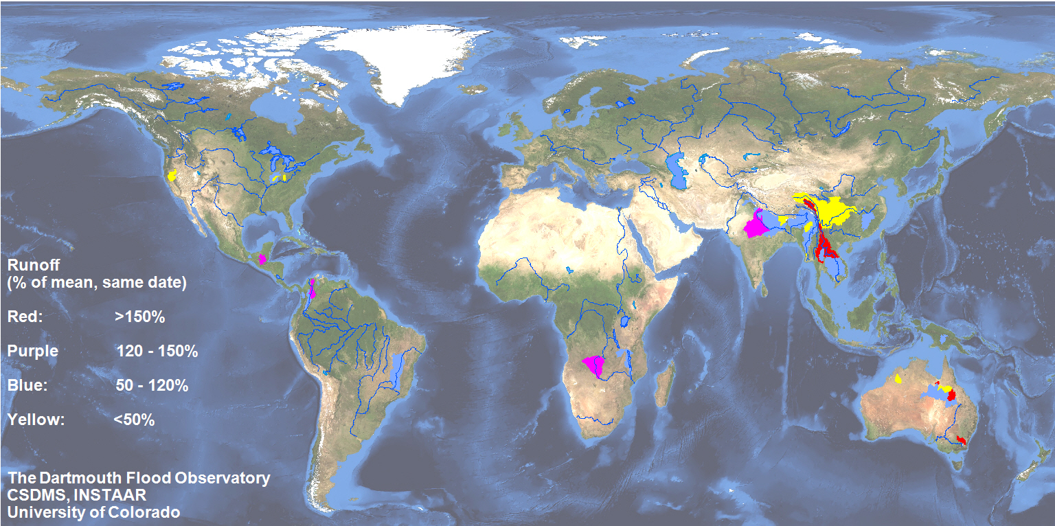
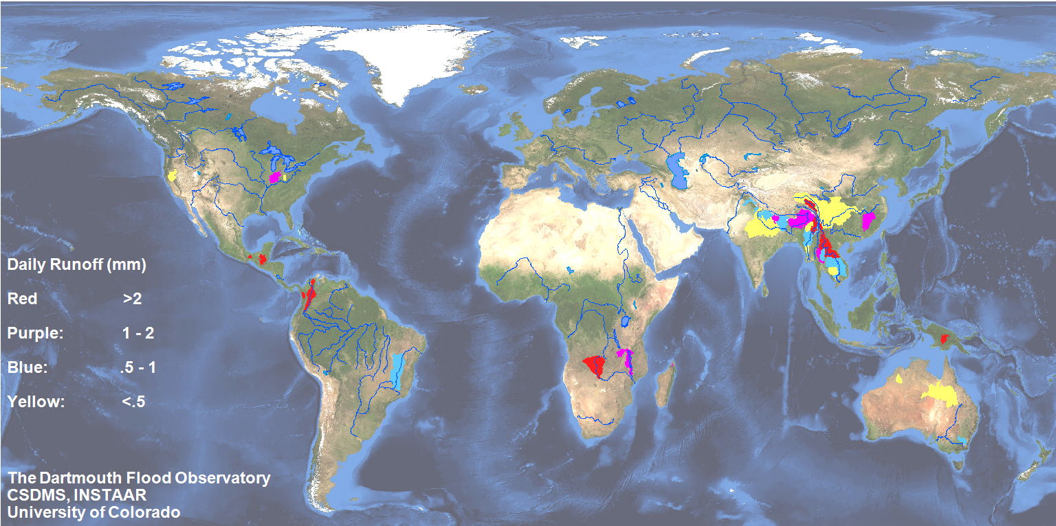
Satellite-Estimated Watershed Runoff
Experimental, Under Construction
These displays use microwave (37 GHz) NASA/Japanese Space Agency TRMM data to estimate discharge at an increasing array of river measurement sites. From the daily discharge values, daily runoff (mm) is computed by accumulating the discharge (m3/sec) over a 24 hour day, and dividing that runoff volume by the upstream watershed contributing area. These runoff values are then displayed for the watersheds.
The records acessible here are based on daily data extending back to January 1, 2002. Many more watersheds will be added as new river measurement sites are established. See the site displays for more information.
Citation: Brakenridge, G. R., Cohen, S., Kettner, A.J., De Groeve, T., and Nghiem, S. V., 2012, Online Publication, "Satellite-estimated Watershed Runoff"", http://floodobservatory.colorado.edu/RunoffMaps.htm.