| Dartmouth Flood Observatory - Flood Analysis Report 2003-121 | ||||||||||||||||||||||||||||||||||
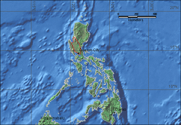
| Location Map: | Northern Philippines - Heavy rains from Tropical Storm Linfa - Flooding and mudslides | |||||||||||||||||||||||||||||||||
|
||||||||||||||||||||||||||||||||||
| DFO # | Location | Continent | Detailed Locations |
Began | Ended | Duration (days) | Dead | Displaced | Damage (USD) | Flood Type | Recurrence Interval (anecdotal) | Severity Class* | Hectares flooded | Hayden Code | Affected Region ( sq km) | Flood Magnitude** | Notes and Comments | |||||||||||||||||
| 121 | Philippines - Tropical Storm Linfa | Australia and Oceania | Northern provinces on Luzon: Pangasinan, Bulacan, Benguet. Cities: Dagupan, Urdaneta, Calasiao, Manila, Quezon, Caloocan, Makati, Pasay, Meycauayan, Pandayan, Calasiao, Sta. Barbara, Taytay, Valenzuela, Malabon, Pasig City. Rivers: Angalacan, Sinocalan, | 26-May-03 | 30-May-03 | 5 | 25 | 8,357 | $ 1,000,000 | Rain and mudslides | 60 | 2 | Tpz | 17,430 | 4.2 | Tropical storm Linfa (Chedeng) causes widespread flooding, landslides and uproots trees. Worst flooding in 60 years in central Pangasinan. "thousands were stranded in floods " "only 10% of Metro Manila was submerged compared to an average of 20% during l | ||||||||||||||||||
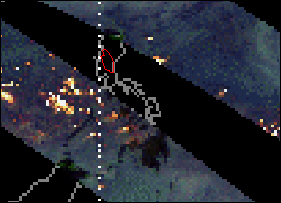
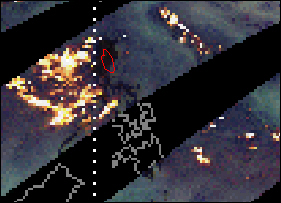
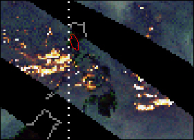
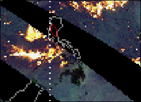
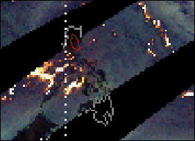
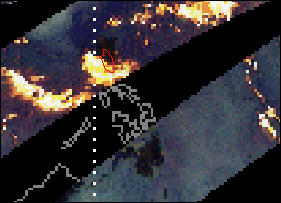
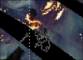
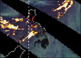
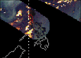
| May 22 - 30 - TRMM data showing Tropical Storm Linfa hovering over Luzon and delivering heavy rains. | ||||||||||||||||||||||||||||||||||
| Red polygon shows location of flooding. | ||||||||||||||||||||||||||||||||||
|
||||||||||||||||||||||||||||||||||
| 22-May-03 | 23-May-03 | 24-May-03 | ||||||||||||||||||||||||||||||||
|
||||||||||||||||||||||||||||||||||
| 25-May-03 | 26-May-03 | 27-May-03 | ||||||||||||||||||||||||||||||||
|
||||||||||||||||||||||||||||||||||
| 28-May-03 | 29-May-03 | 30-May-03 | ||||||||||||||||||||||||||||||||
| Dartmouth Flood Observatory Homepage | ||||||||||||||||||||||||||||||||||