| Dartmouth Flood Observatory - Flood Analysis Report 2003-117 | |||||||||||||||||||||||||||||||||||
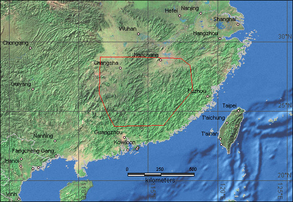
| Location Map: | Southern China - Continuous heavy rains | ||||||||||||||||||||||||||||||||||
| Link to Pdf map of Lake Poyang | |||||||||||||||||||||||||||||||||||
|
|||||||||||||||||||||||||||||||||||
| DFO # | Location | Continent | Detailed Locations |
Began | Ended | Duration (days) | Dead | Displaced | Damage (USD) | Flood Type | Recurrence Interval (anecdotal) | Severity Class* | Hectares flooded | Hayden Code | Affected Region ( sq km) | Flood Magnitude** | Notes and Comments | ||||||||||||||||||
| 117 | S. China | Asia | Guangdong province -
Meizhou, Heyuan and Shaoguan cities. Southern Hunan province - Linwu county. Changsha. Huaihua. Rivers: Xiangjiang, Zhishui, Yangtze. Jiangxi province - Jian city. Ganzhou. Guangchang county. Gan river. Fujian province - Sanming City. Jiangle County. Minjiang River tributaries. |
15-May-03 | 19-May-03 | 5 | 47 | 18,000 | $ 135,000,000 | Rain | 1 | Tszo | 317,900 | 9.1 | 19 different counties throughout Hunan have been affected by the flooding. May 16-17 - 2,440 houses and 26,370 hectares of crops destroyed in Guangdong. A levee burst and flooded a mining camp in Linwu county, Hunan. Jiangxi - Water levels in Poyang Lake rose by 1.43 m. By May 19 the Yangtze River had already surpassed its flood-water point by 58 centimeters. | ||||||||||||||||||||
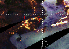
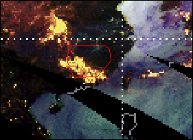
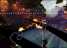
| TRMM data showing heavy monsoon rains over southern China May 14 - 18 . | |||||||||||||||||||||||||||||||||||
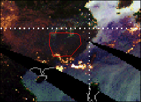
| Red polygon shows location of flooding. | |||||||||||||||||||||||||||||||||||
|
|||||||||||||||||||||||||||||||||||
| 14-May-03 | 15-May-03 | 16-May-03 | |||||||||||||||||||||||||||||||||
|
|||||||||||||||||||||||||||||||||||
| 17-May-03 | 18-May-03 | ||||||||||||||||||||||||||||||||||
| Dartmouth Flood Observatory Homepage | |||||||||||||||||||||||||||||||||||
