|
|
|
Dartmouth Flood
Observatory - Flood Analysis Report 2003-116 |
|
|
|
|
|
|
|
|
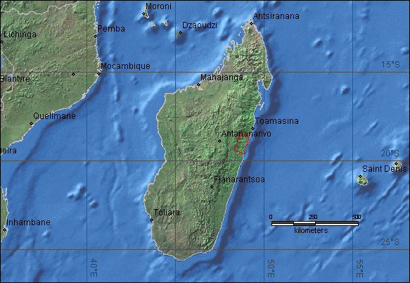
| Location Map: |
|
Eastern Madagascar - Cyclone Manou |
|
|
|
|
|
|
|
|
|
|
|
|
|
|
|
|
|
|
|
|
|
|
|
|
|
|
|
|
|
|
|
| DFO
# |
Location |
Continent |
Detailed
Locations |
Began |
Ended |
Duration (days) |
Dead |
Displaced |
Damage (USD) |
Flood Type |
Recurrence Interval
(anecdotal) |
Severity Class* |
Hectares flooded |
Hayden
Code |
Affected Region ( sq km) |
Flood Magnitude** |
Notes and
Comments |
| |
|
|
|
|
|
|
|
|
|
|
|
|
|
|
|
|
|
| 116 |
E. Madagascar - Cyclone Manou |
Africa |
Tomasina Province -
Districts of Andevoranto and Vatomandry. Brickaville |
9-May-03 |
12-May-03 |
4 |
68 |
47,000 |
|
Rain |
|
1 |
|
Tpo |
5,280 |
1.0 |
High winds and flooding.
Bridges destroyed, extensive infastructure damage. 85% of buildings in
District of Vatomandry destroyed. |
|
|
|
|
|
|
|
|
|
|
|
|
|
|
|
|
|
|
|
|
|
|
|
|
|
|
|
|
|
|
|
|
|
|
|
|
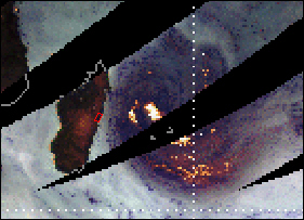
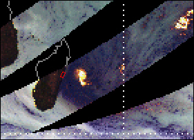
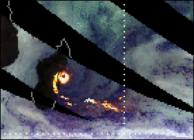
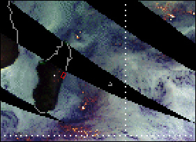
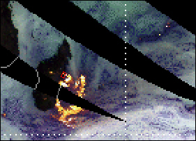
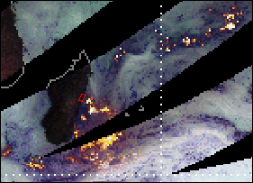
| TRMM data
showing Cyclone Manou approaching eastern Madagascar and making landfall on
May 8. |
|
|
|
|
|
|
|
|
|
|
|
| Red polygon
shows location of most serious flooding, in the Districts of Andevoranto and
Vatomandry |
|
|
|
|
|
|
|
|
|
|
|
|
|
|
|
|
|
|
|
|
|
|
|
|
|
|
|
|
|
|
|
|
|
|
|
|
|
|
|
|
|
|
|
|
|
|
|
|
|
|
|
|
|
|
|
|
|
|
|
|
|
|
|
|
|
|
|
|
|
|
|
|
|
|
|
|
|
|
|
|
|
|
|
|
|
|
|
|
|
|
|
|
|
|
|
|
|
|
|
|
|
|
|
|
|
|
|
|
|
|
|
|
|
|
|
|
|
|
|
|
|
|
|
|
|
|
|
|
|
|
|
|
|
|
|
|
|
|
|
|
|
|
|
|
|
|
|
|
|
|
|
|
|
|
|
|
|
|
|
|
|
|
|
|
|
|
|
|
|
|
|
|
|
|
|
|
|
|
|
|
|
|
|
|
|
|
|
|
|
|
|
|
|
|
|
|
|
|
|
|
|
|
|
|
|
|
|
|
|
|
|
|
|
|
|
|
|
|
|
|
|
|
|
|
|
|
|
|
|
|
|
|
|
|
|
|
|
|
|
|
|
|
|
|
|
|
|
|
6-May-03 |
|
7-May-03 |
|
|
|
|
8-May-03 |
|
|
|
|
|
|
|
|
|
|
|
|
|
|
|
|
|
|
|
|
|
|
|
|
|
|
|
|
|
|
|
|
|
|
|
|
|
|
|
|
|
|
|
|
|
|
|
|
|
|
|
|
|
|
|
|
|
|
|
|
|
|
|
|
|
|
|
|
|
|
|
|
|
|
|
|
|
|
|
|
|
|
|
|
|
|
|
|
|
|
|
|
|
|
|
|
|
|
|
|
|
|
|
|
|
|
|
|
|
|
|
|
|
|
|
|
|
|
|
|
|
|
|
|
|
|
|
|
|
|
|
|
|
|
|
|
|
|
|
|
|
|
|
|
|
|
|
|
|
|
|
|
|
|
|
|
|
|
|
|
|
|
|
|
|
|
|
|
|
|
|
|
|
|
|
|
|
|
|
|
|
|
|
|
|
|
|
|
|
|
|
|
|
|
|
|
|
|
|
|
|
|
|
|
|
|
|
|
|
|
|
|
|
|
|
|
|
|
|
|
|
|
|
|
|
|
|
|
|
|
|
|
|
|
|
|
|
|
|
|
|
|
|
|
|
9-May-03 |
|
10-May-03 |
|
|
|
|
11-May-03 |
|
|
|
|
|
|
|
|
|
|
|
|
|
|
|
|
|
|
|
|
|
|
|
|
|
|
|
|
|
|
|
|
|
|
|
|
|
|
|
|
|
|
|
|
|
|
|
|
|
|
|
|
|
|
|
|
|
|
|
|
|
|
|
| Dartmouth Flood
Observatory Homepage |
|
|
|
|
|
|
|
|
|
|
|
|
|
|
|
|
|
|
|
|
|
|
|
|
|
|
|
|
|
|
|
|
|
|
|
|
|
|
|
|
|
|
|
|
|
|
|
|
|
|
|
|
|
|
|
|
|
|
|
|
|
|
|
|
|
|
|
|

