 |
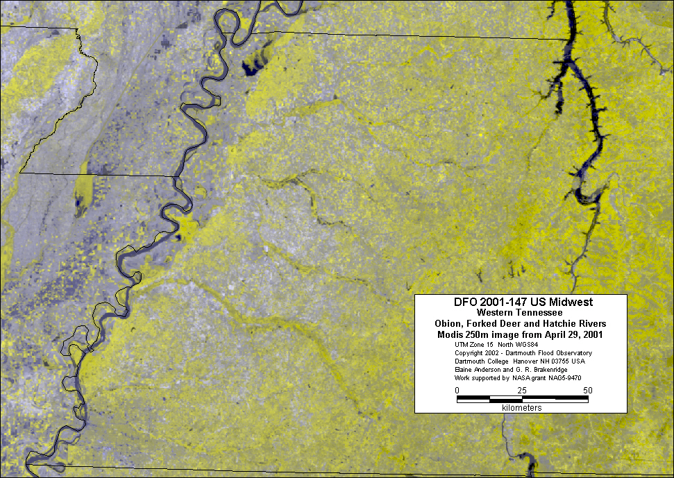
| Before Flooding - Modis 250 image
of Hatchie, Forked Deer and Obion rivers in western Tennessee
on April 29, 2001. Bands 2,2,1 in R,G,B |
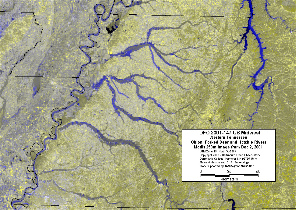 |
| During Flooding - Modis 250 image
of Hatchie, Forked Deer and Obion rivers in western Tennessee
on December 2, 2001. Bands 2,2,1 in R,G,B |
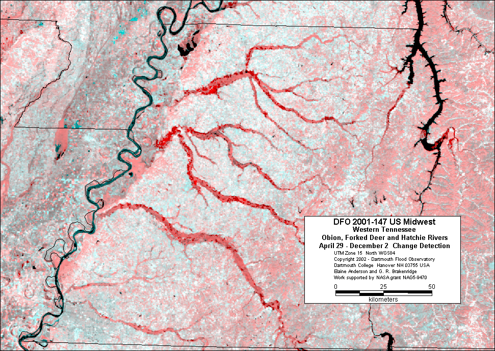 |
| Change Detection image -
Persistent water appears black, new water appears red. Red: Band
2 from April 29, 2001. Green and Blue: Band 2 from December 2,
2001 |
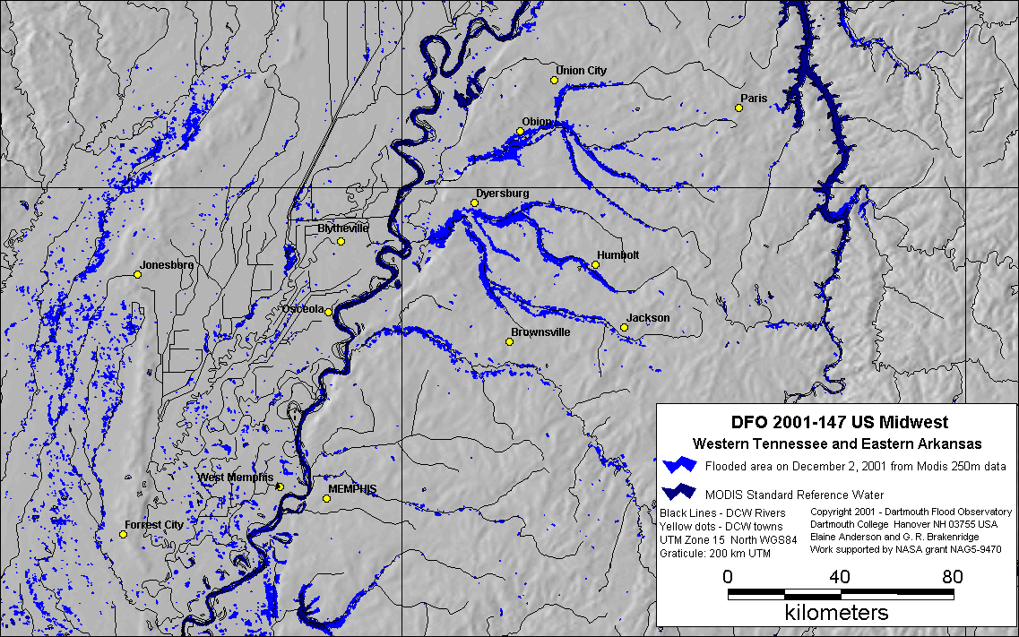 |
| Inundation map based upon Modis
December 2, 2001 250km data. |
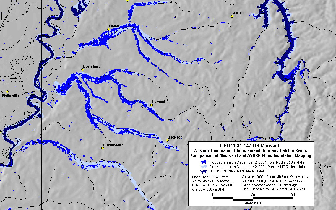 |
| Inundation map comparing flood
limits measured from both Modis and AVHRR satellite data on December
2, 2001. |