
 |
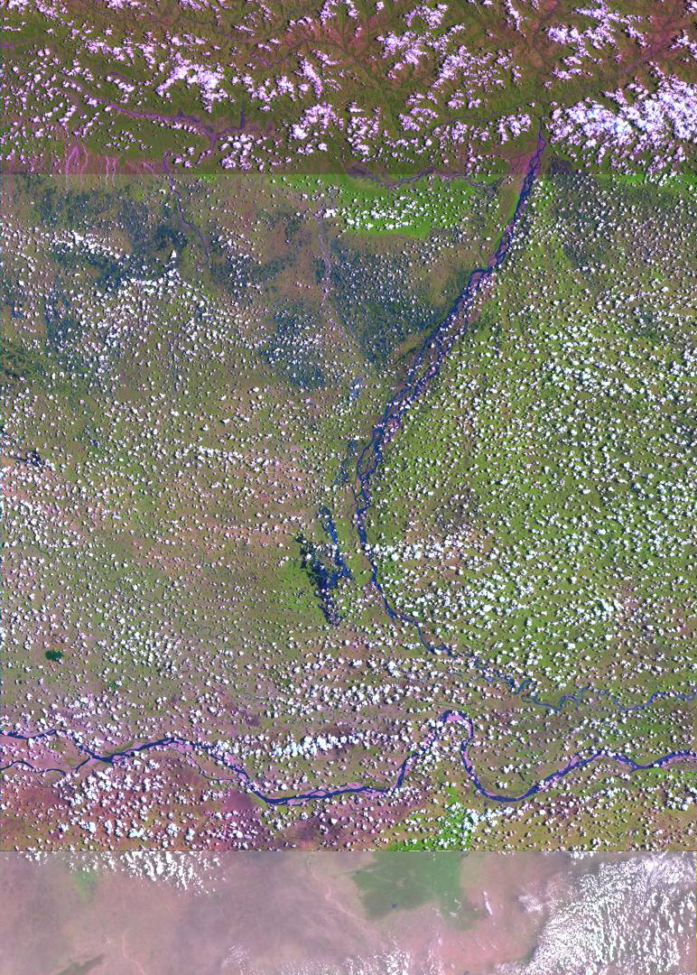
| Before Flooding - Landsat7 browse images composite of the Baghmati and Ganges Rivers in Bihar, India - Top images: June 11, 2001; Bottom image May 10, 2001 |
 |
| Landsat7 browse image composite of the Baghmati and Ganges Rivers in Bihar, India on September 15, 2001. |
 |
|
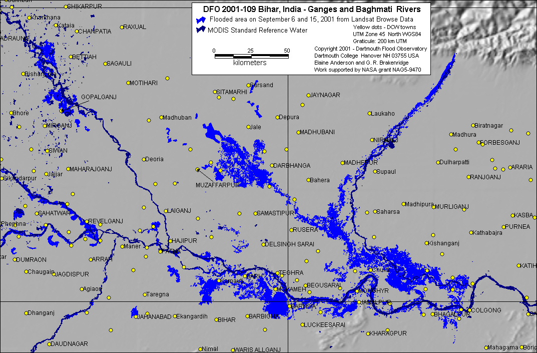
Inundation map based upon Landsat 7 browse data for September 6 and 15, 2001
|