Multi-angle Imaging SpectroRadiometer Image Series of the Nile River: (images from JPL website, see below)
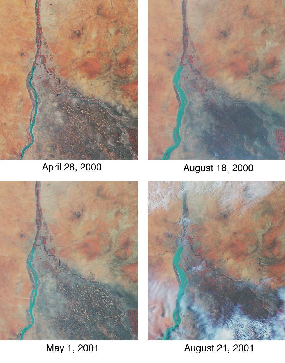
See JPL's captions and press release for these images
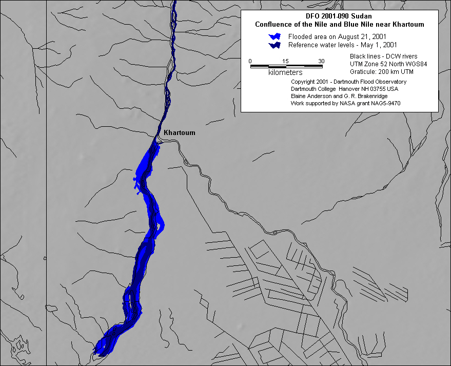 |
| Inundation map based upon JPL images. |
Map preparation and image analysis: E Anderson