
 |
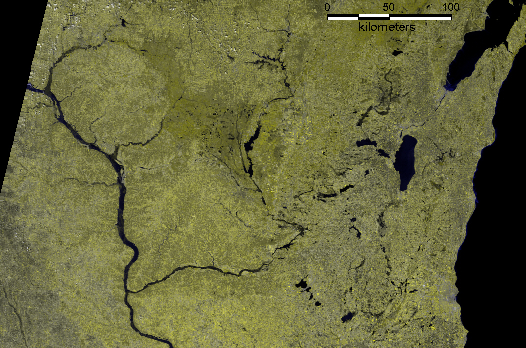
| Geocorrected Modis 250 Image of the Upper Mississippi River in Wisconsin and Iowa from April 13, 2001. Bands 2,2,1 in R,G,B. |
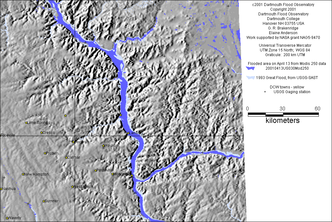 |
| Inundation map based upon Modis 250 data, including comparision with 1993 flood event |
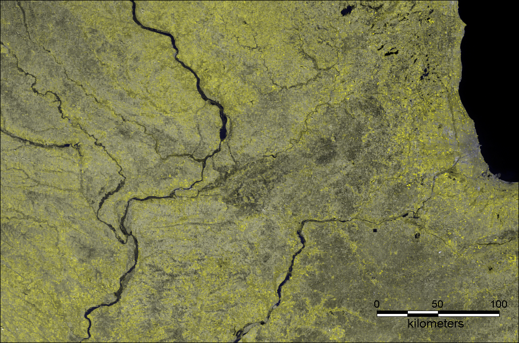 |
| Geocorrected Modis 250 Image of the Mississippi River in Iowa and Illinois from April 13, 2001. Bands 2,2,1 in R,G,B. |
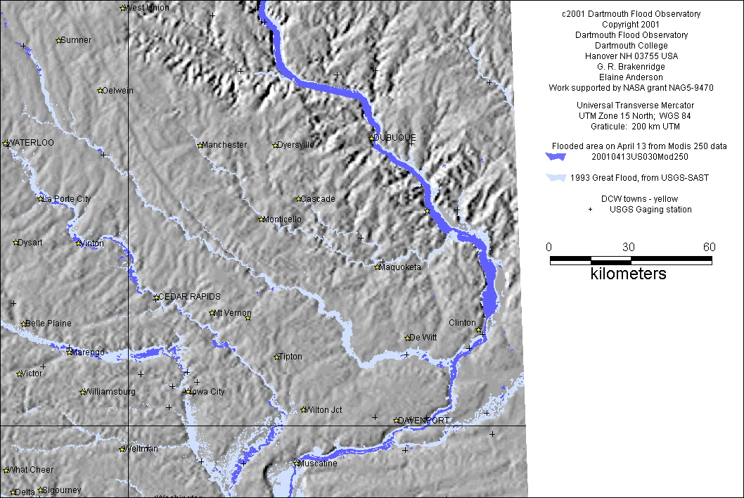 |
| Inundation map based upon Modis 250 data, including comparision with 1993 flood event |