
 |
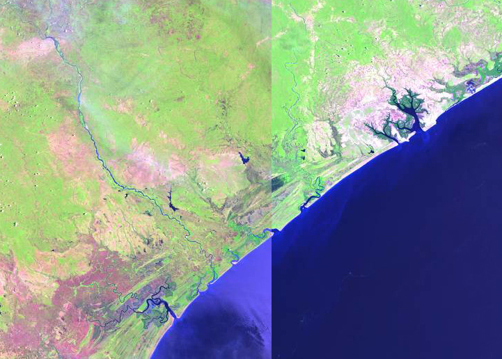
| Composite of Landsat 7 Browse Images of the Licungo River area of the Zambezia coast. Left image from Nov 21, 2000 and right image from Jan 1, 2001 |
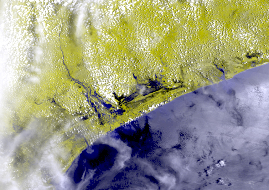 |
| Geocorrected Modis 250 Image of the Licungo River area of the Zambezia coast from Feb 9, 2001 |
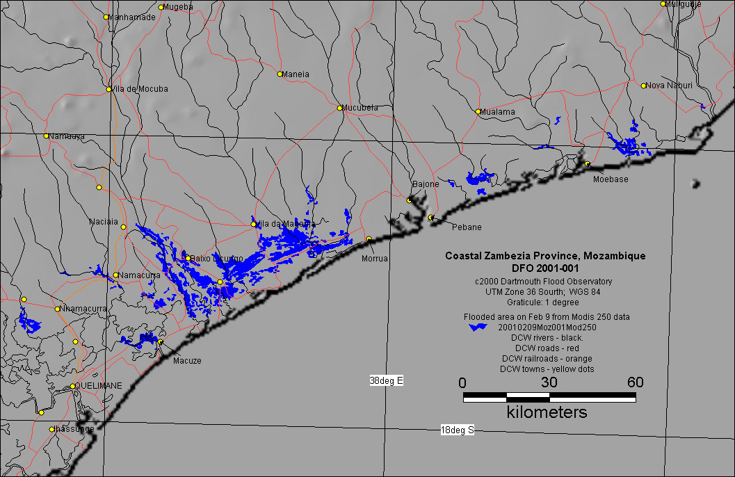 |
| Inundation map of the Licungo River area of the Zambezia coast based upon Modis 250 data from Feb 9, 2001 |