
 |
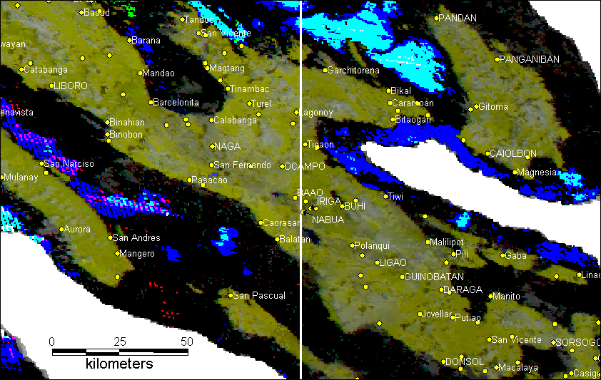
| Modis9 8-day surface reflectance composite image from October 15-22, 2000 with DCW overlays |
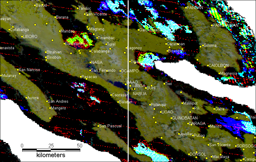 |
| Modis9 8-day surface reflectance composite image from November 1-7, 2000 with DCW overlays |
 |
|
|
| |
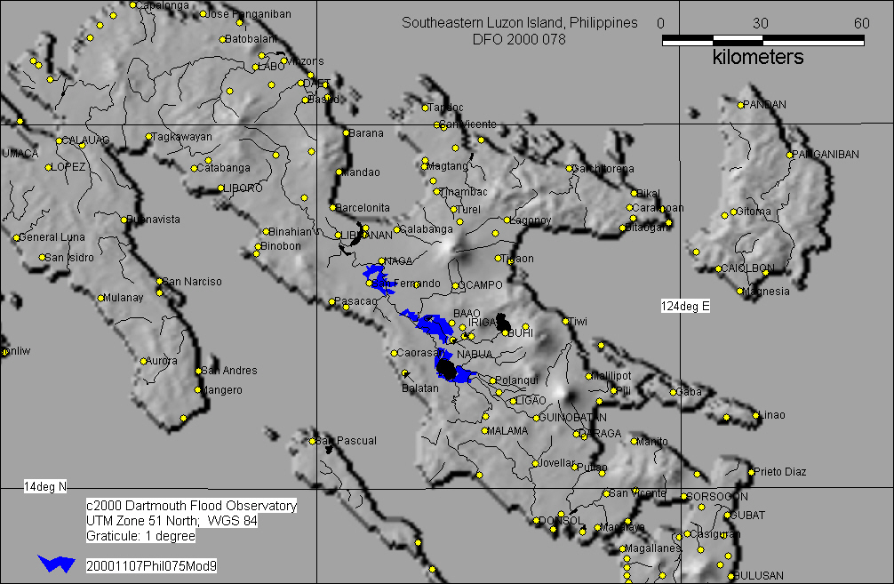
| Modis9 8-day surface reflectance composite image from October 15-22, 2000 with DCW overlays |
| |
| Modis9 8-day surface reflectance composite image from November 1-7, 2000 with DCW overlays |
| |
|
|