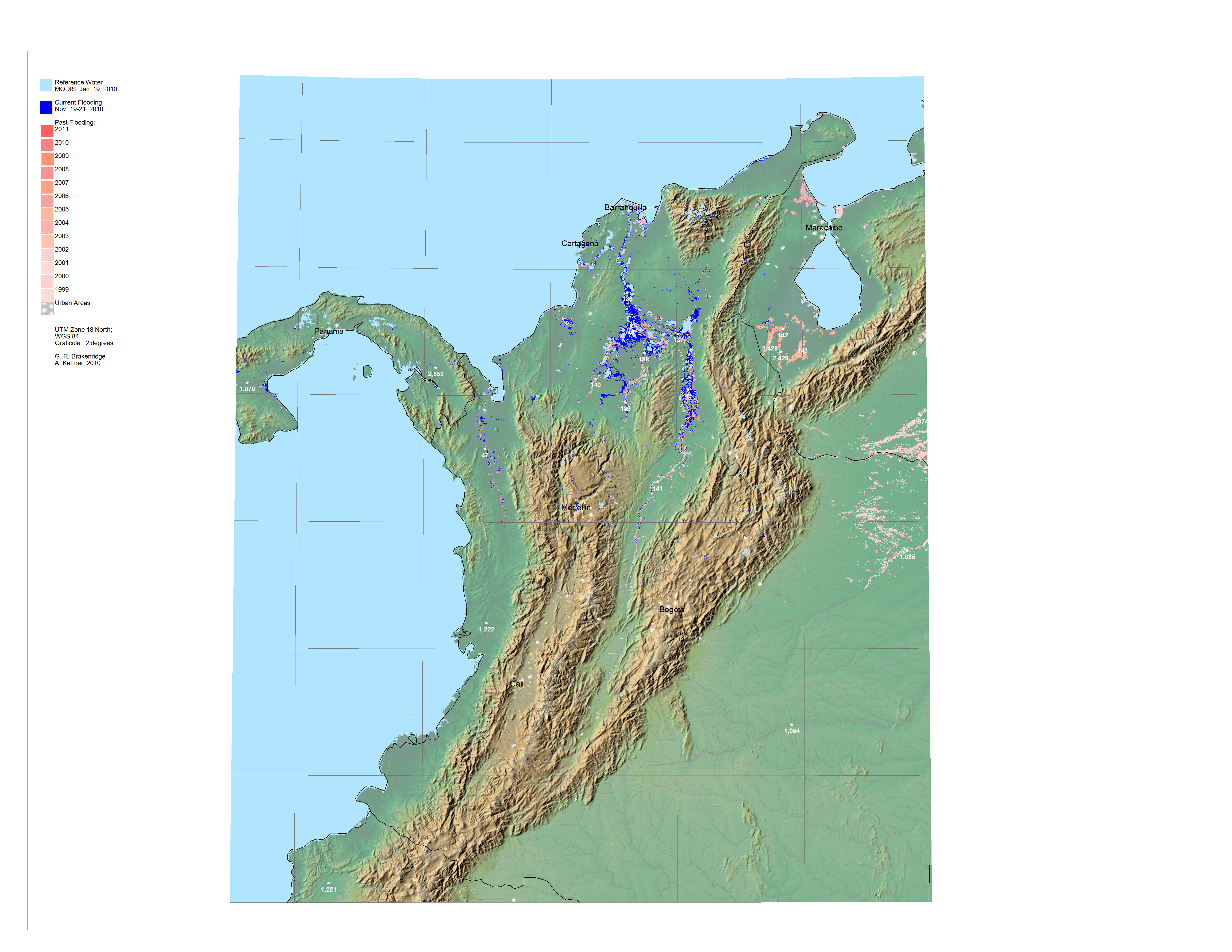
Global Surface Water Record W81N13
Light Blue (top layer) is a reference surface water (sensor and date provided).
Dark Blue is the most recent flood water imaged and mapped.
Medium (younger) and lighter (older) reds are previously mapped flooding, by year.
Click on the white dots for River Watch satellite-based estimated river discharge, 2002-present.
Rapid Response Inundation Maps for W81N13, if available
Powerpoint record of this display
GIS data for this display are located at: http://floodobservatory.colorado.edu/GISdata/ in the TC4_CostaRica and the W81N13_Older_Data folders.The map display below can also be downloaded (right click) as a large jpg. file, and read into most GIS software. To accomplish GIS map registration, enter three latitude and longitude coordinates using the two degree graticule and also the map projection and datum..
Please cite G. R. Brakenridge and A. Kettner, date, "Global Surface Water Record, E100N20" and the internet address when further publishing this display or associated data.
Known errors: 1) The present water classification algorithm produces false water from terrain shadowing in mountainous areas. 2) Only a portion of this sheet is included in the TC4_CostaRica Modis RapidResponse Subset.