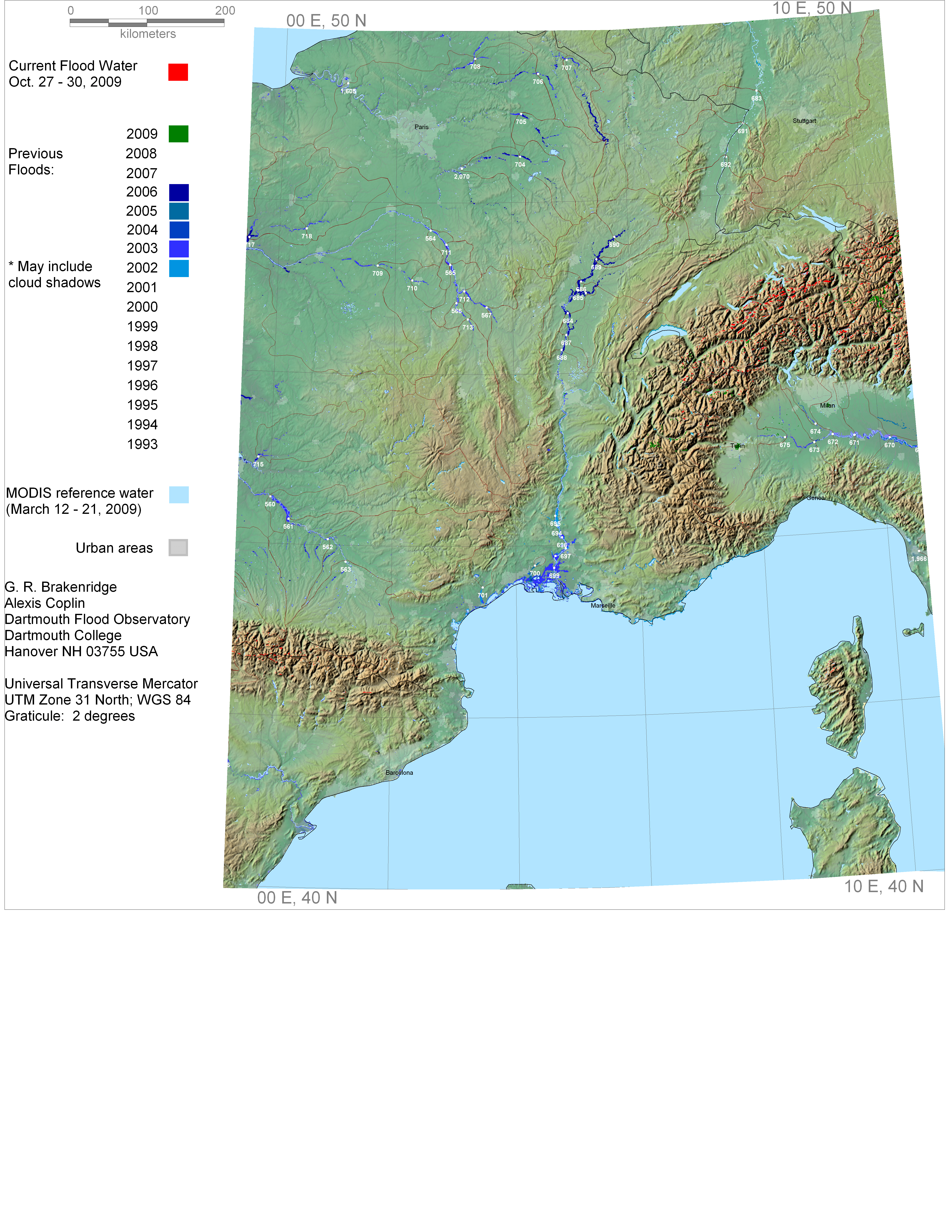
How to use this Surface Water Record display:
If red areas are showing, these are lands inundated by current or recent flooding (dates shown in the symbology key below).
Light blue areas are water imaged by MODIS on a date chosen to represent average conditions.
Darker blue or green-blue areas are lands inundated by previous mapped flood events. See symbology key for year of event.
Compare red area to previous flood events to estimate current flood severity. Click for powerpoint of 2009 results, in prep.
Flooded areas earlier this year are shown in the appropriate color (green, for 2009).
Click on the white dots to access records of estimated river discharge, 2002-present, at the River Watch measurement sites.