
Rapid Response Preliminary Results
NASA coverage of Argentina Flash Flooding, DFO 4046, April 1-4, 2013
by G.R. Brakenridge
Satellite-measured Rain Rate, from Global Flood Monitoring System (GFMS), University of Maryland (http://flood.umd.edu/)

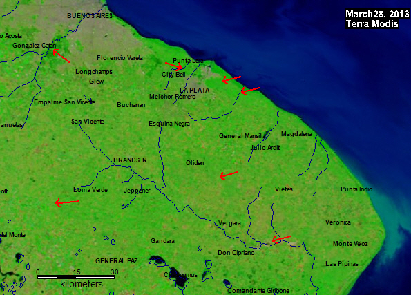
Post-storm Image

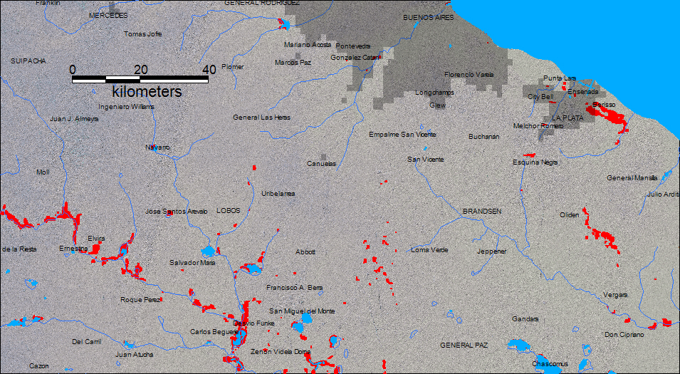
Post-storm MODIS Map, April 4, 2013(Overview)
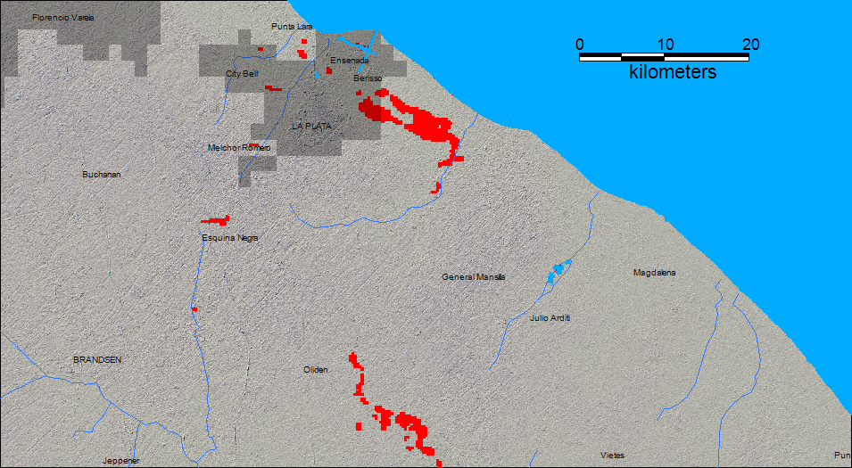
Post-storm MODIS Map (April 4, 2013 Detail for La Plata area)
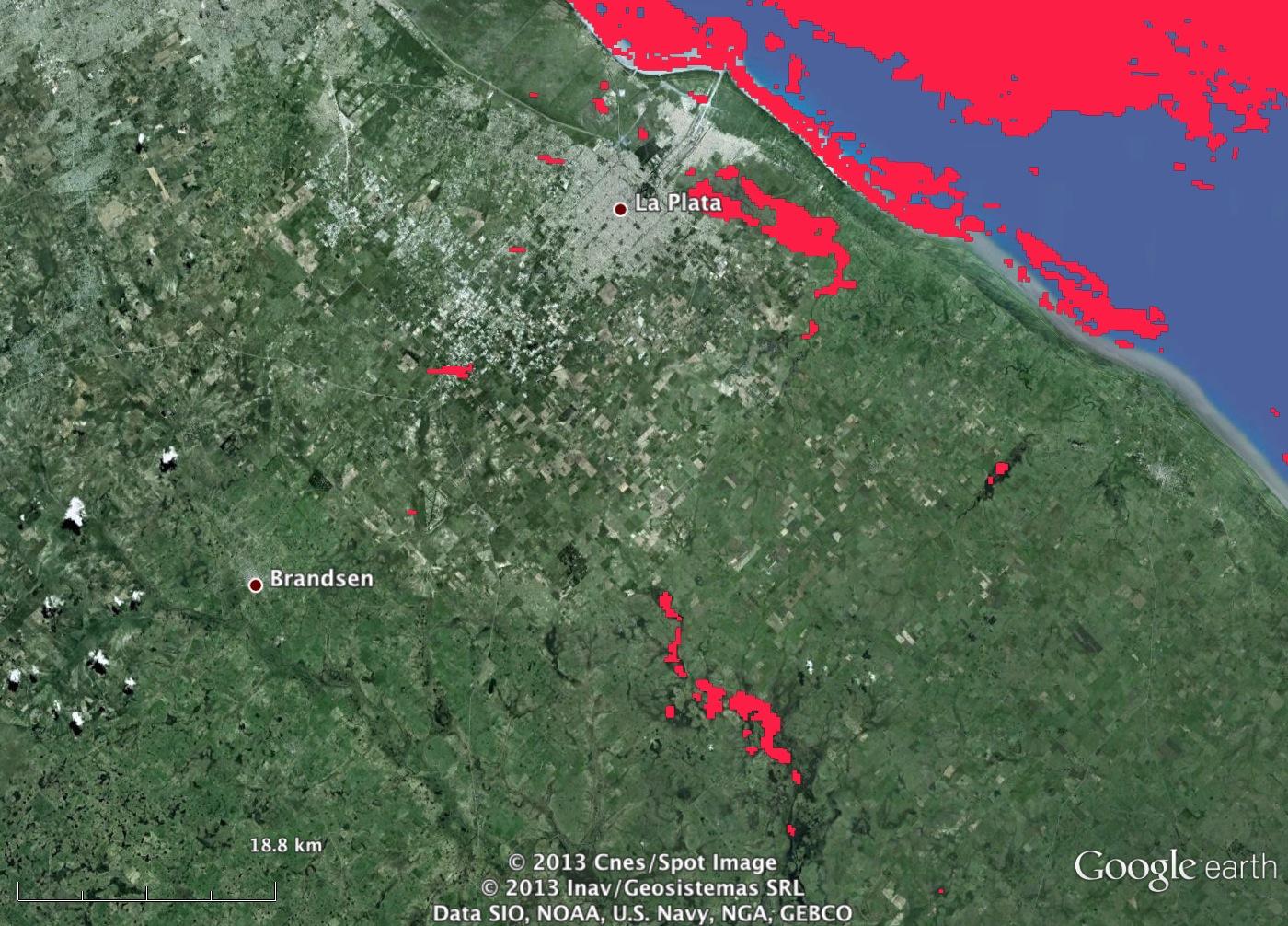
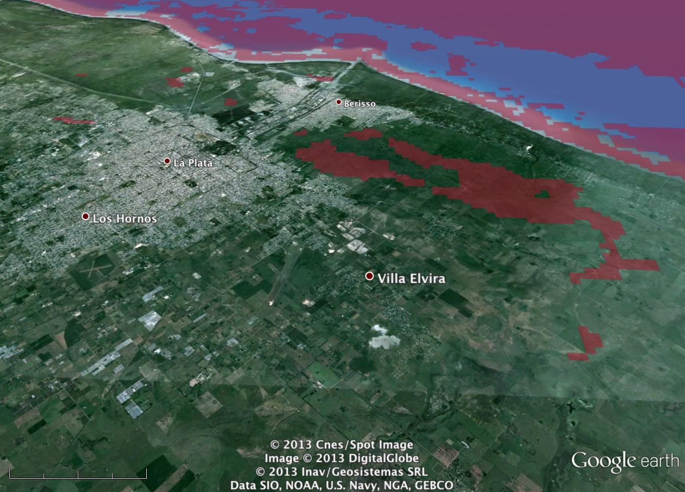
GoogleEarth views of April 4, 2013 MODIS-imaged Flooding
GoogleEarth KMZ File, April 4 Water from MODIS
GoogleEarth KMZ File, April 5 Water from ASTER
ASTER image from April 5, 2013, courtesy NASA/GSFC/METI/ERSDAC/JAROS, and U.S./Japan ASTER Science Team

Comparison: MODIS only

MODIS and ASTER

MODIS and ASTER (detail)

Satellite Data:
The two MODIS sensors commonly provide the first satellite imagery of major flood events, because they are "always on" and provide global coverage, morning and afternoon passes. Cloud cover is a limiting factor, but the frequent revisits allow immediate imaging, within hours of a break in cloud cover. In the maps, red is water imaged by MODIS, blue is reference ("normal") water data or mapped drainages.
Prior to mapping of the flooding, DFO accesses the LANCE-MODIS Rapid Response images to examine the coverage. However, complete coverage of the event awaits accumulation of more imaging. Once accomplished, mapping of this flood event will be integrated, in map and GIS format, in the Surface Water Survey map sheet and data compilations for this area: 060W030S.
The ASTER sensor provides spatial resolution of much greater detail (15 m): obviously valuable for flooding focused on an urban area. ASTER is carried by the NASA Terra satellite, which hosts one of the two MODIS sensors. However, it does not provide the same frequent sampling in time, is not always on, and provides much smaller geographic "footprints" than MODIS.
Interpretation: Urban flooding is difficult for MODIS to image, with spatial resolution of 250 m. Also, the flooding was short-lived in some areas, and cloud cover did not allow coverage before the morning of April 4 (Terra-MODIS and ASTER). Many areas of flooding within both Buenos Aires and La Plata are not visible on especially the MODIS images and maps.
However, a large area of flooding is visible: adjacent to but southeast of La Plata, and it was first detected by analysis of MODIS data. It appears to have resulted from a sudden, flood-related "avulsion" (temporary or permanent diversion of stream or river flow) to the west, towards La Plata. The northwestern-flowing flood water left its streambanks where the old channel turns abruptly to the north and the coast; the water instead continued on a northwest track, towards and into the city. It is not yet known what role this event had in the large amount of damage and fatalies (>50) suffered by La Plata. However, the satellite imagery suggests the damage might have been much decreased without this avulsion.
The GoogleEarth KMZ file allows examination of the scene of the diversion of flow in detail (click on above link). Mapping using the ASTER data will soon be added.
Local Videos:
http://www.youtube.com/watch?v=RZC_BLHsXOE