September 2013 Flooding in Eastern Colorado, USA
Flood water mapping is based on the NASA Landsat 8 satellite (30 m spatial resolution) and on the two NASA-MODIS sensors, at 250 meters spatial resolution
Authors: G. R. Brakenridge, at Dartmouth Flood Observatory, University of Colorado, and Dan Slayback and Fritz Policelli, at NASA Goddard Spaceflight Center, Greenbelt, Maryland.
Surface water, light blue overlay, as obtained from Landsat 8 scene, September 17, 2013 (includes permanent water)
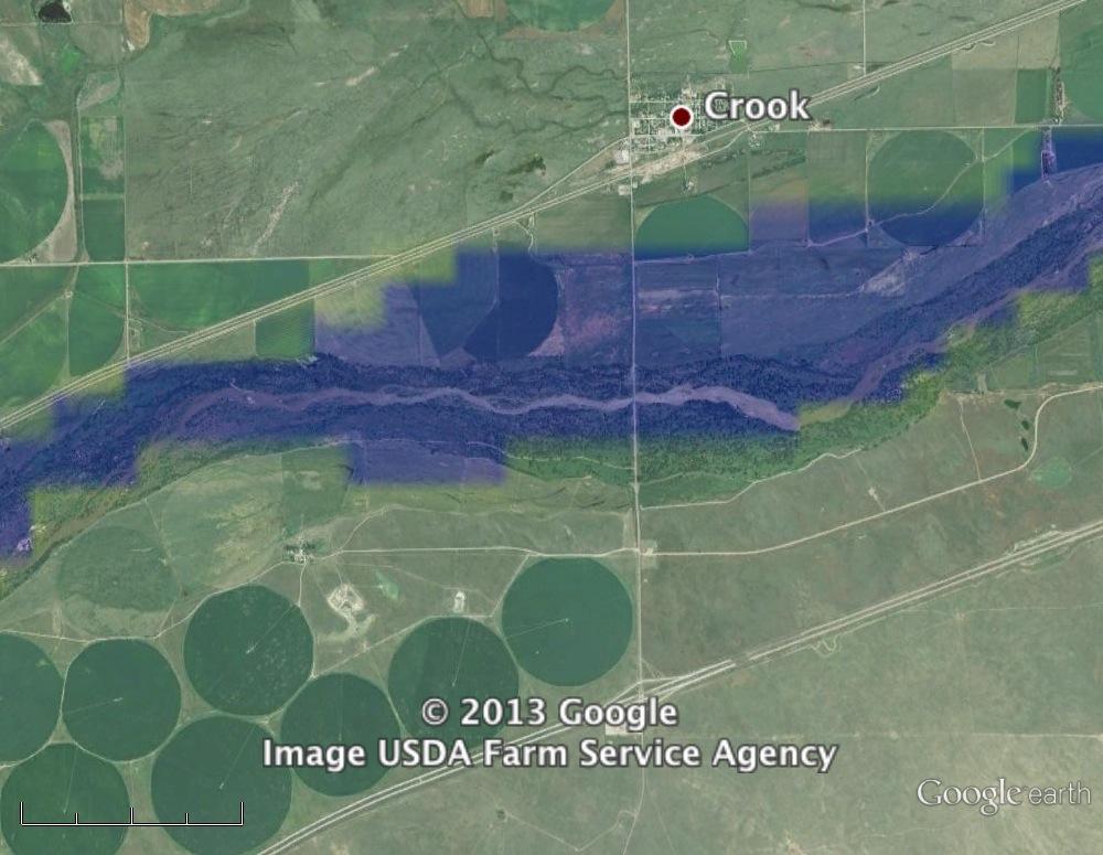
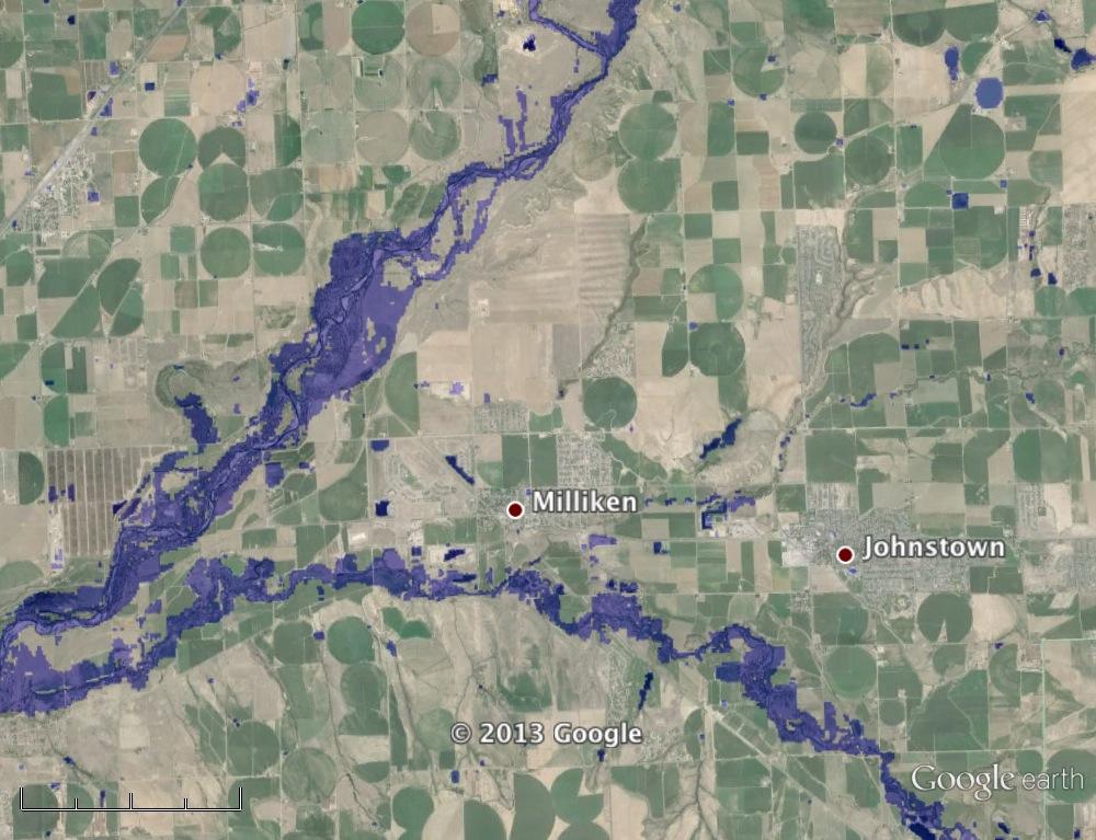
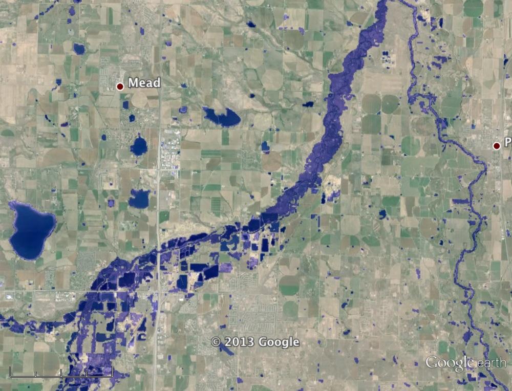
Sample Images from GoogleEarth KMZ version, Landsat 8 September 17, 2013:
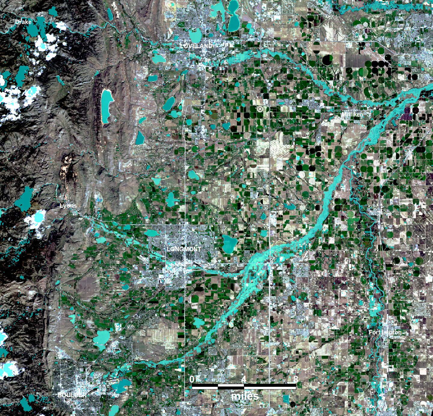
Combined Landsat 8 (September 17, western portion of map only) and MODIS (September 13-20) wide-area mapping
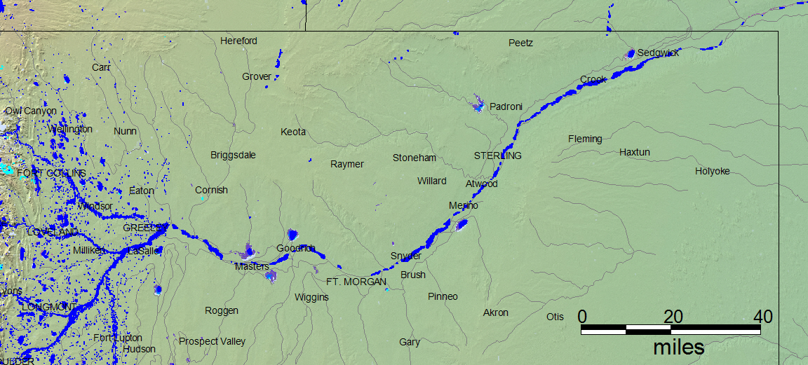
Sample Images from GoogleEarth KMZ version, Combined Landsat 8 and MODIS coverage
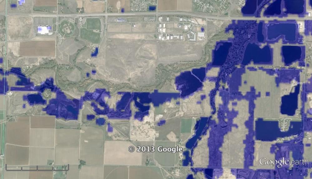
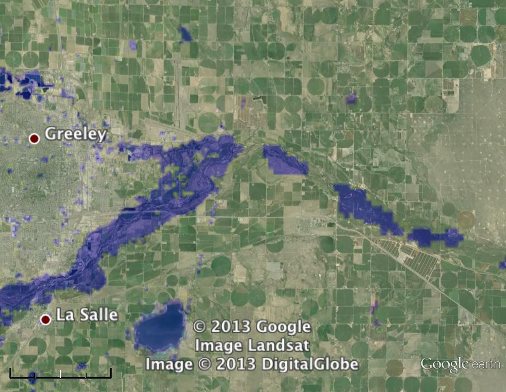
Greeley
Greeley (Detail)
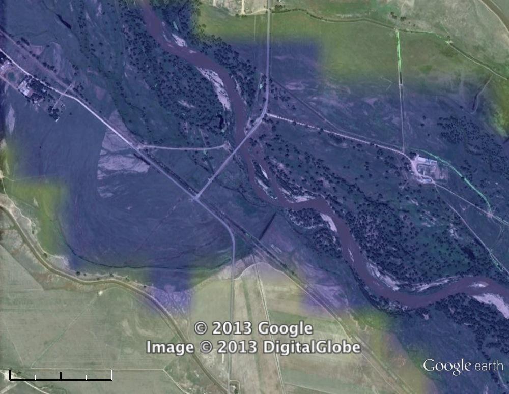
Downstream from Greeley
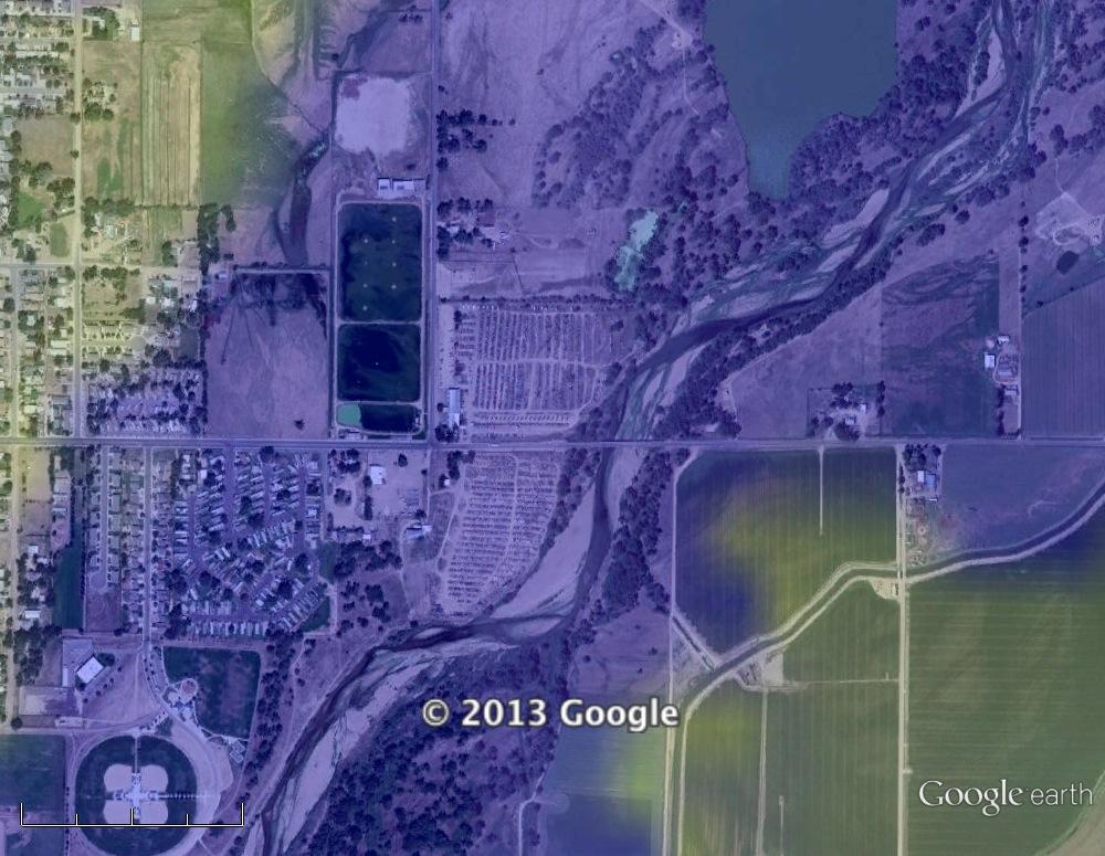
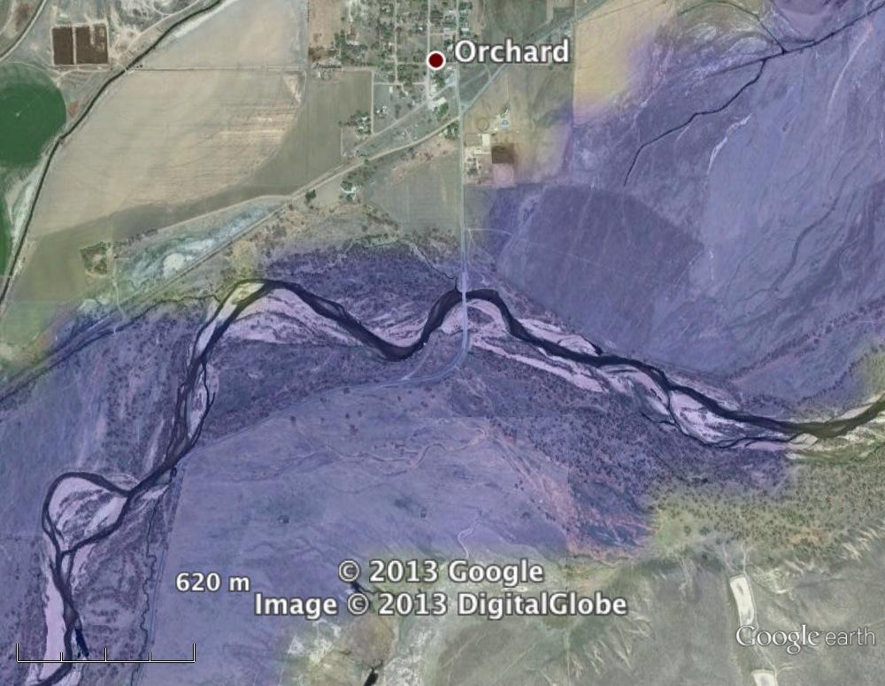
Bridge at Orchard
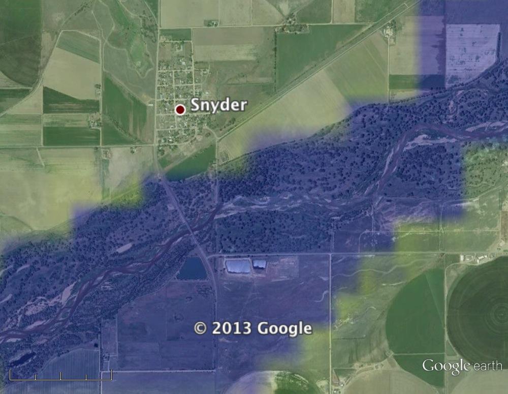
At Snyder
Flooded Cropland at Crook