|
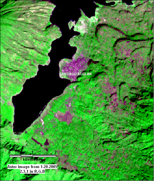
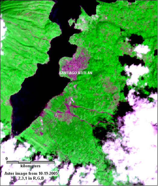
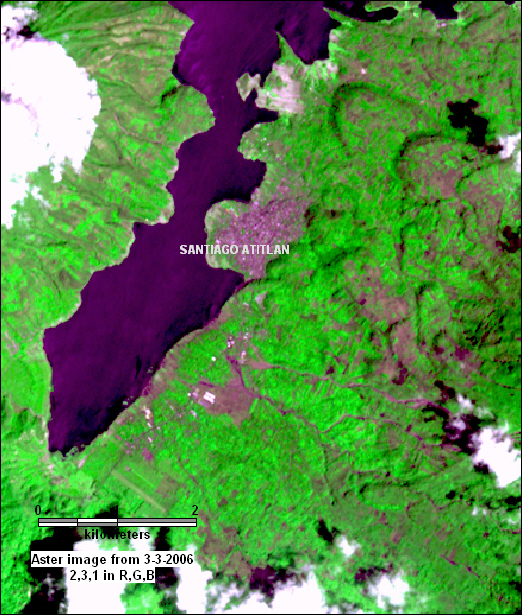
| Above - series of ASTER images from before and after the landslide
at Panabaj on Lake Atitlan, south of the town of Santiago Atitlan.
Left: January 20, 2005. Center: October 19, 2005. Right: March 3,
2006. ASTER bands 3,2,1 in R,G,B. Extreme stretching to try to make
the town of Santiago Atitlan look the same in each image. The mudslide
is clearly seen as two rivers of mud. The map below shows that the
mudslide came down the slopes of Volcan Toliman. New structures, probably
associated with the relief effort, are seen in the March 3rd image. |
|
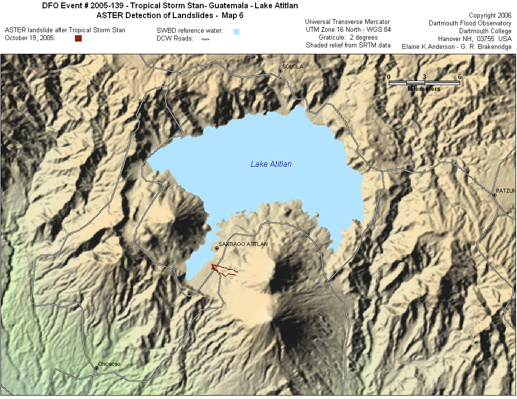 |
| Information from news reports: The mudslide took place on Wednesday
morning, October 5, 2005. One report said it was 4 kilometers long
and up to 12 meters deep in places. Another said it was a "half-mile
wide mudflow as much as 15 to 20 feet thick" Aproximately 1,400
people were missing from the worst-hit communities of Panabaj and
Tzanchaj near Lake Atitlan. Roads were covered with mud and this
prevented rescuers from reaching the site for two days. By October
9 rescue efforts had been stopped, 160 bodies had been recovered
and 250 were still missing. The mayor of Panabaj declared: "Panabaj
will no longer exist. We are asking that it be declared a cemetery.
We are tired, we no longer know where to dig," All of the mudslide
victims were Sutujil Indians, there are only about 100,000 Sutujil
Indians in Guatemala, all live on the shores of Lake Atitlan. The
residents of Panabaj did not allow Guatemalan soldiers to help in
the recovery efforts. Guatemala had a civil war from 1960-1996,
and in 1990 13 villagers from Panabaj were killed by soldiers.
sources: BBC news, Reuters, Associated Press |
|
|
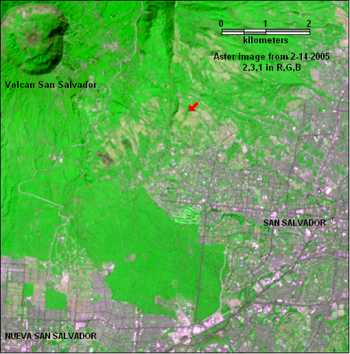
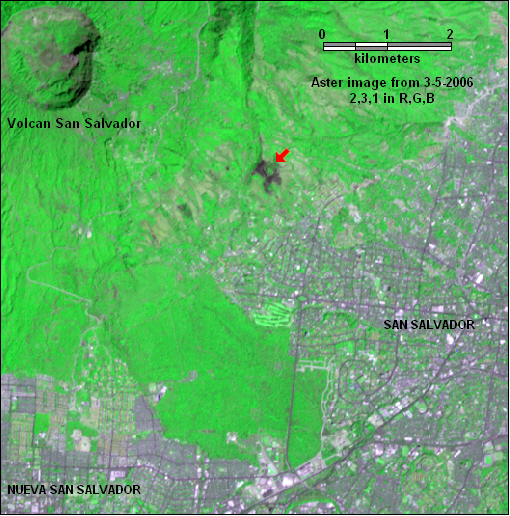
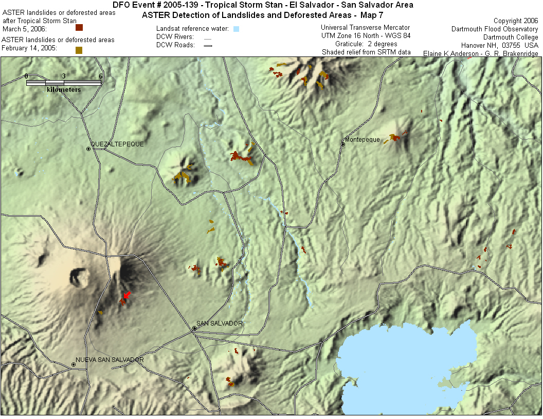
A landslide or new area of deforestation on the outskirts of
the city of San Salvador in El Salvador. ASTER images from before
and after Tropical Storm Stan. There were news reports of a landslide
on a hillside in Nueva San Salvador, just west of the capital. However,
since the ASTER image is from March 2006, we can not determine if
it happened as a result of Tropical Storm Stan.
Below - map showing landslides or deforested areas on hillsides
around the city of San Salvador before and after Tropical Storm
Stan. Red arrow on map points to same landslide as shown in the
ASTER images. |
|
 |
|
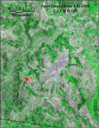
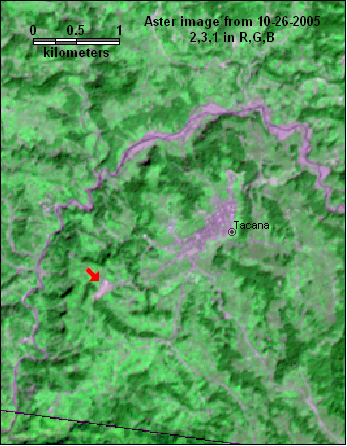
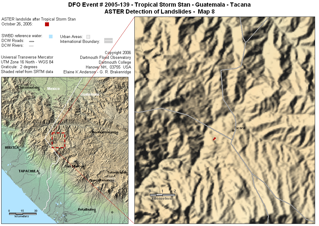
Possibly the landslide that occurred in the town of Tacana in
San Marcos, Guatemala during Tropical Storm Stan. A landslide or
deforested area on the edge of town appears in the October 26, 2005
ASTER image above, it was not there on April 17, 2005 (red arrow
points to area). The river near Tacana is not normally visible to
ASTER, but it is clearly visible even 2 weeks after the storm, and
the flooding has left sediment on the floodplain north of Tacana.
New reports state that more than 40 people were killed when a mudslide
buried a building being used as temporary shelter in Tacana.
Below - map showing location of landslide in Tacana. |
|
 |
|
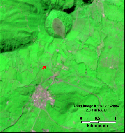
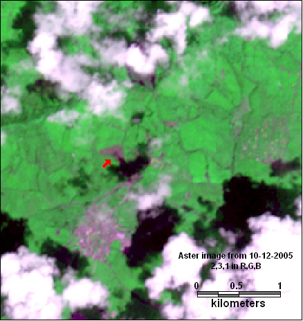
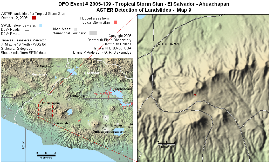
Another landslide or deforested area possibly caused by Tropical
Storm Stan, located near a small town in the Ahuachapan area of
Guatemala. The landslide or deforested area appears clear in the
image from October 12, 2005. The image before the landslide in from
January 11, 2004. (red arrow points to area). DFO did not find any
news reports associated with this event.
Below - map showing location of landslide or deforested area in
Ahuachapan, clearly showing the area in question is on the slopes
of a volcano. |
|
 |
| |