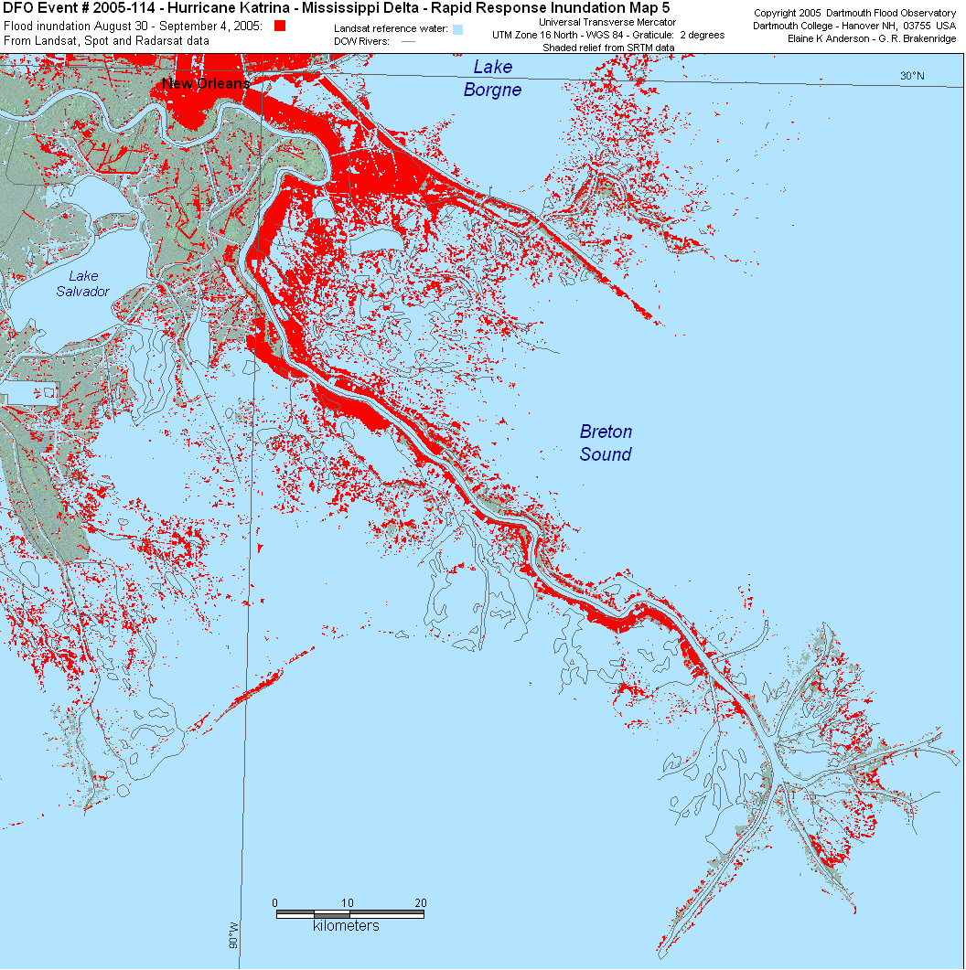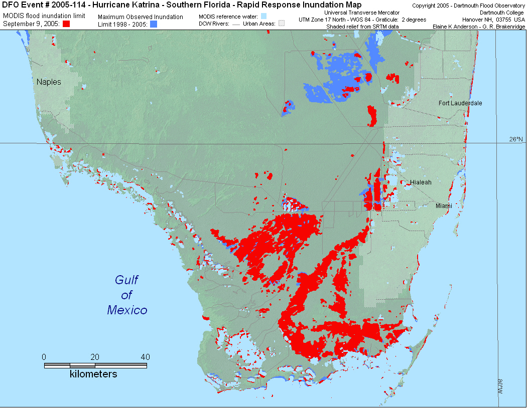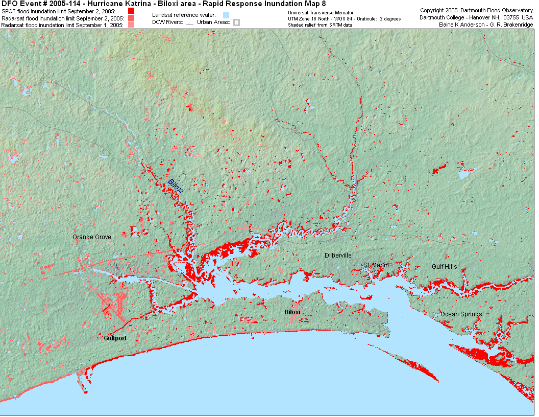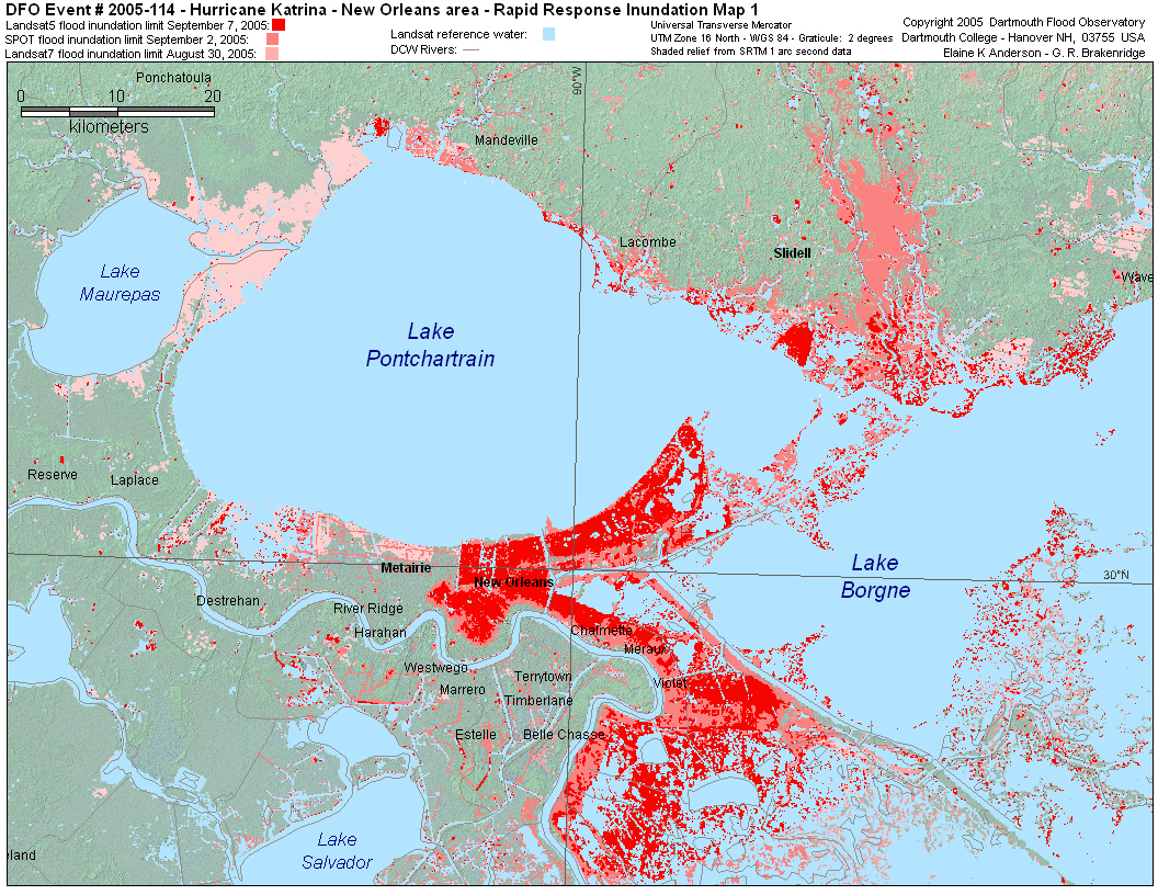
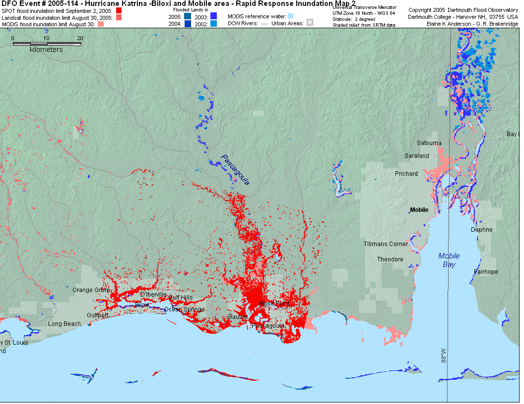
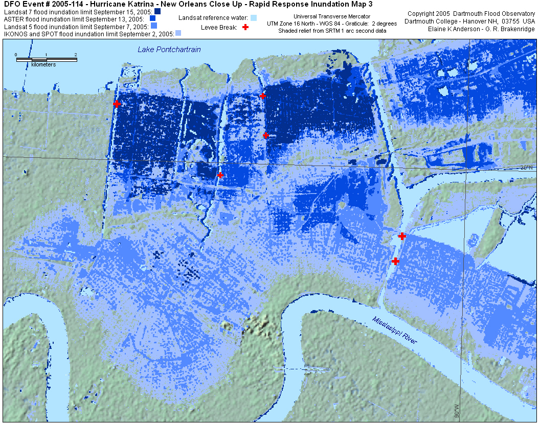
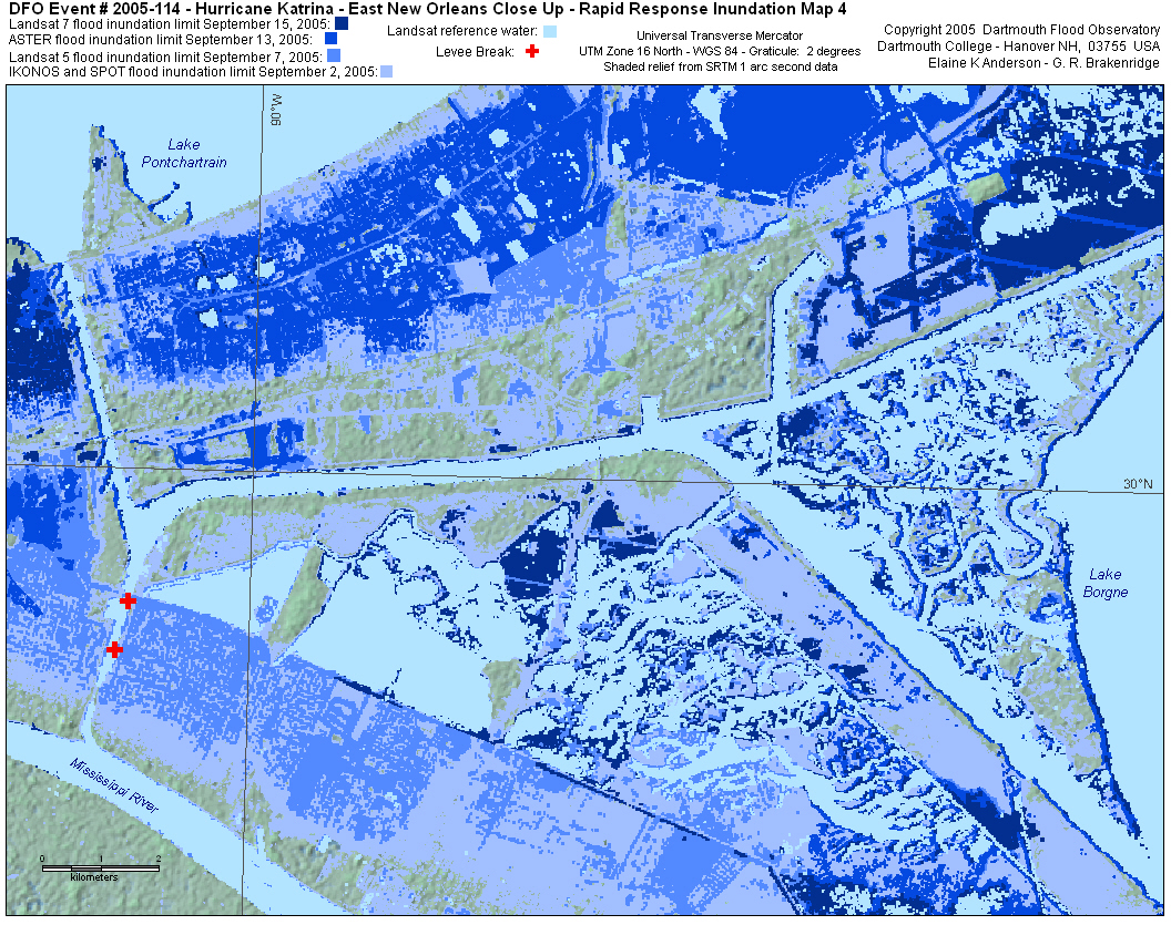
SPOT vectors derived from SPOT data provided by CNES/SPOT through the
activation of the International Charter: Space and Major Disasters
IKONOS vectors derived from IKONOS data provided by Space Imaging through
an agreement with the USGS
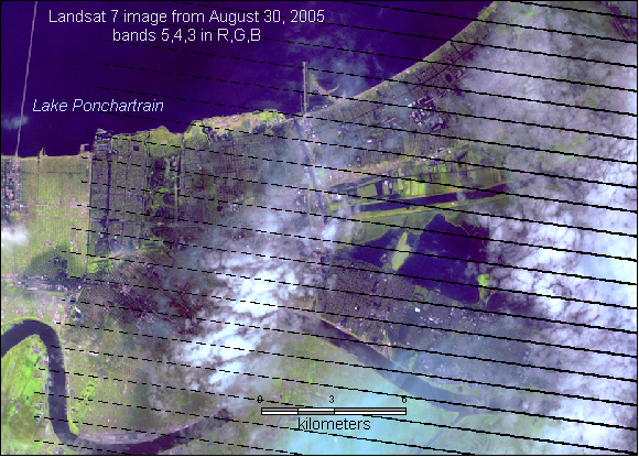
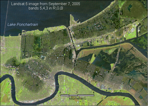
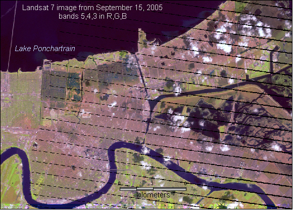
Landsat 5 and 7 data provided by the USGS.
 |
 |
 |
 |