DFO 2005-019

Flooding: 2/9/05 - 2/16/05

Southern Pakistan - Baluchistan Province

MODIS observations: observation of flooding along the Dasht river and sediment plumes at Omara, Pasni and Gwadar areas of Baluchistan on February 11, 15

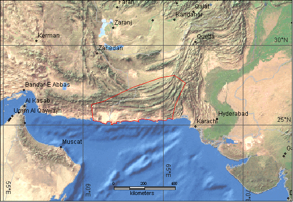
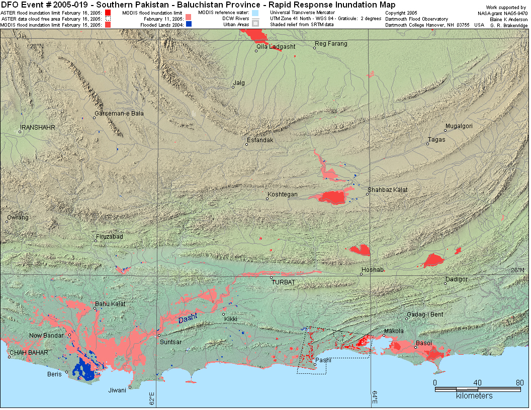
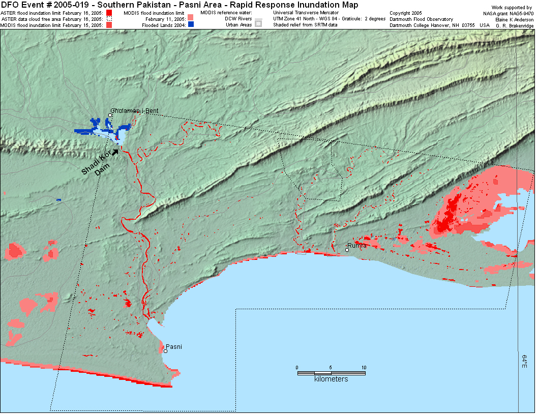
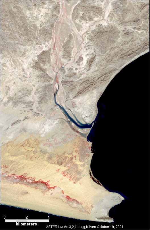
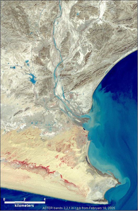
Detailed Locations: Balochistan province - Pasni, Shadi Khore, Chaman, Pishin, Awaran, Turbat, Baila, Jaffarabad, Naseerabad, Gwadar, Mand, Aushab, Ormara, Sibbi, Bela, Kaetch, Khuzdar, Lasbella, Panjgoor. Nano. Suntesar. Villages washed away: Sindhi Paso, Turati, Kurki, Zar Khor and Sharnu Baza.

Rivers: Dasht, Hingol, Nehang.

Comments: Feb 10 - Shadikor Dam burst near Pasni after more than a week of heavy rain, killing at least 80. Several villages near Pasni washed away. Town of Pasni half inundated. 5,500 people trapped by floodwaters around Pasni; 1,500 missing; 1,200 rescued from the floodwater. 40,000 acres of crops destroyed. 40 kilometers of Makran coastal highway washed away. Many bridges washed away. 4,000 families without shelter.
Feb 12 - Gaggo dam burst in Lasbella district, Gawar Bagh dam in Turbat district burst.
Feb 13 - Chalvi dam burst in Kech district.
40,000 homeless in Lasbella, Gwadar, Khuzdar, Awaran, Ketch and Panjgoor districts.


Dead: 300 Displaced: 40,000 Damages: no data Affected Region : 123,200 Severity Class* : 1 Flood Magnitude**: 7.3 MODIS flood inundation limit file names***:
20050216062554Pak019Aster
20050420605Pakis019M2bm
A pair of ASTER images of the Pasni area from October 2001 and February 16, 2005 as the floods are receding. In these images water varies from a dark blue or black to light blue, depending on the sediment content. Vegetation is red, and the desert appears in shades of light brown and brownish yellow. The most noticable change is the huge plume of sediment off the coast of Pasni, and that there is much more water in the channel of the main river in the image. There is vegetation in the flood plain of this river in the 2001 image (hints of red northeast of the new reservoirs), and there is none in the post flood image - this change could be due to the flooding or to normal seasonal varaiations. A series of small reservoirs and a couple new or improved roads can be seen in the 2005 image to the west of the river in the center of the image. There is also some standing water remaining in the agricultural areas to the south of the reservoirs. A road that can be seen running east west in the 2001 image through these lowlands appears to have disappeared after the floods. The mouth of the river has also been reshaped by the huge volume of water and sediment that recently passed through it in the flooding. The Shadi Kore dam, which is 40 kilometers away from the town of Pasni, is not in these images.

Map preparation and image analysis: Elaine Anderson

DFO Homepage