 |
Comments: Several days of heavy snow,
ice and rain on saturated ground followed by warm temperatures.
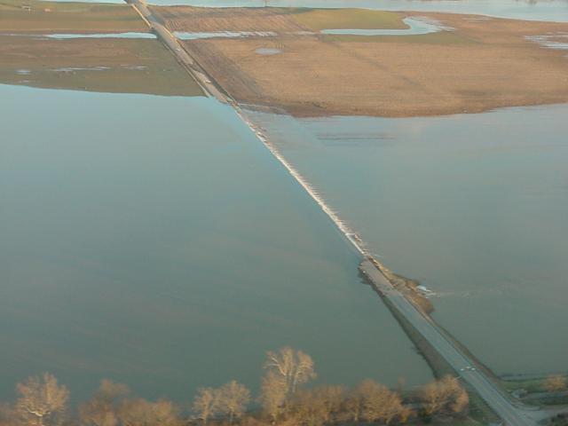
West Virginia - Heavy damage on Wheeling Island.
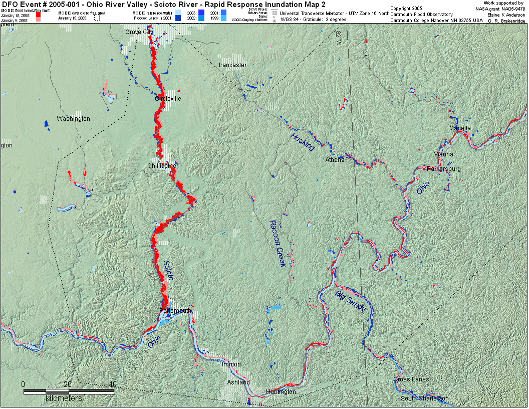
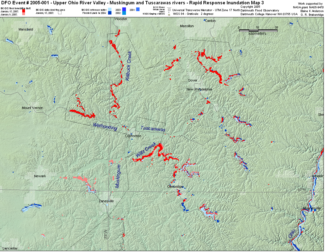
Jan 6 - Highest levels on Muskingum River since 1964 at McConnelsville,
OH.
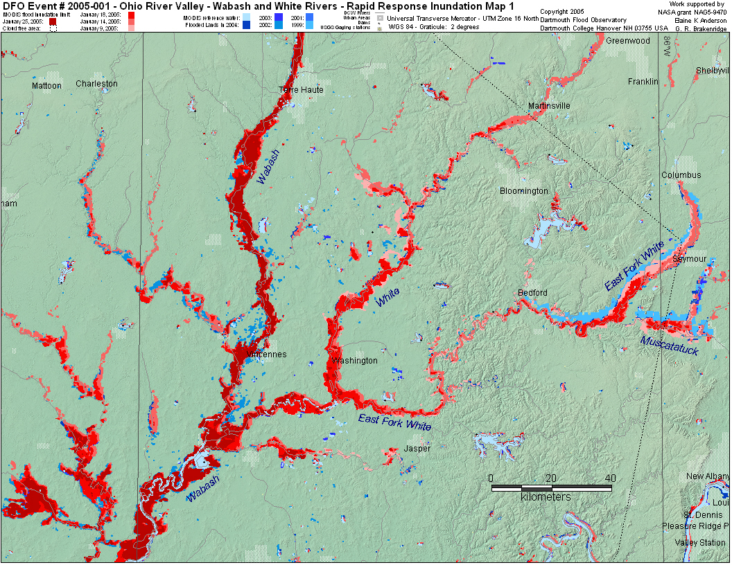
Jan 8 - White River at Newberry and Bloomfield at highest
level since March 1913. East Fork of White River at highest
levels since 1937 in Lawrence County.
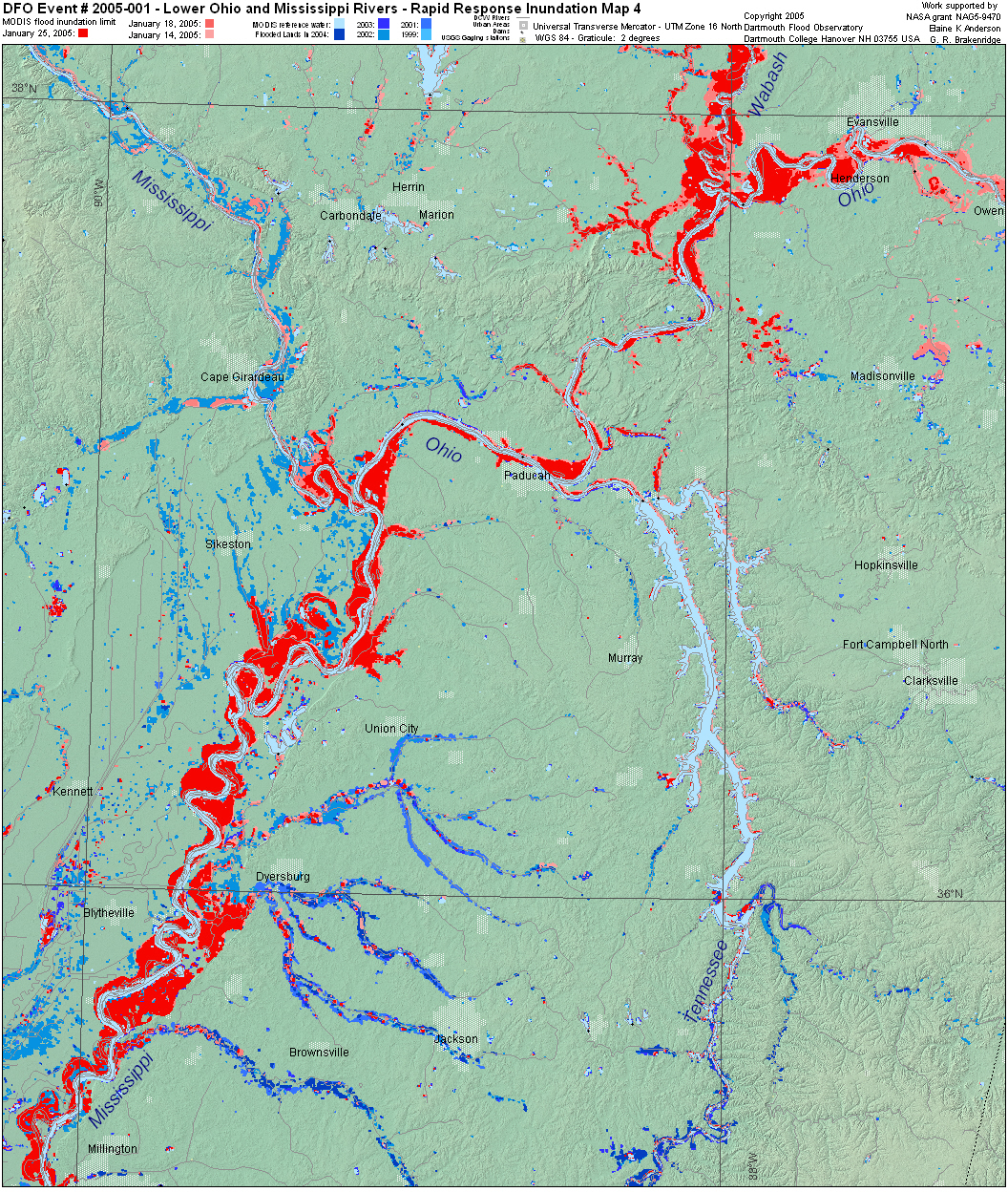
Record flooding on Maries River at Westphalia, MO.
Jan 10 - Southern Indiana - worst flooding since 1937 in "isolated
pockets"
Jan 14 - Levees fail along the Wabash River in West Terre
Haute.
Jan 17 - Wabash river at third highest flood stage in recorded
history at Terre Haute.
Jan 18 - 3,300 evacuated from Bolivar, Ohio. |
|
Detailed Locations:
Ohio - counties: Hocking, Franklin, Licking, Fairfield, Madison,
Pickaway, Marion, Marietta, Washington, Hamilton, Tuscarawas. towns:
Dayton, Prospect, Bolivar.
Indiana - counties: Greene, Daviess, Knox, Gibson, Pike, Dubois,
Martin, Lawrence, Orange, Jackson, Washington, Posey, Owen, Shelby,
Vigo and Madison. Petersburg, Hazleton, Mount Carmel, West Terre
Haute.
Illinois - Clark and Crawford counties. Lawrenceville, Vandallia,
Darwin and York.
West Virginia - Northern Panhandle area. Wheeling Island. New Cumberland,
Wellsburg, Parkersburg.
Kentucky - Henderson county
Pennsylvania - counties: Beaver, Washington, Allegheny.
Missouri - St Louis area.
Rivers:
Ohio River - from Pittsburg to the confluence with the Mississippi
River
Ohio - Scioto, Hocking, Licking, Muskingum, Great Miami, Auglaize,
Maumee, Saint Marys, Kankakee, Tuscarawas. Big Darby and Big Walnut
creeks.
Indiana - White, Wabash, East Fork White, Flatrock, Muscatatuck,
Big Blue, Mississinewa, Tippecanoe.
Illinois - Embarras, Kaskaskia, Illinois, Wabash.
West Virginia -
Pennsylvania - Monongahela, Youghiogheny, Allegheny.
Missouri - Moreau, Maries, Meramec, Black Water, Big, Cuivre.
MODIS observations: flooding along lower Ohio,
Wabash, White and tributaries, and Scioto on January 9, 14, 15.
Illinois river high January 16. Lower Mississippi high on January
17, 18. |