 |
Detailed Locations:
Northwest India - Uttaranchal state - Udham Singh Nagar district
Gujarat State - Surat, districts: Bharuch, Vadodara, Dahod and Panchamahals
Maharashtra State - Mumbai, Jalgaon
Punjab state -Haryana state -
Rajasthan - Kota and Bhilwara districts.
Pakistan - Pasroor area, Sialkot District
Rivers:
India - Narmada, Mahi, Kailash, Bayal
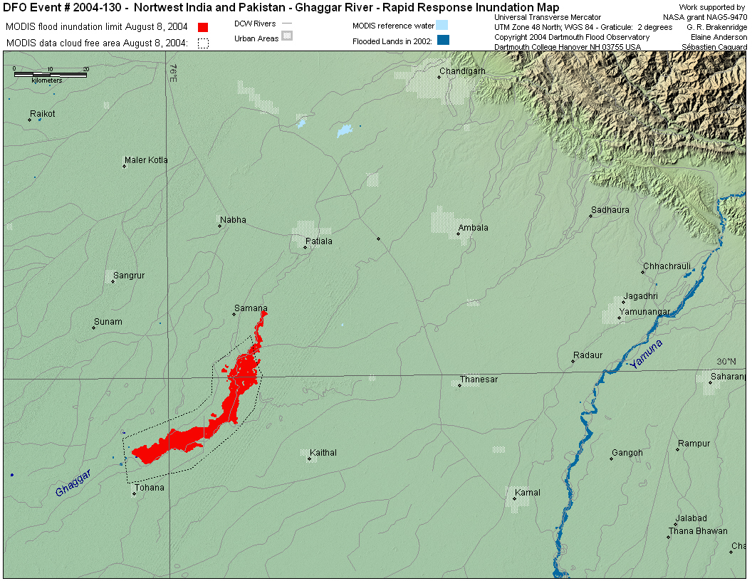
Punjab - Ghaggar River
Pakistan - Indus tributaries, Tavi,
Comments:
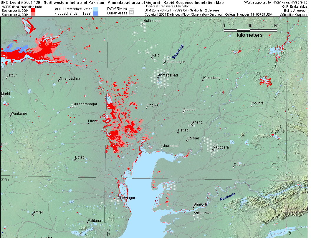
Worst flooding in Gujarat since 1998.
Narmada dam in Gujarat begins overflowing on August 6 - thousands
prepare to evacuate.
August 9 - India releases water into Nullahs Dek and Hasri which
floods hundreds of Pakistani villages in Pasroor.
MODIS observations of high levels on the upper and middle Indus
river begin on July 12 and continue.
MODIS observation of flooding on Ghaggar river on border of Punjab
and Haryana on August 8, 21. Smaller floods observed further downriver
on August 14.
MODIS observation of high levels in the Gulf and Rann of Kutch and
in Gujarat around Ahmadabad on August 25, September 3, 8. |