DFO 2004-024

Flooding: 2/13/04 - 2/24/04

New Zealand - Southern North Island

Detailed Locations:
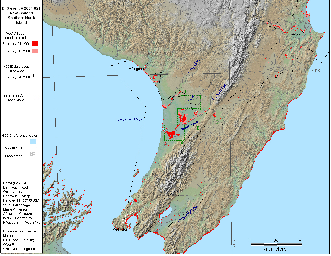
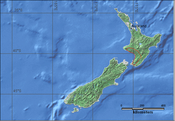
North Island - Wellington region, Waitotara Valley in South Taranaki, farm regions of Wairarapa, Manawatu, Hawke's Bay. Rangitikei district. 
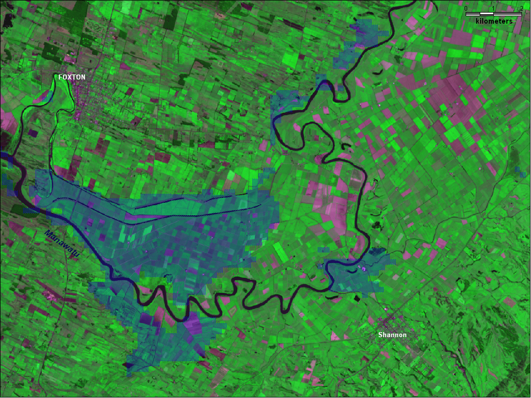
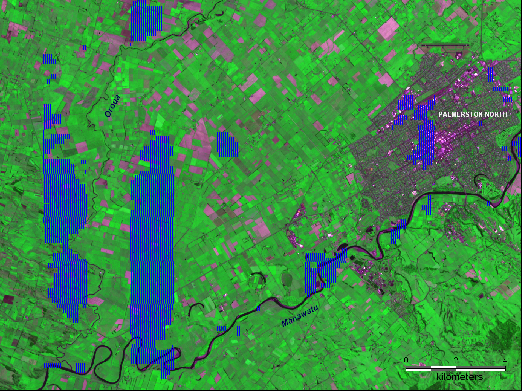
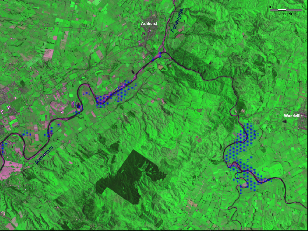
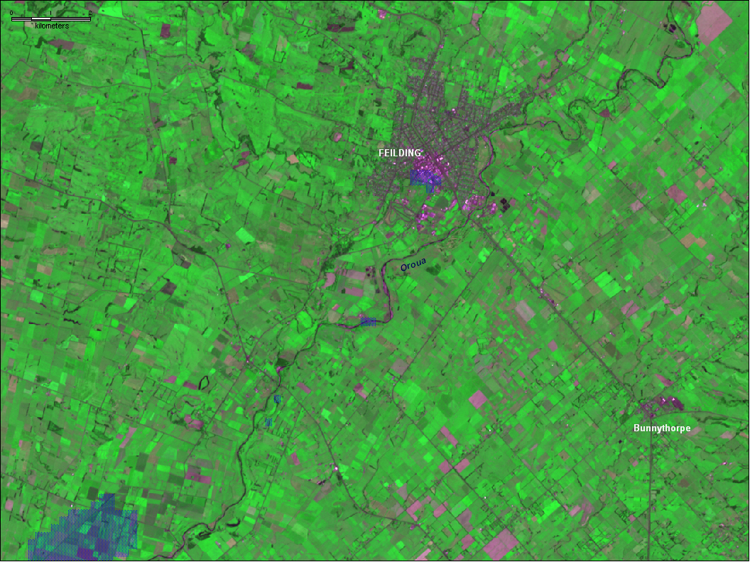
Towns: Feilding, Palmerston North, Moutoa, Waitotara, Wairarapa, Martinborough, Marton, Lower Hutt, Tangimoana, Picton, Paekakariki, Scotts Ferry, Whangaehu.

Rivers:
Rivers: Rangitikei, Oroua, Manawatu, Mangaweka, Waitotara, Ruamahanga. streams: Makino, Kiwitea, Waiwhetu, Whangaehu

Comments:
Southerly storm "worst storm in decades". Landslides cause road closures. Biggest flood in 60 years on Mangaweka river. Tens of thousands of acres of farmland inundated; extensive agricultural damages.
"This was a one in 100 year event so there was not much you could compare it to," "...worst natural disaster since the Napier earthquake in 1931."
MODIS observation of flooding near Palmerston North on February 18. Additional observations on February 24,

Dead: 2 Displaced: 2,500 Damages: $70,000,000 Affected Region ( sq km): 14,840 Severity Class* : 3 Flood Magnitude**: 9.1 MODIS flood inundation limit file names***:
20040552210NewZea024M2.50
20040490215NewZea024Ma2.55
A. Lower Manawatu River near Foxton. Blue pattern shows inundated areas on February 18-24, 2004. Aster image from January 2, 2003; bands 2,3,1 in R,G,B.
B. Manawatu and Pahangina rivers near Palmerston North. Blue pattern shows inundated areas on February 18-24, 2004. Aster image from January 2, 2003; bands 2,3,1 in R,G,B.
C. Manawatu River near Ashhurst and Woodvillle. Blue pattern shows inundated areas on February 18-24, 2004. Aster image from December 4, 2000; bands 2,3,1 in R,G,B.
D. Oroua River near Feilding. Blue pattern shows inundated areas on February 18-24, 2004. Aster image from January 2, 2003; bands 2,3,1 in R,G,B.


Map preparation and image analysis: Elaine Anderson

DFO Homepage