 |
Detailed Locations:
Sumatra -
Jambi Province - districts of Jambi, Muaro Jambi, Batanghari and
Sarolangan. Muara Tembesi.
Riau Province - Indragiri Hulu
South Sumatra - Musi Banyuasin
South Sulawesi Province - Majene district. Wajo, Soppeng and Sidrap
regencies.
North Sulawesi - Manado area
Rivers:
Jambi Province - Batanghari River
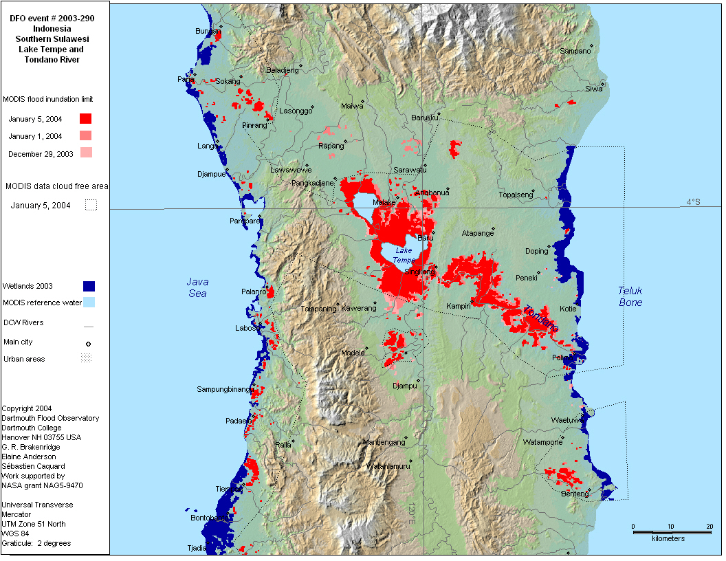
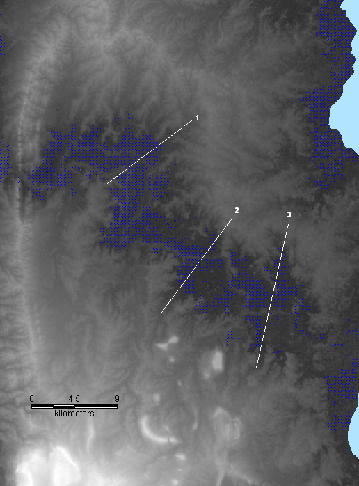
Sulawesi - Tondano River, Lake Tempe
Comments:
Biggest floods in Jambi since 1955. Batanghari River overflowed.
"floods have destroyed about 40,000 units of houses dwelt in
by 357,000 people, swept away 114 houses of worship and inundated
48 kilometers of national roads, along with 72 kilometers of provincial
roads.... floods also submerged 39,268 hectares of plantations and
36,023 hectares of agricultur land"
11,000 houses inundated in Riau.
Floods and landslides in Majene, Sulawesi. South Sulawesi "Thousands
of hectares of paddy fields and cacao plantations were damaged,
while hundreds of livestock were washed away"
MODIS observation of flooding in Sulawesi Selatan around Singkang
on December 29 and January 1, 5, 10, 12 in areas that were dry on
December 13.. |