 |
Detailed Locations: Rivers: Comments: |
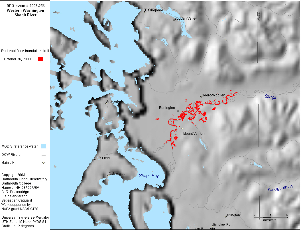
| Dead: 4 | Displaced: 4,000 | Damages: $190,000,000 | Affected Region ( sq km): 61,820 | Severity Class* : 2 | Flood Magnitude**: 11.5 | MODIS flood inundation limit file names***: 20031026Skagit256Rsat |
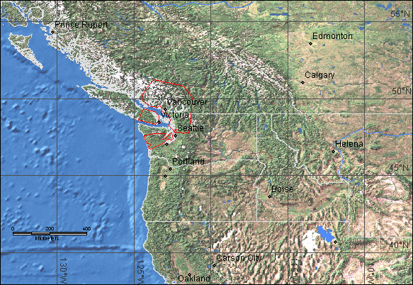
British Columbia, Canada and Washington, USA
|
|||||||
|
|||||||
|
|||||||
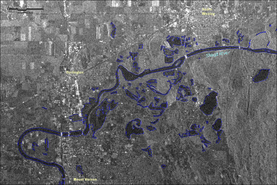
| Flooding along the Lower Skagit River in western Washington state, near the city of Mount Vernon. Radarsat Standard Beam Full Resolution data, geocorrected to 10m pixels, aquired October 26, 2003 at 02:07 utc. Vector overlay in blue shows areas interpreted by DFO staff to be water on October 26. Image map in UTM projection, zone 10. Radarsat data are © Canadian Space Agency 2003. | |||||||
|
Map preparation and image analysis: Elaine Anderson. We acknowledge NASA, the Alaskan SAR Facility, the National Ice Center, and Brenda Jones at the USGS for facilitating this experimental "rapid response" data product.