 |
Detailed Locations: Rivers: Comments: |
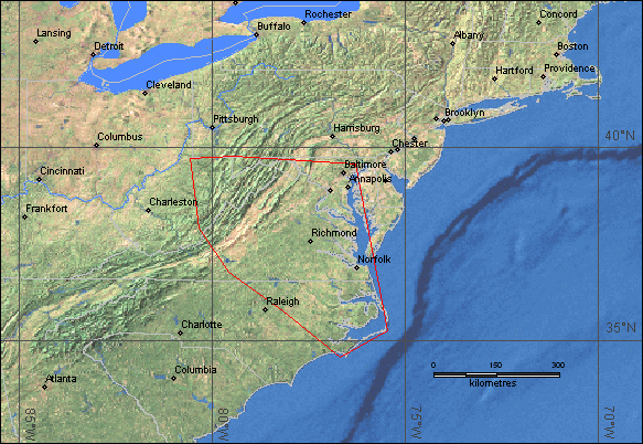
| Dead: 7 | Displaced: 2,500 | Damages: no data | Affected Region ( sq km): 171,200 | Severity Class* : 1 | Flood Magnitude**: 5.7 | MODIS flood inundation limit file names***: 20030920Isabel239RSat |
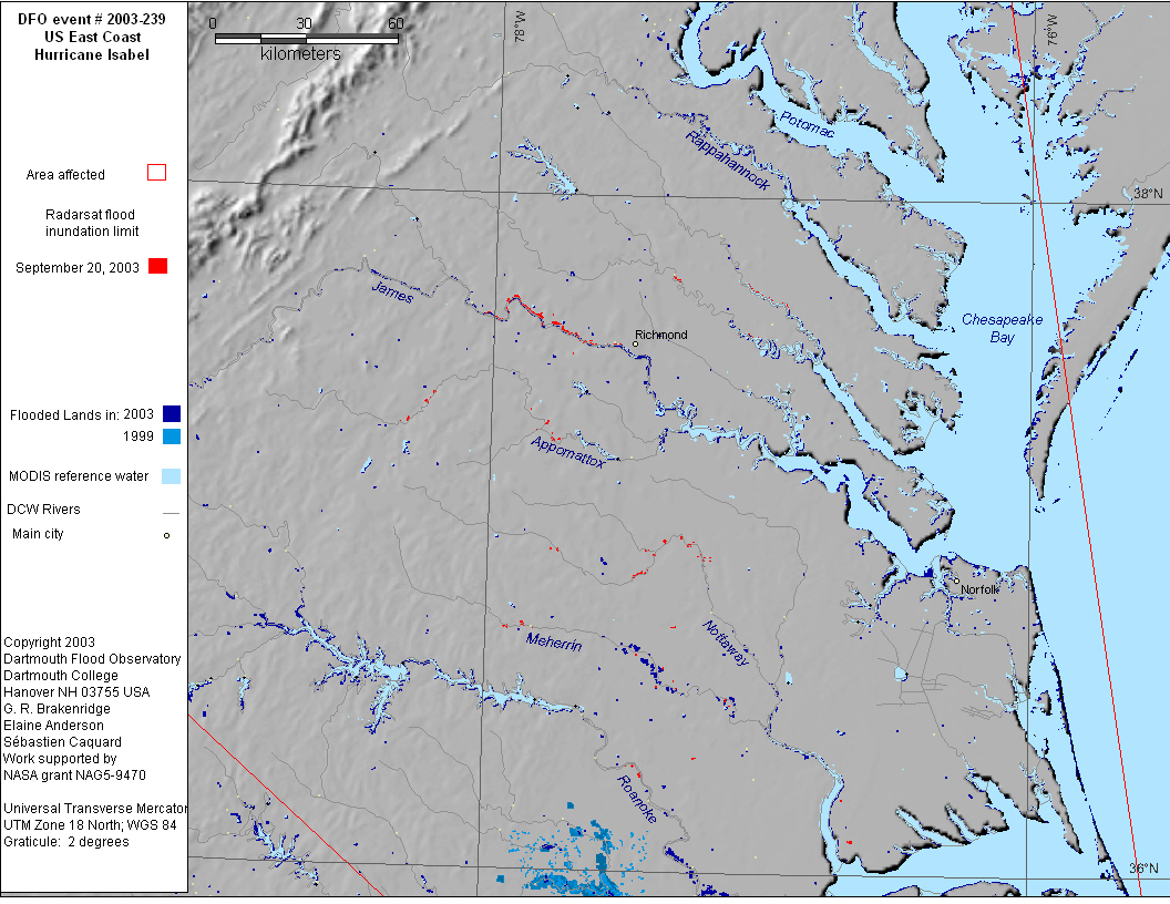
Eastern USA - Hurricane Isabel - Chesapeake Bay Area
|
|||||||
|
|||||||
|
|||||||
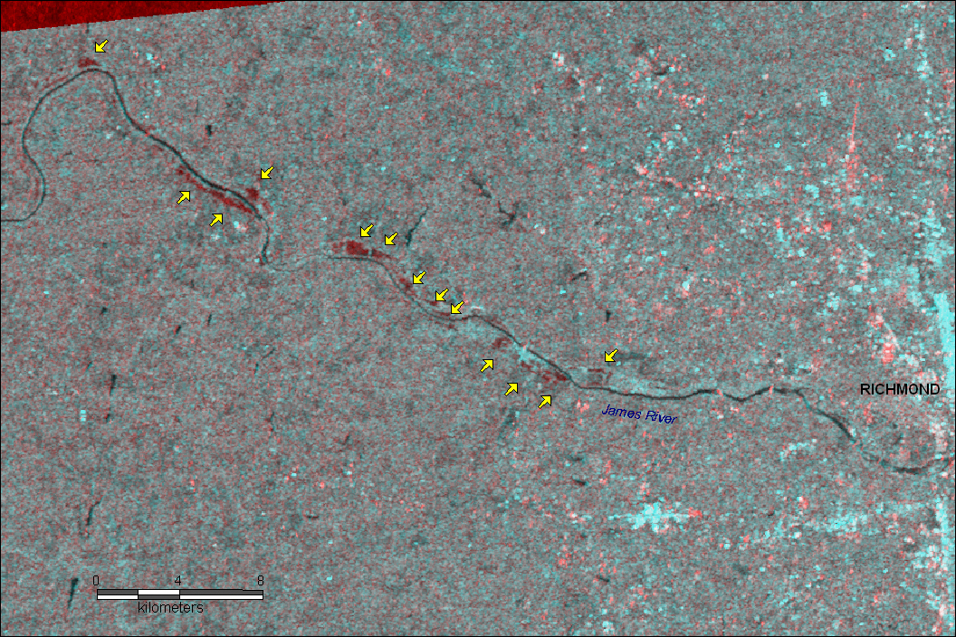
| Flooding along the James River west of Richmond Virginia. Radarsat Scansar Wide Beam 50m resolution data, aquired September 20 at 23:02 utc. Change detection image with Radarsat Scansar Wide Beam 50m resolution data from May 2003 in the red channel and the flood data from September 20 in the green and blue channels. Yellow arrows point to new water, which shows in red. Image map in UTM projection, zone 18. Radarsat data are © Canadian Space Agency 2003 | |||||||
|
|||||||
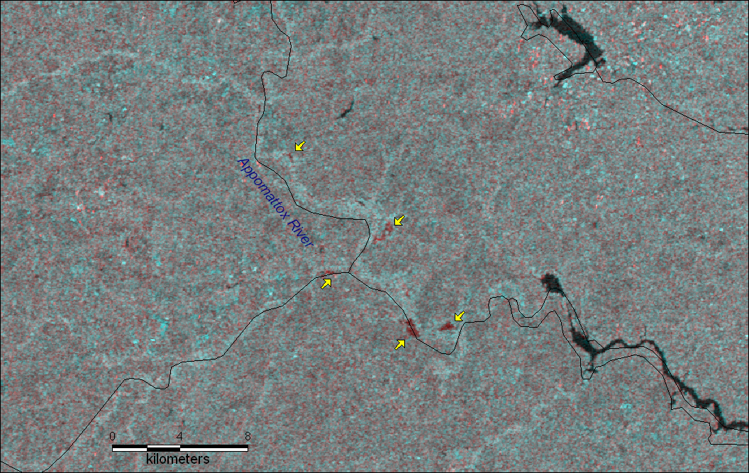
| Flooding along Appomattox river southwest of Richmond, Virginia. Radarsat Scansar Wide Beam 50m resolution data, aquired September 20 at 23:02 utc. Change detection image with Radarsat Scansar Wide Beam 50m resolution data from May 2003 in the red channel and the flood data from September 20 in the green and blue channels. Yellow arrows point to new water, which shows in red. Image map in UTM projection, zone 18. Black lines - DCW rivers overlay. Radarsat data are © Canadian Space Agency 2003 | |||||||
|
|||||||
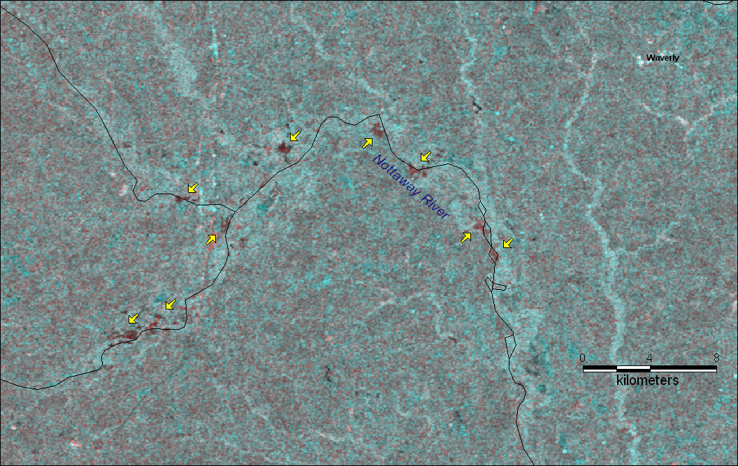
| Flooding along the Nottaway River near Waverly, Virginia. Radarsat Scansar Wide Beam 50m resolution data, aquired September 20 at 23:02 utc. Change detection image with Radarsat Scansar Wide Beam 50m resolution data from May 2003 in the red channel and the flood data from September 20 in the green and blue channels. Yellow arrows point to new water, which shows in red. Image map in UTM projection, zone 18. Black lines - DCW rivers overlay. Radarsat data are © Canadian Space Agency 2003 | |||||||
|
Map preparation and image analysis: Elaine Anderson, Emily Bryant and Robert Brakenridge. We acknowledge NASA, the Alaskan SAR Facility, the National Ice Center, and the U.S. Army Corps of Engineers for facilitating this experimental "rapid response" data product.