 |
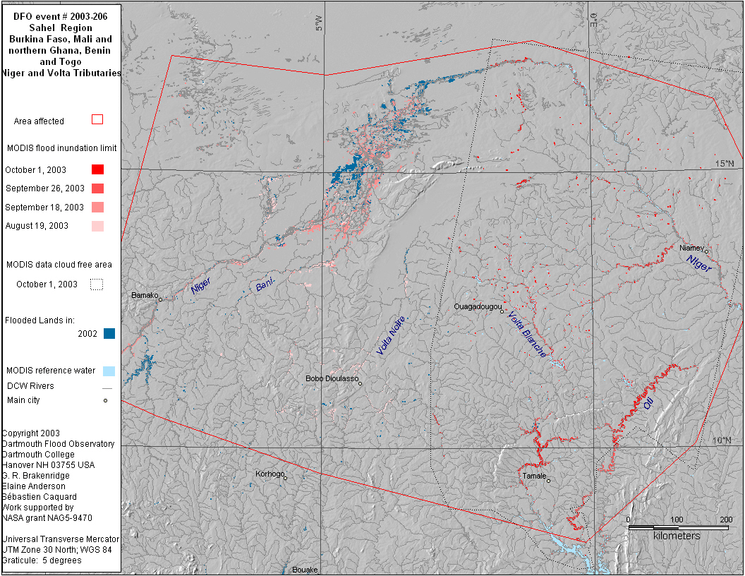
Detailed Locations:
Mali - Tominian district, Bamako area, Missabougou. regions of Mopti
and Segou. Tenekou and Timbuktu regions
Burkina Faso - Dori and Djibo areas
Rivers:
Niger River and tributaries.
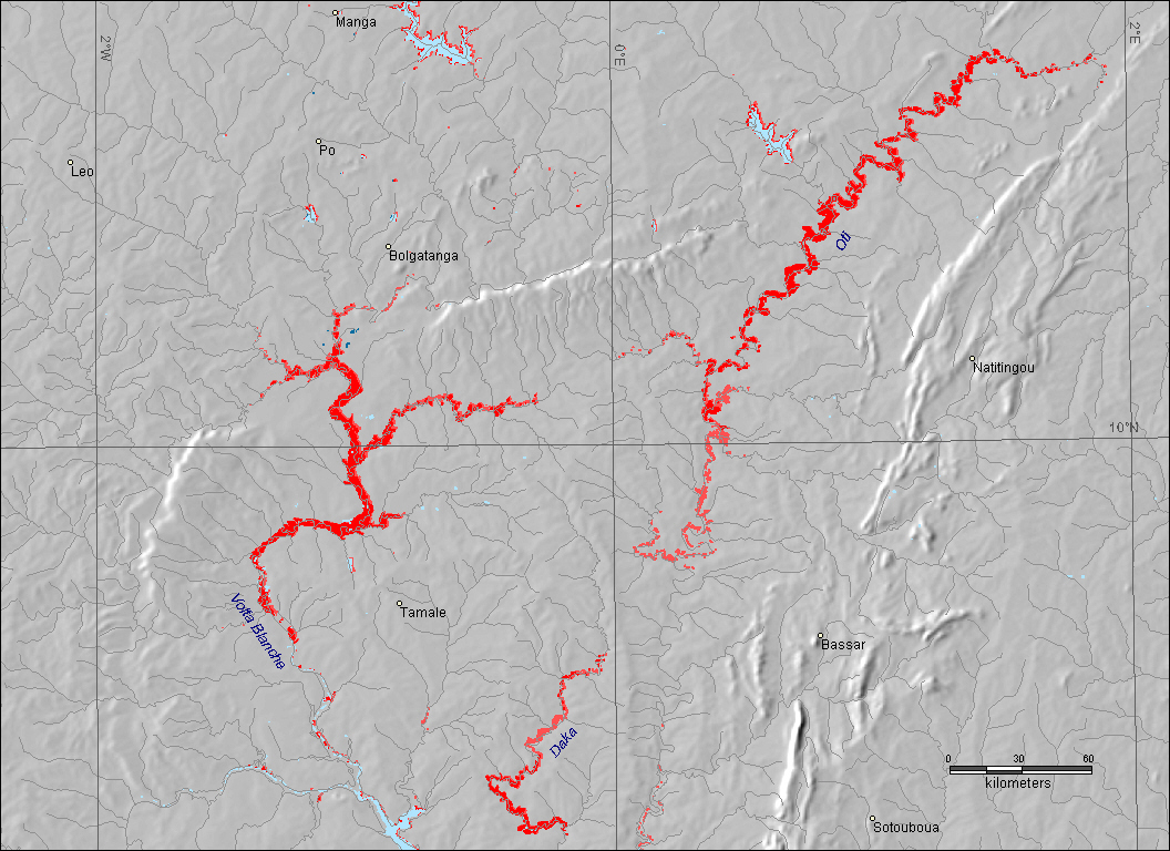
Volta Noire, Oti, White Volta
Comments:
"Exceptional Heavy Rainfall" in the Sahel started in May.
Water reserviors around Ouagadougou overflowing. "On 10 August,
Tominian lost among other things over 700 storehouses; over 2,000
hectares of inundated fields, and hundreds of inundated houses"
September 8 - "scores" of people killed in central and
northern Mali. 180 homes in Timbuktu have collapsed. Niger river
within a few inches of overflowing its banks.
MODIS observations of wet conditions in the Sahel along the Niger
river begin in late July. MODIS observations of high levels on upper
Senegal river in western Mali on August 19, 26. Wet conditions observed
in western Mali on September 2, 4, 9, 13, 17, 18. High levels observed
on Oti and White Volta rivers in eastern Burkina Faso, Togo and
Ghana on September 17, 22, 24, 26
QuikSCAT has been showing wetter than average conditions in the
Sahel throughout July and August. |