 |
Detailed Locations:
Indiana - Counties: Carroll, Adams, Cass, Howard, Tipton, Wells,
Miami, Boone, Jennings, Clay, Tippecanoe. Lafayette, Fort Wayne,
Decatur, Huntington .
Ohio - Counties: Mercer, Auglaize, Van Wert, Darke, Shelby, Logan,
Hamilton . Rockford, Montezuma, Celina, Miamitown.
Illinois -
Rivers:
Indiana - Wabash, White, Mississinewa, St. Mary's, Eel, White, Tippecanoe,
Muscatatuck, West Fork Whitewater. Wildcat, Deer and Pipe Creeks.
Ohio - St. Marys, Chagrin, Blanchard, Maumee, Miami, Pike, Scioto,
Warren, Great Miami, Sandusky and White (West Fork) Rivers.
Illinois - Wabash, White, Embarras, Iroquois
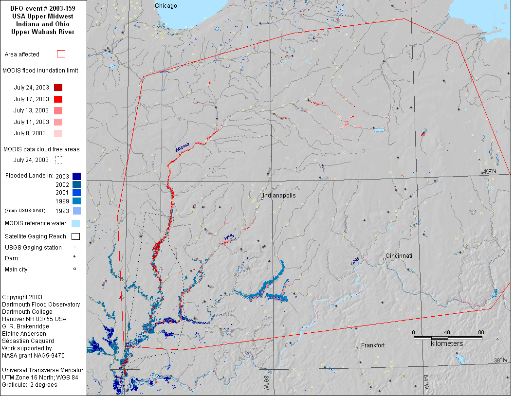
Comments:
Several days of severe thunderstorms. Wabash River at Lafayette,
IN at the highest level since February 1959. Wildcat Creek in Kokomo
highest levels since 1958. St. Marys River south of Fort Wayne hit
a record flood level of 26.54 feet Tuesday, passing the mark of
26.5 feet set in 1913. Levels on parts of the White River are as
high as they've been since 1929. $100 million crop damage in Indiana.
1300 homes in Indiana damaged by floods. 250 damaged or destroyed
homes in Ohio.
MODIS observation of high water on Wabash River on July 8. High
water observed on Wabash and White rivers on July 12 and 13.
QuikSCATshows new anomalies in central Ohio week ending July 3.
|