DFO-2000-039 Russian Far East
 
Blue:
This flood event on August 5, 2000. See the downloadable Mapinfo export format vectors below the maps for data sources and dates.
Within the vector file names, An=AVHRR 1 km night image; Ad=AVHRR 1 km day image, LB=Landsat 7 browse images; L7=Landsat 7 full resolution data; Rs=Radarsat Scansar; E=ERS SAR.
 
Light Blue:
Maximum observed flooding, 1985-present, from multiple sensor sources. This data layer is still incomplete.
 
Black lines or areas:
Digital Chart of the World hydrography streams, rivers, and lakes.
 
Map Preparation and Image analysis: E Anderson and GR Brakenridge


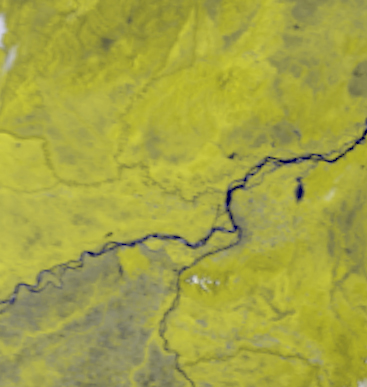
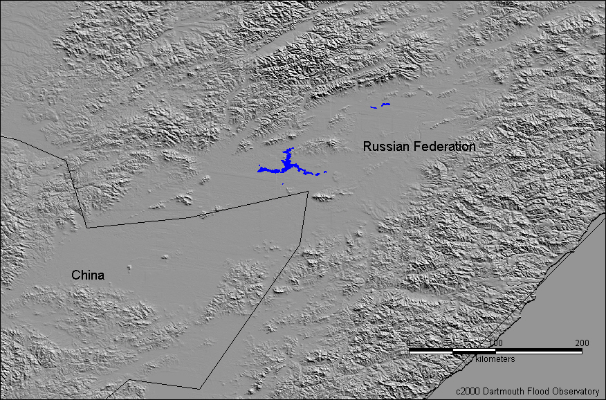
Caption for above map: Location of Eastern Russia flooding on August 5, 2000, in blue. 1 km Satellite data courtesy NOAA and topographic data courtesy USGS Eros Data Center.


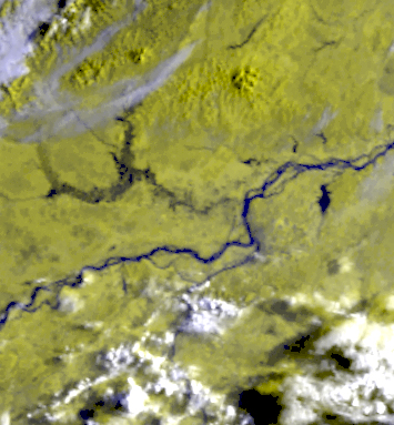
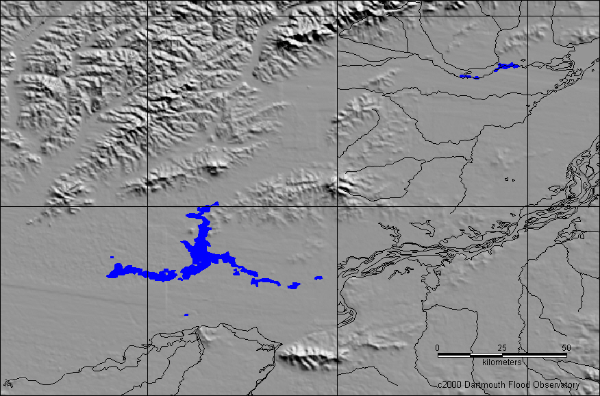
Caption for above map: Detail of flooded lands along the Amur River near the city of Chabarovsk on August 5, 2000 (dark blue).

   
Geocorrected AVHRR image from July 2, 2000. bands 2,2,1 in R,G,B Geocorrected AVHRR image from August 5, 2000. bands 2,2,1 in R,G,B


DFO Homepage