Index of DFO images or image maps:
1. DFO - Ten Degree Flood Map W100N40
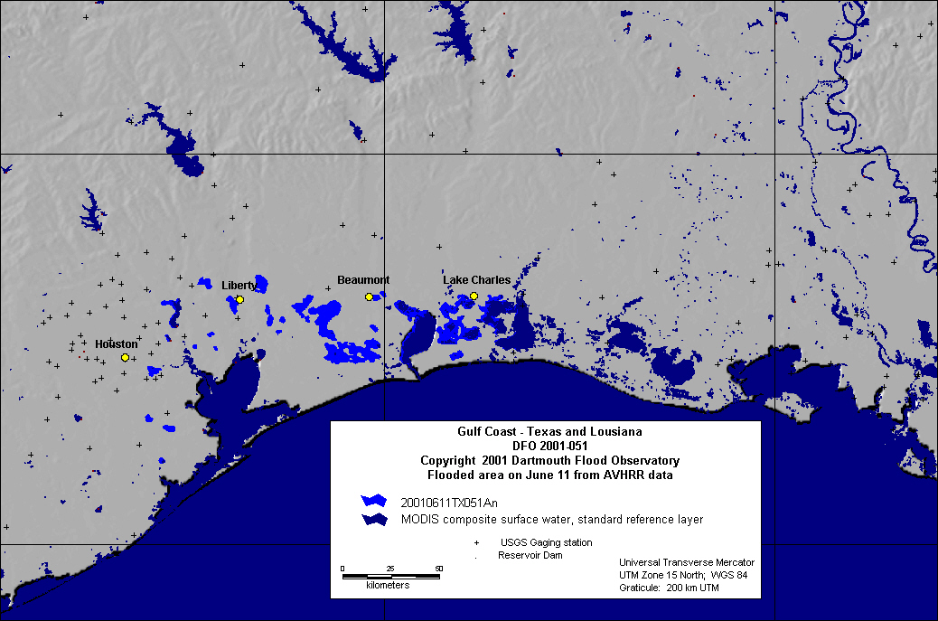
2. Color Shaded Relief Map of Gulf Coast Flooding
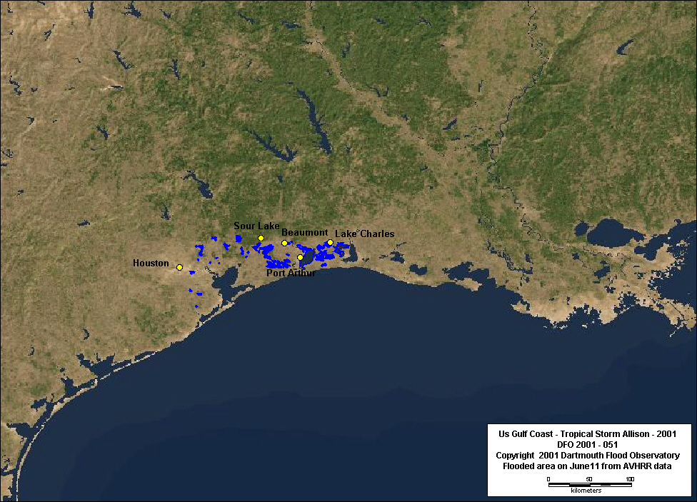
3. Gulf Coast inundation map based upon AVHRR data from 6/11/01
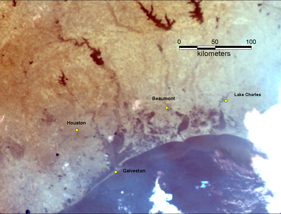
4. Geocorrected AVHRR image of Houston area from early morning of 6/11/01
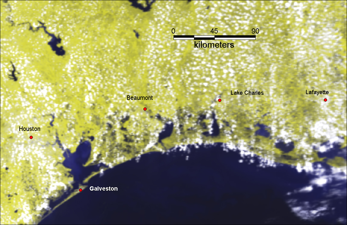
5. Geocorrected AVHRR image of Texas and Lousiana from 6/11/01
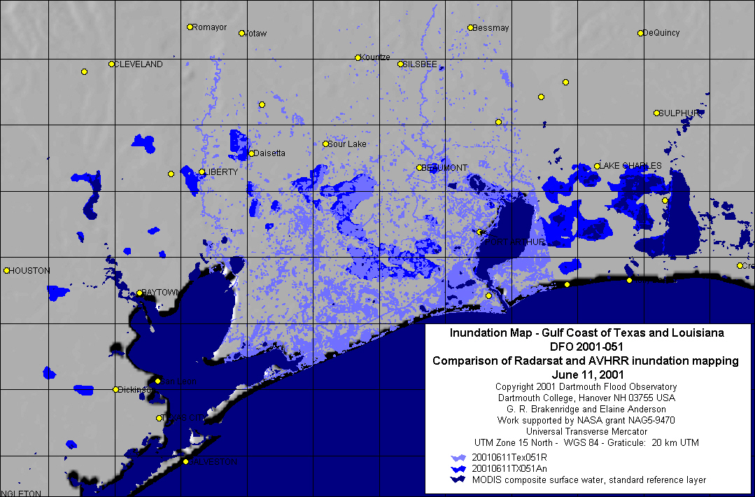
6. Inundation map of Gulf Coast based on Radarsat data from June 11, 2001
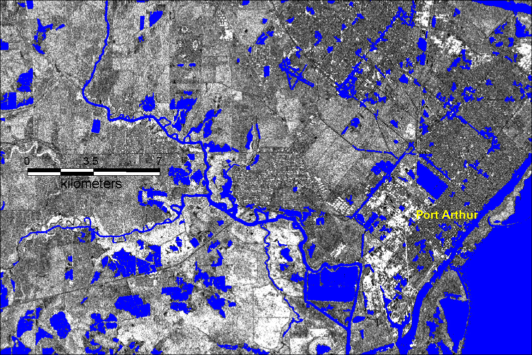
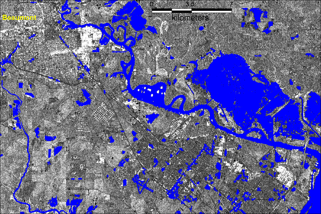
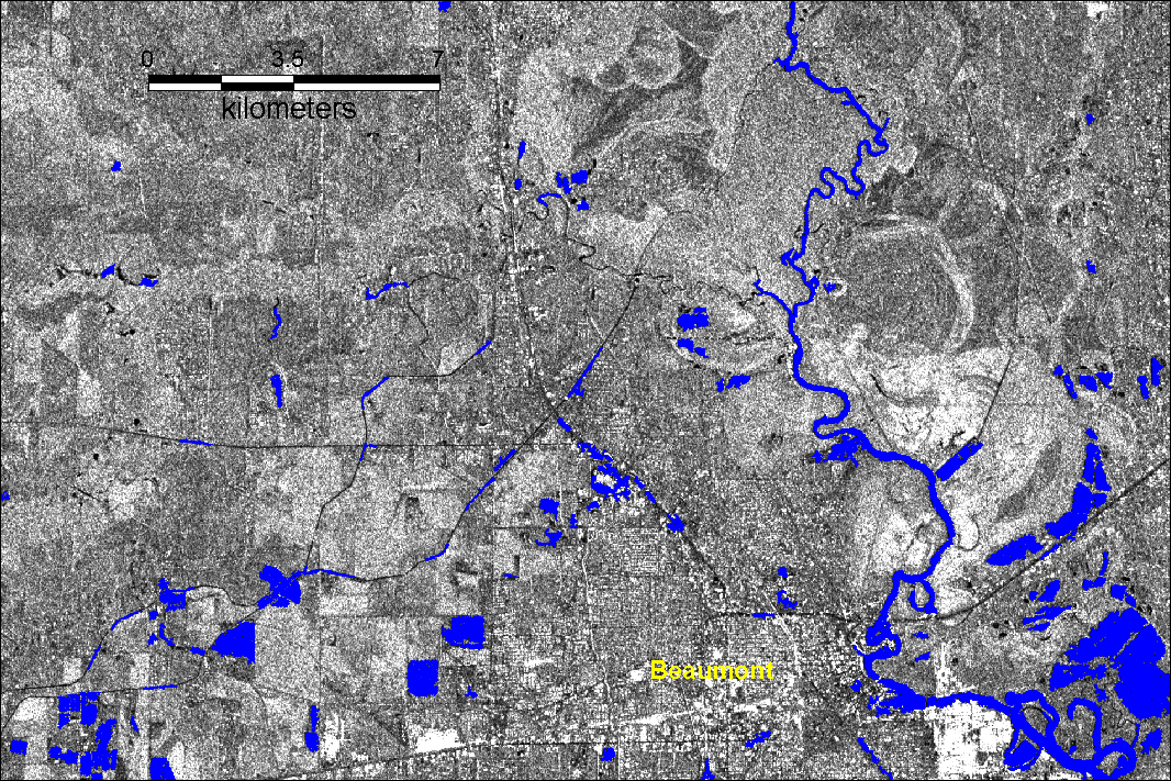
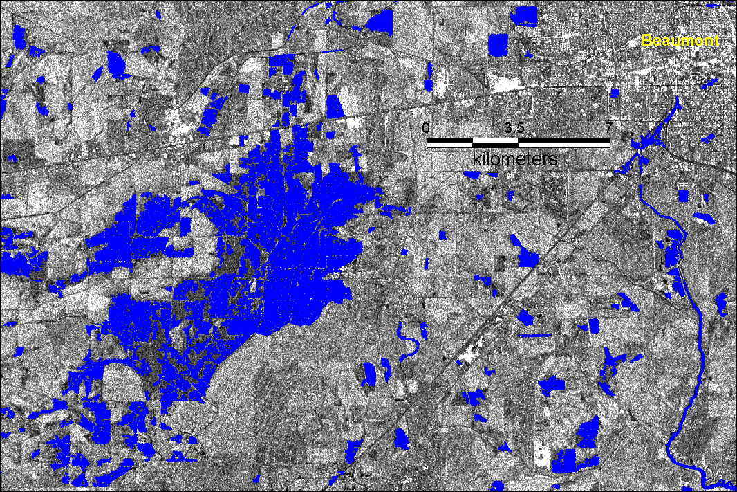
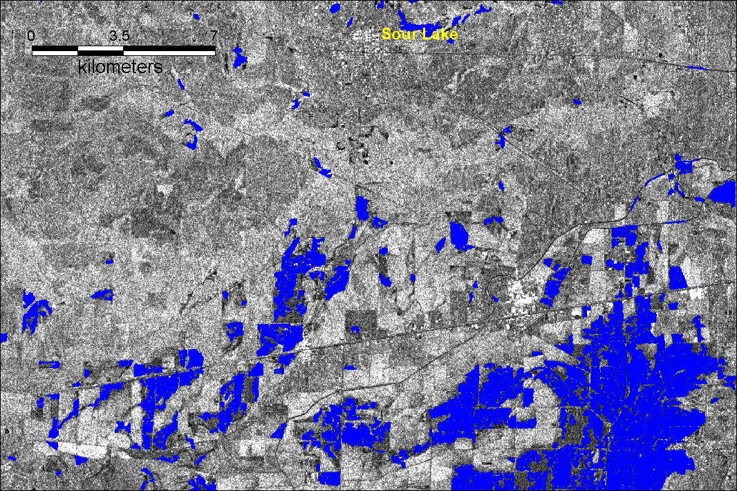
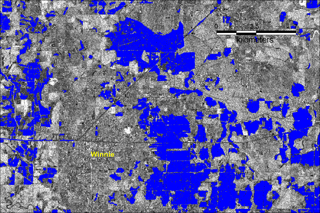
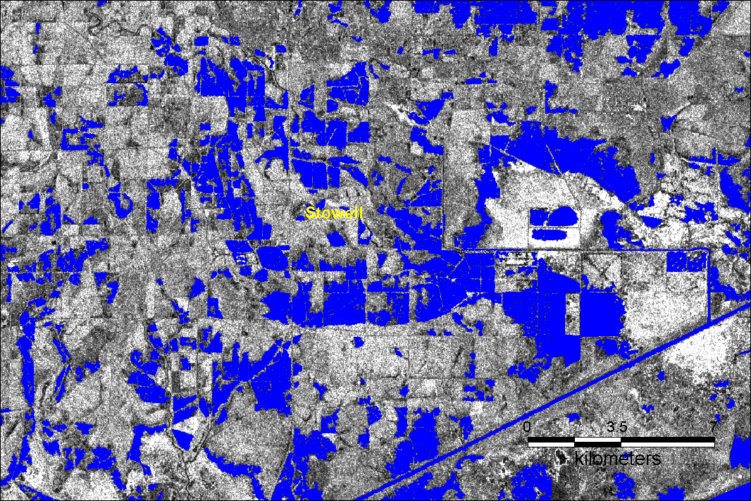
7. Radarsat image maps based on data from June 11, 2001. Water vectors (blue polygons) superimposed on Radarsat images.