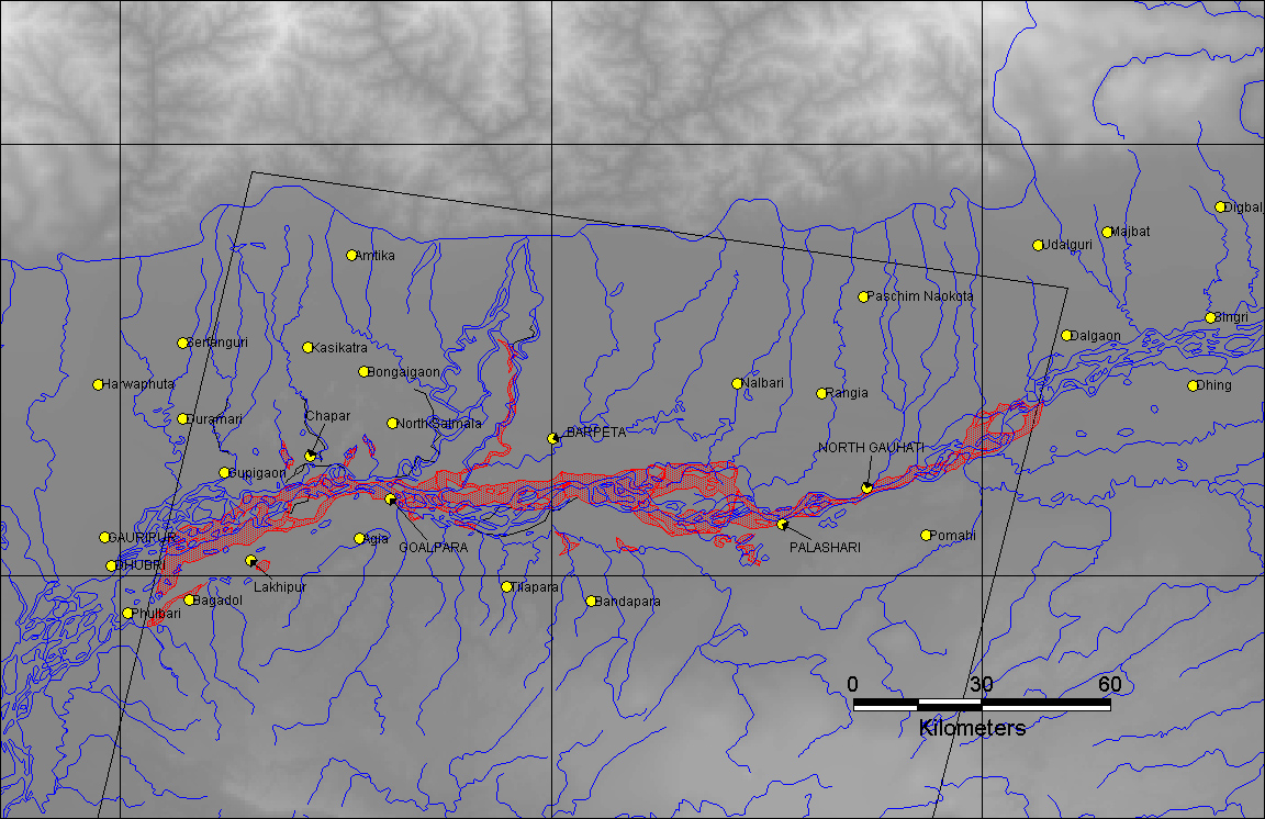
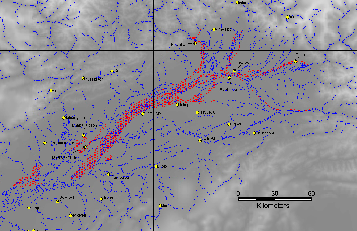
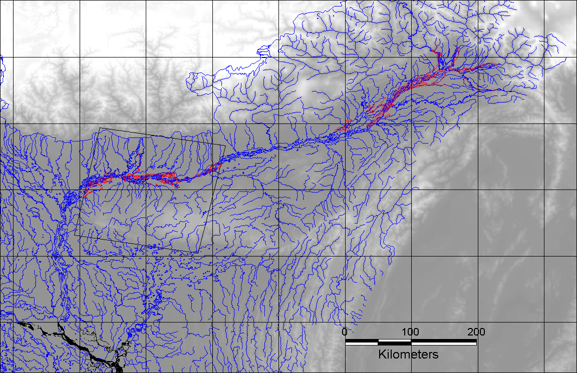
DFO 2000-26
Flooding: 06/10/00-ongoing
Eastern India, Bramaputra River
Index of DFO images or image maps:
1. Induation Map of Gauhati
area based on Landsat 7 browse image from June 3, 2000.
2. Inundation Map of Tinsukia
area based on AVHRR data from June 16, 2000
3. Inundation Map of the
Bramaputra River for June, 2000
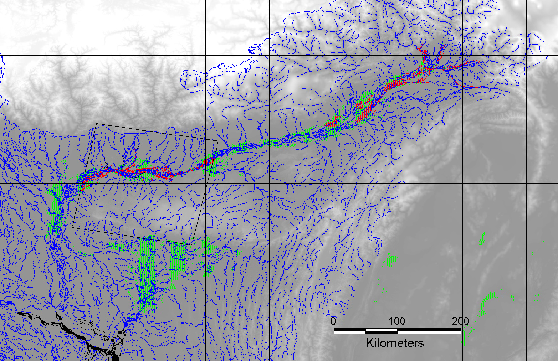
4. Bramaputra River flooding
- comparison of June 2000 (red areas) to the 1998 inundated areas
(in green)