Index of DFO images or image maps:
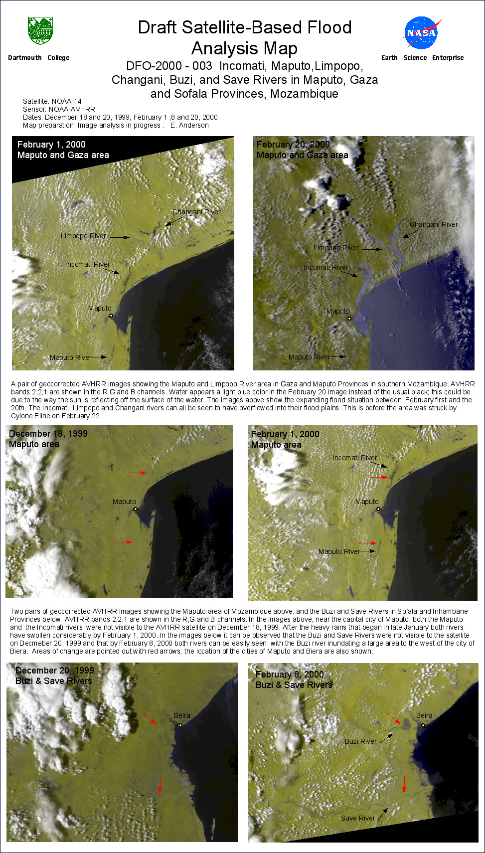
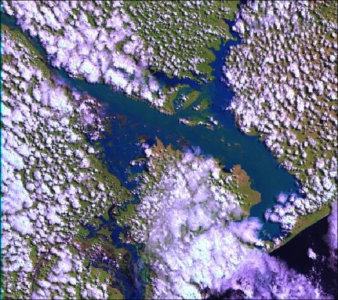
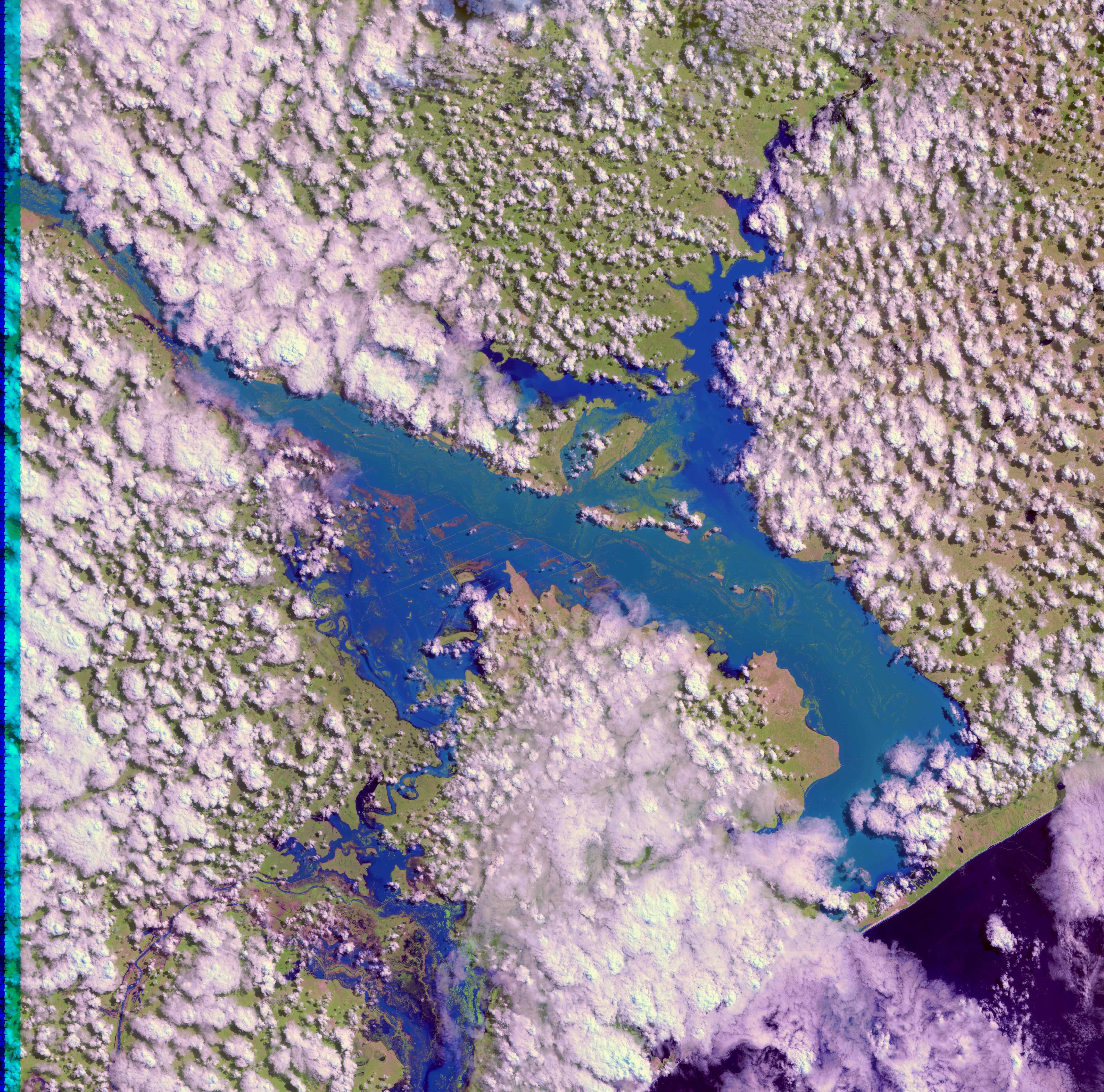
1. AVHRR images of Flooding in Mozambique in late January and February 2000
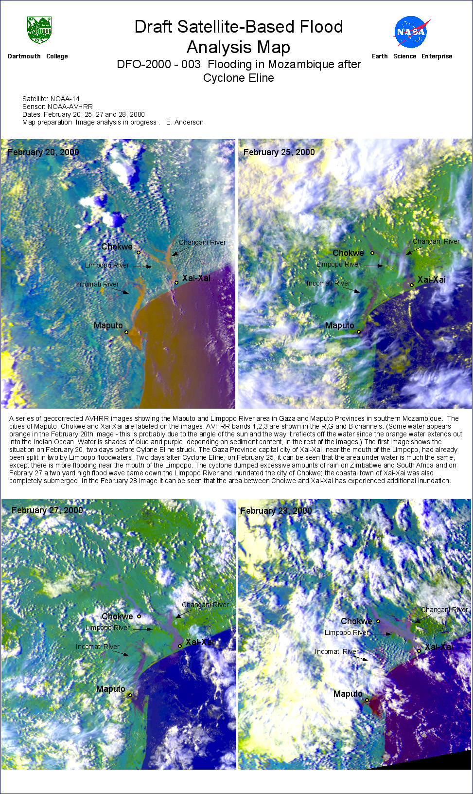
2. AVHRR image series of Mozambique after Cyclone Eline
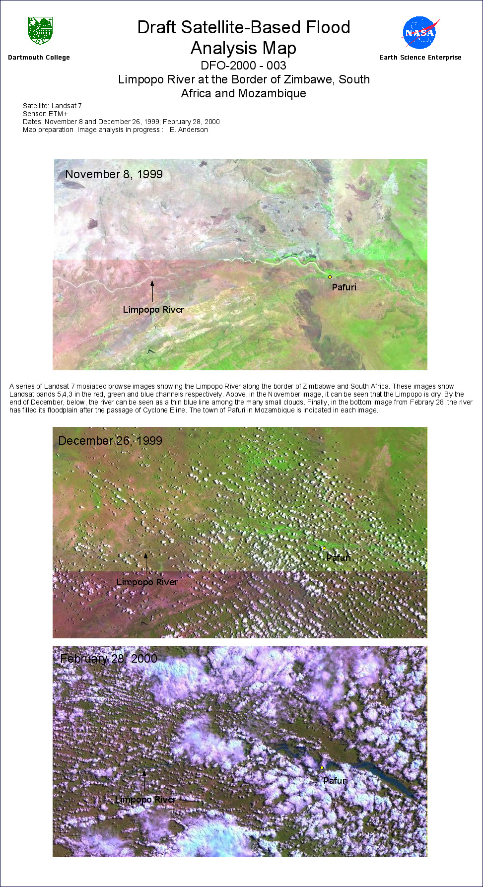
3. Landsat 7 image series of the Limpopo River at the Border of Zimbawe, South Africa and Mozambique
4. Radarsat Scansar Image Maps of the Limpopo and Incomati rivers, February 23, 2000
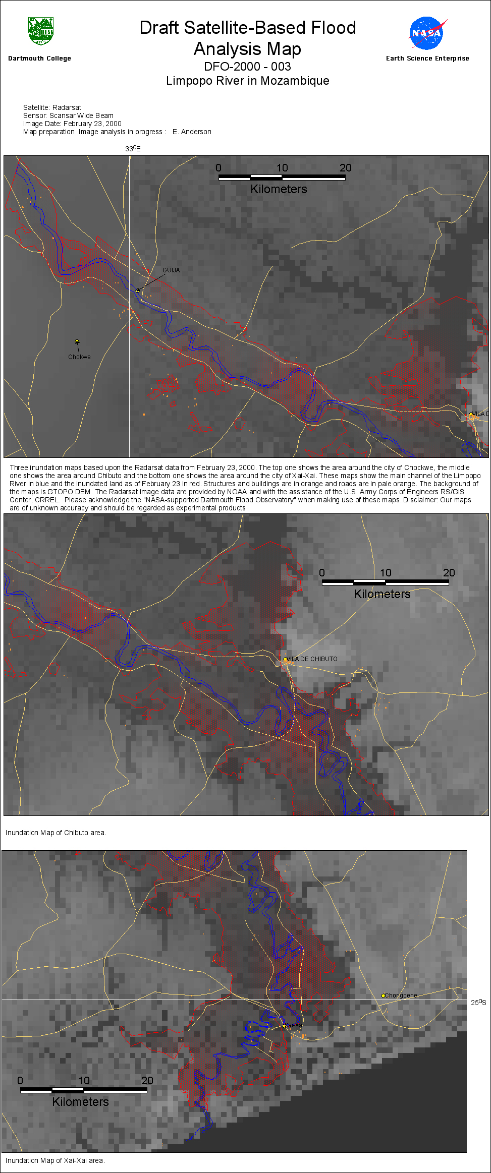
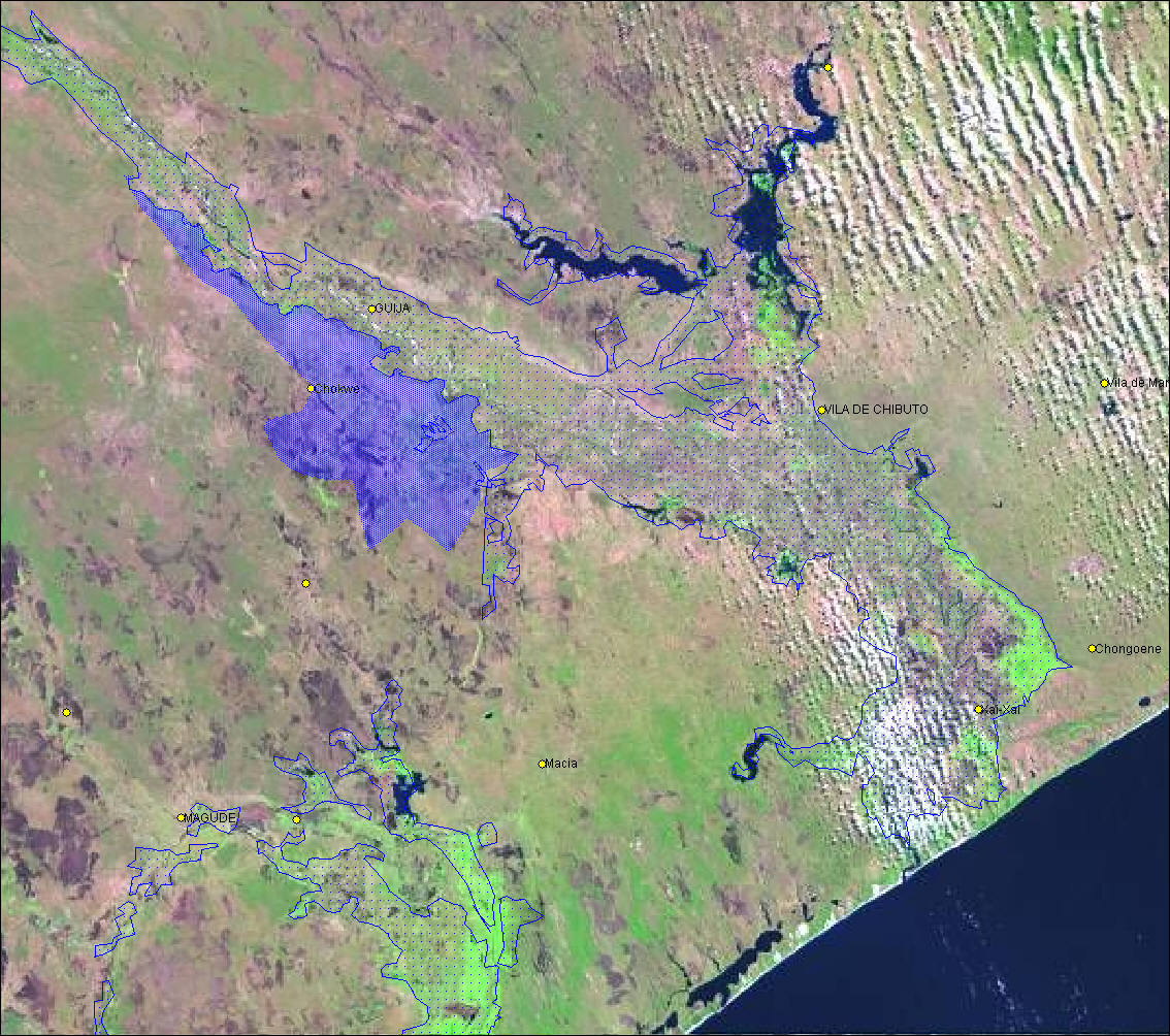
5. Inundation Maps of Chockwe, Chibuto and Xai-Xai based upon February 23 Radarsat Data
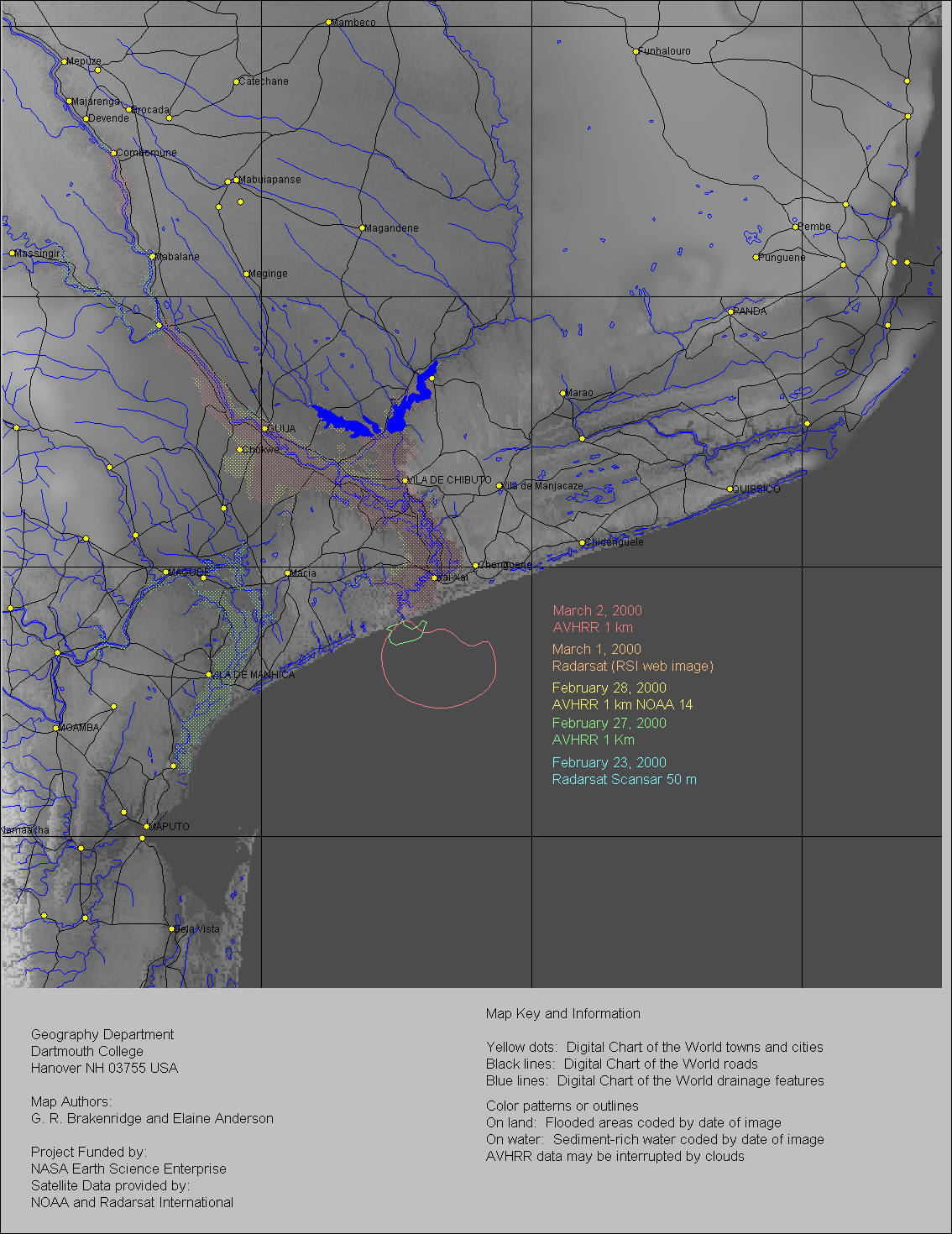
6. Multi-temporal Map based on AVHRR and Radarsat data, Feb. 23-Mar 2, 2000
7. Final Composite Map, Feb 23-Mar 1, Radarsat-based mapping displayed on Landsat 7 pre-flood scene
8. Landsat 7 image for March 1, 2000 of the Limpopo River
9. High Resolution Landsat 7 image for March 1, 2000 of the Limpopo River
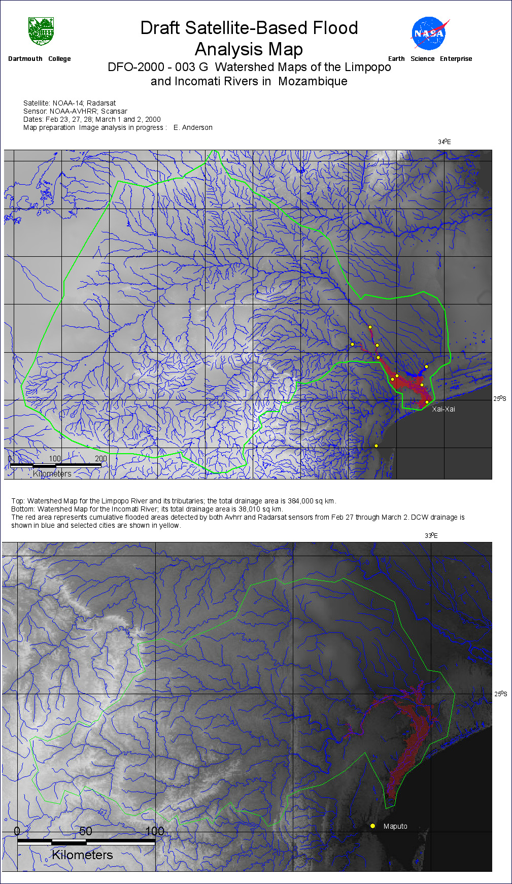
10. Watershed Maps of the Limpopo and Incomati Rivers
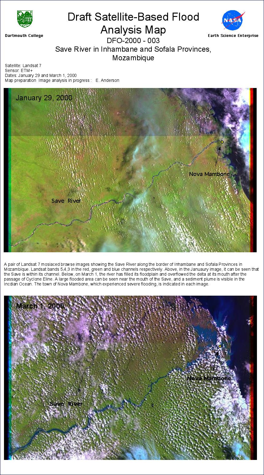
11. Landsat 7 Images of the Save River
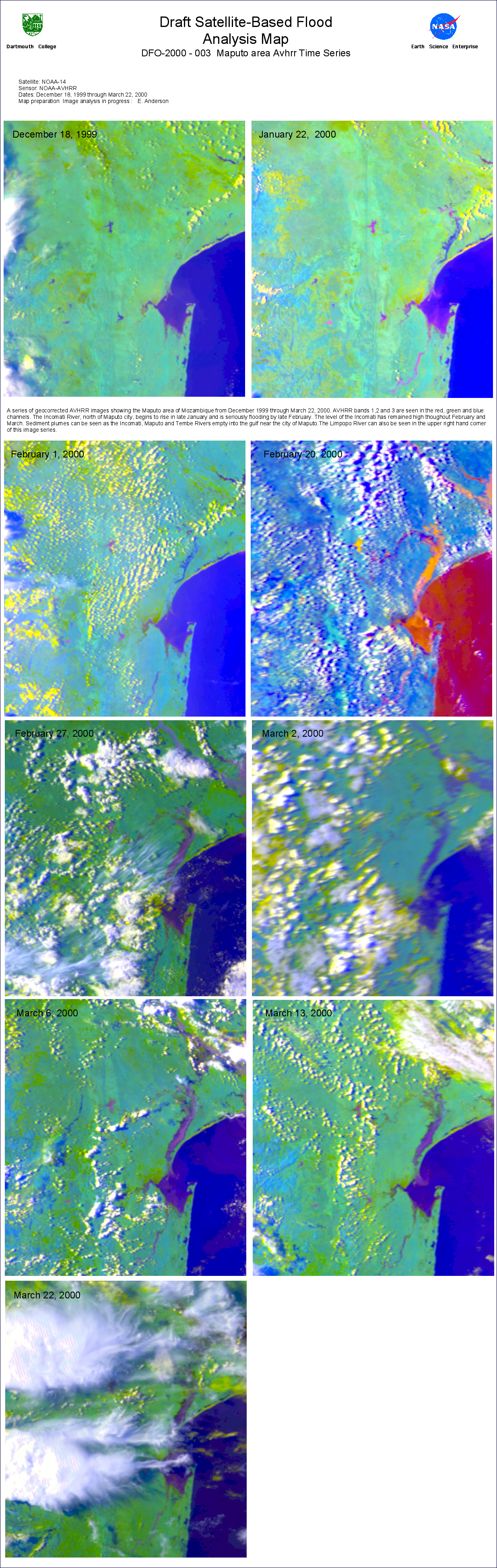
12. Incomati River AVHRR Image Time Series December 18, 1999 - March 22, 2000