NASA Near Real Time Experimental Flood Maps
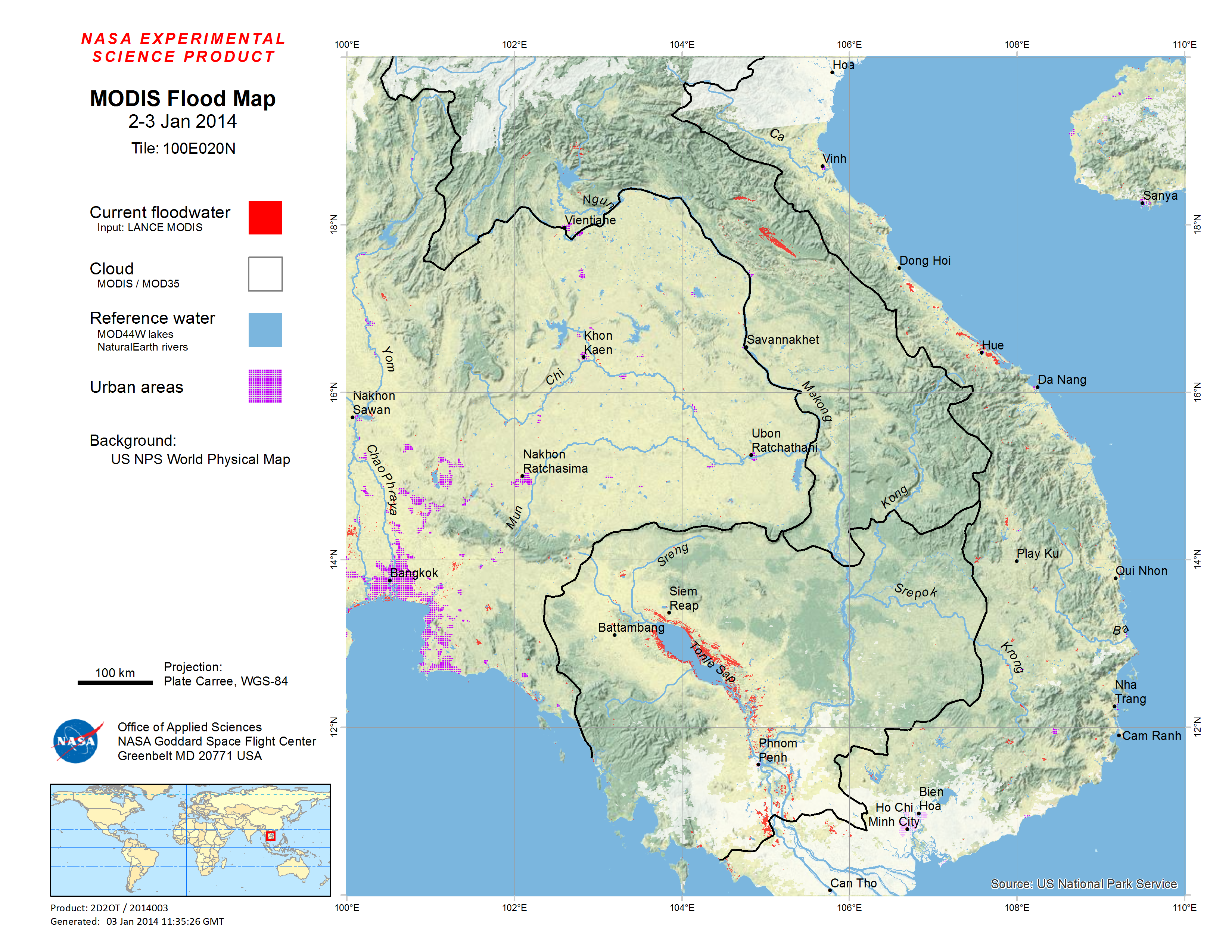
100E020N
Automated mapping of surface water changes using the LANCE MODIS rapid response processor.
Updated Daily. See also the Surface Water Record
MODIS data (four scenes, Terra and Aqua, over two days) are used to classify water pixels using an algorithm developed at the Dartmouth Flood Observatory. Use of four images (two sequential days) for each daily update allows most cloud shadow noise to be removed, and decreases obscuration from changing cloud cover. Data are processed at NASA Goddard Space Flight Center, and transmitted to the Flood Observatory for display.
Recent GIS data for this display can be retrieved from http://csdms.colorado.edu/pub/flood_observatory/MODISlance/
See also the technical description of this and other displays at this address.
Cite this online publication as: Policelli, F., Slayback, D., Brakenridge, G., Sun, J., Ouzounov, D., and Kettner, A.J., "NASA Near Real Time Experimental Flood Maps": http://floodobservatory.colorado.edu/.
Project supported by NASA grants to F. Policelli at Goddard Space Flight Center, and to G. Brakenridge at Dartmouth College and the University of Colorado. Overall principle investigator is F. Policelli, NASA Goddard Space Flight Center.