
MODIS Mapping of 2013 Flooding along the Elbe River, Germany
(See also the applicable Surface Water Record Map)
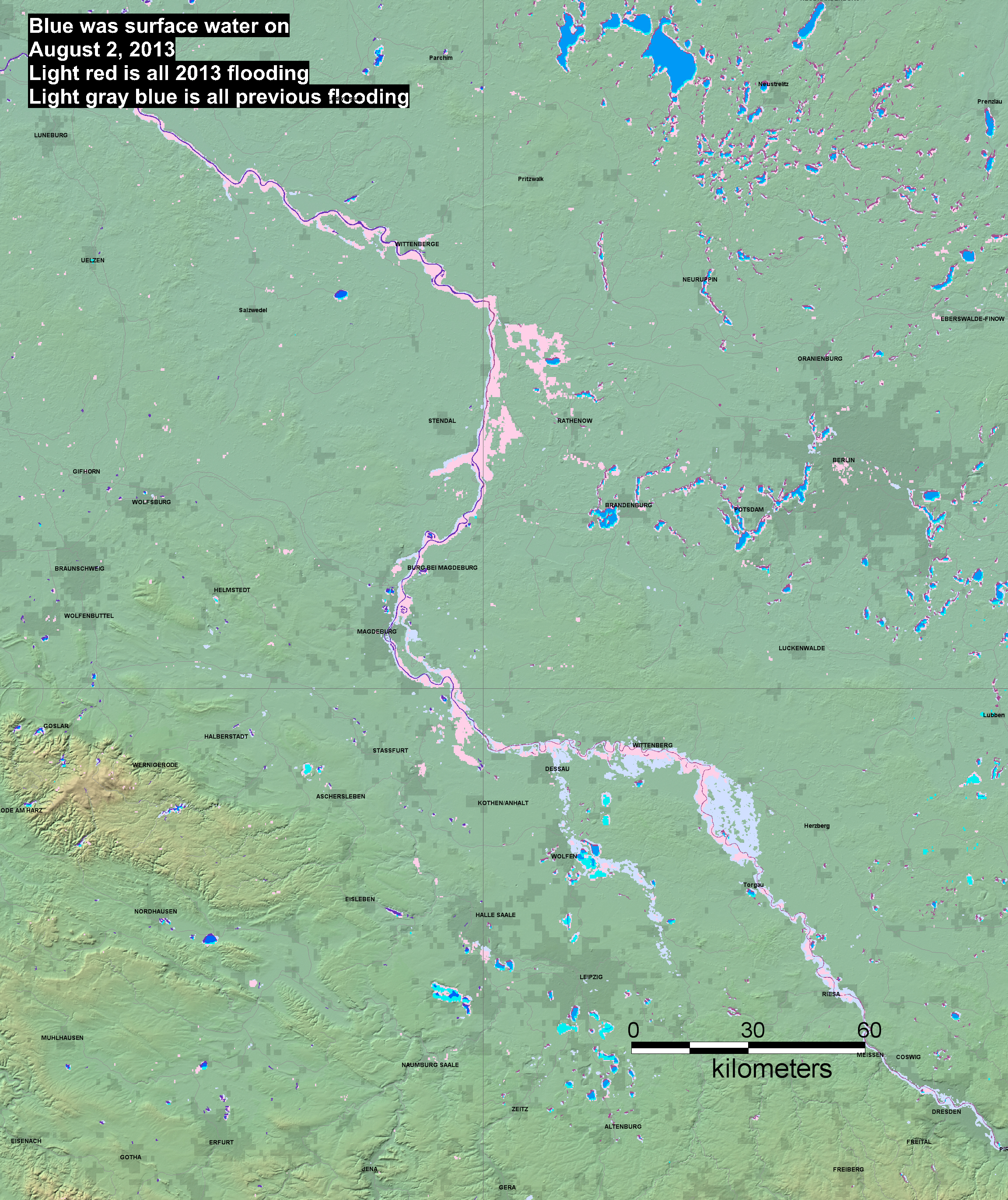
Explanation
At the time of map date:
Large areas of purple are dry land (formerly water in February, 2000, when the reference SWBD water database was obtained for all map sheets). At higher latitudes, such areas may instead be ice-covered water. Small areas of purple are water mapped by SWBD, but are too small to be mappable by MODIS. Dark blue is current water, imaged by MODIS and by SWBD (not flooding). Bright blue is flooding: expanded water areas mapped by MODIS compared to SWBD. Any post-2000 reservoir or new water body is also depicted in bright blue. Finally, light blue-gray is all previous flooding imaged and mapped by the Flood Observatory (now dry land).