
NASA-MODIS Rapid Response Record of 2011 NE USA Tropical Storm Irene Flooding, Western Vermont
.
Notes: 1) Noise caused by cloud shadows are not yet removed.
GIS files used (new and reference surface water polygons; located in USandMexico directory):
New Water files:
Reference Water files:
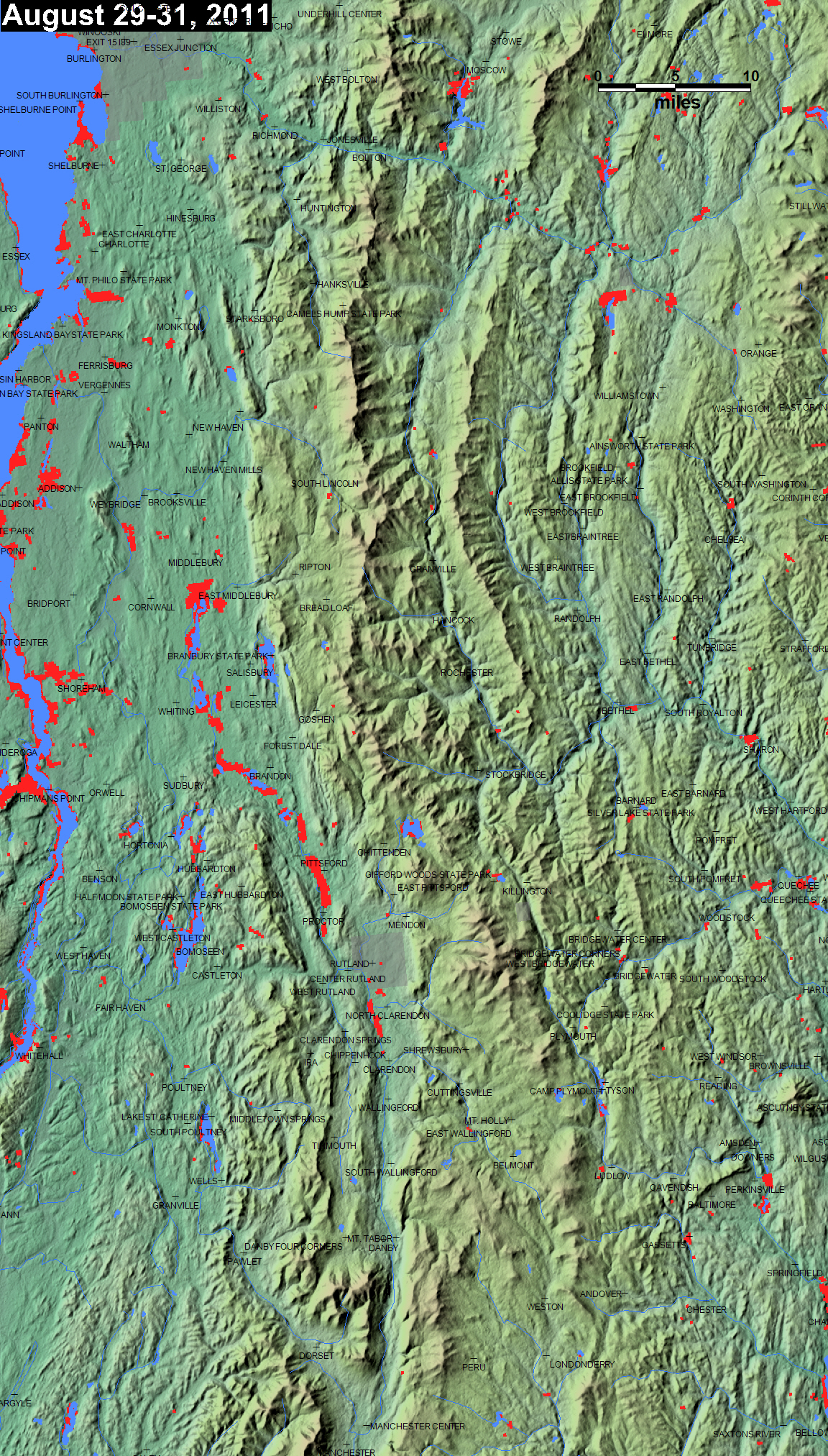
The above map shows, in red, the extent of flooding as imaged by the two MODIS sensors aboard Terra and Aqua during the accumulation period indicated. Dark blue illustrates "normal" surface water prior to the flooding (most commonly, SRTM water from February, 2000). Light red is flooding imaged earlier this year and/or during this flood event, but where land is now dry. A Geotiff file is also available using the link above the map.
The GIS new water files provide only the current surface water component of the above map. Flooding, in red, is water in excess of of the reference water. Reference water GIS files are also available: from the Masks folder in the appropriate continent directory. Four individual files comprise the complete quartet for each individual Mapinfo file name.
These maps and GIS data are online publications of the Dartmouth Flood Observatory, G. R. Brakenridge, A. Kettner, F. Policelli, and D. Slayback, 2011. Please cite this source.