
NASA-MODIS Rapid Response Record of 2011 Flooding in Thailand
Explanation
GIS files used (new and reference surface water polygons):
New Water files:
NASA-GSFC MODIS NRT data, see Mekong Surface Water Record.
Reference Water files:
TBD
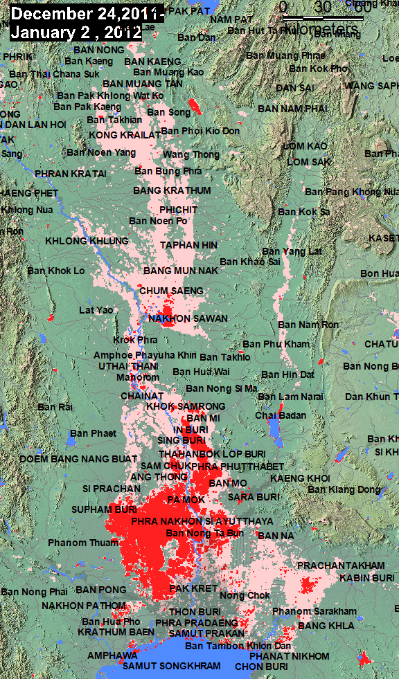
The above map shows, in red, the extent of flooding as imaged by the two MODIS sensors aboard Terra and Aqua during a 10-day accumulation period ending on the date indicated. Dark blue illustrates "normal" surface water prior to the flooding (most commonly, SRTM SWDB water from February, 2000). Light red is any flooding imaged earlier this year and/or during this flood event, but where land is now dry. Light blue is all flooding, 2000-present, imaged and mapped to date. A Geotiff file is also available using the link above the map.
Reference water GIS files are available from the Masks folder in the appropriate continent directory. Note: in all cases, four individual files comprise the complete quartet for each individual Mapinfo file name.
These maps and GIS data are online publications of the Dartmouth Flood Observatory, G. R. Brakenridge, A. Kettner, F. Policelli, and D. Slayback, 2011. Please cite this source.