

![]()
![]()
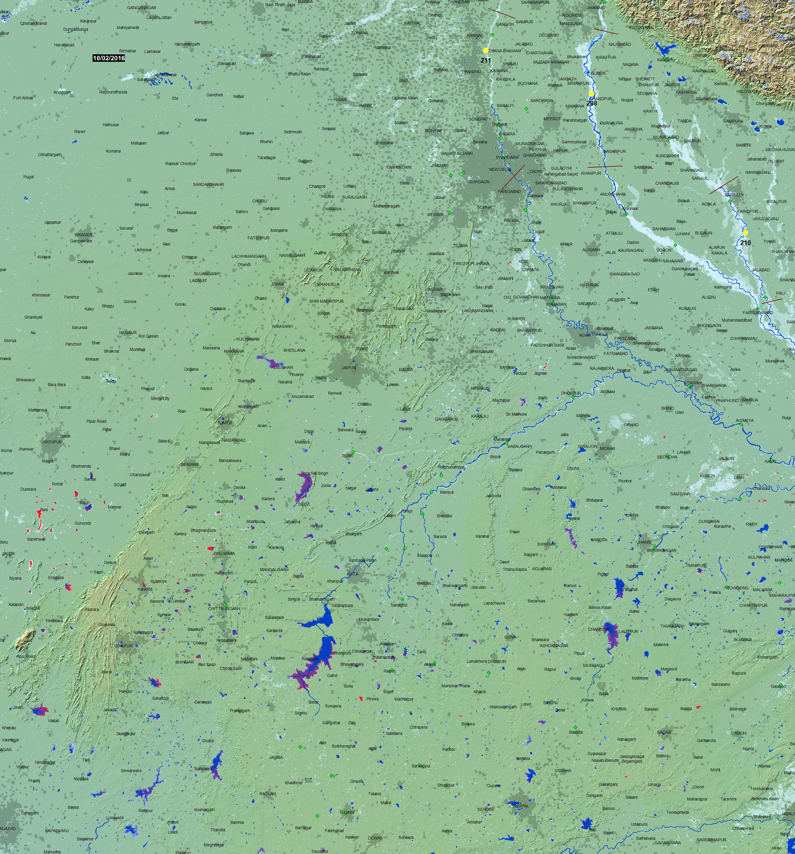
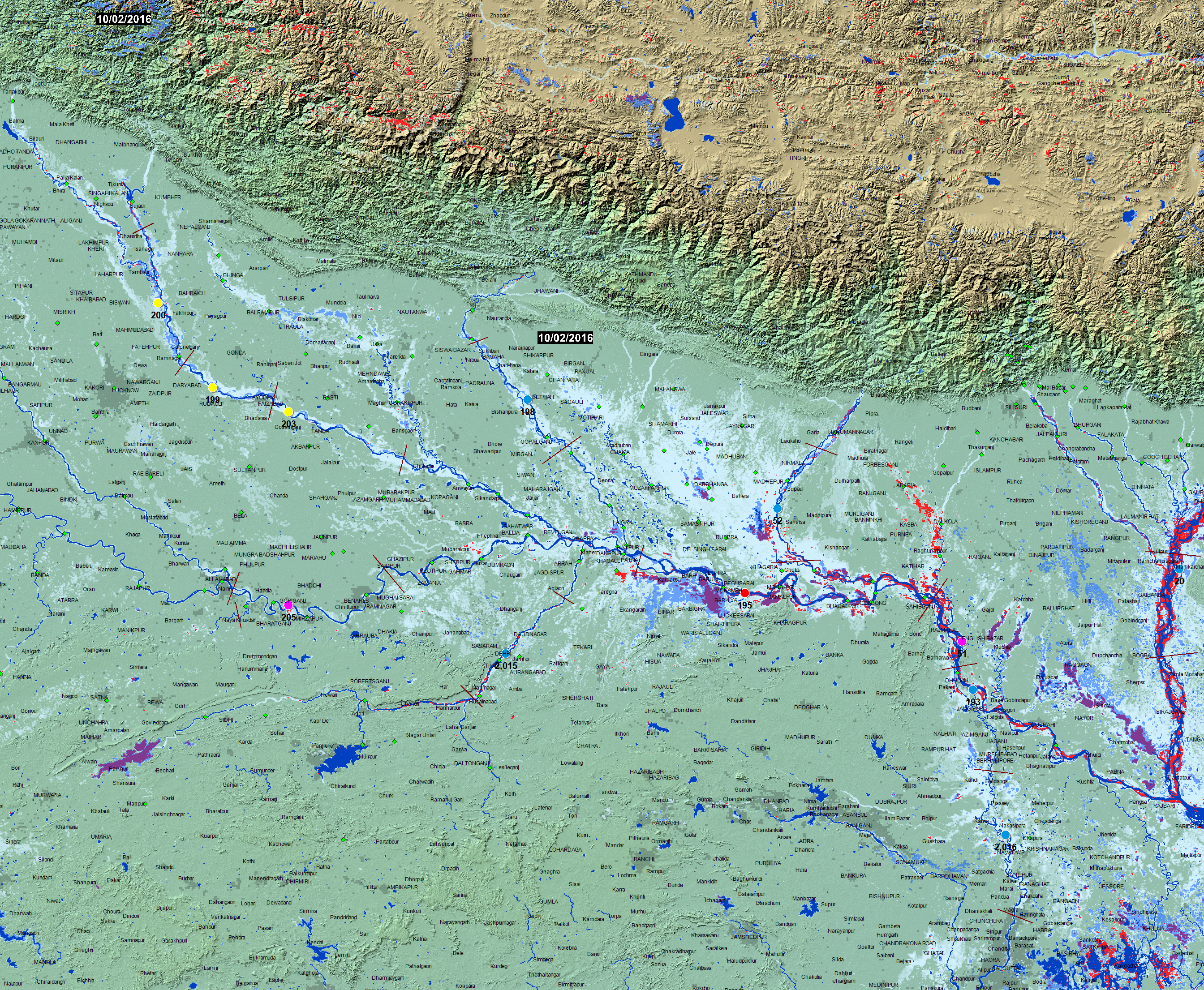
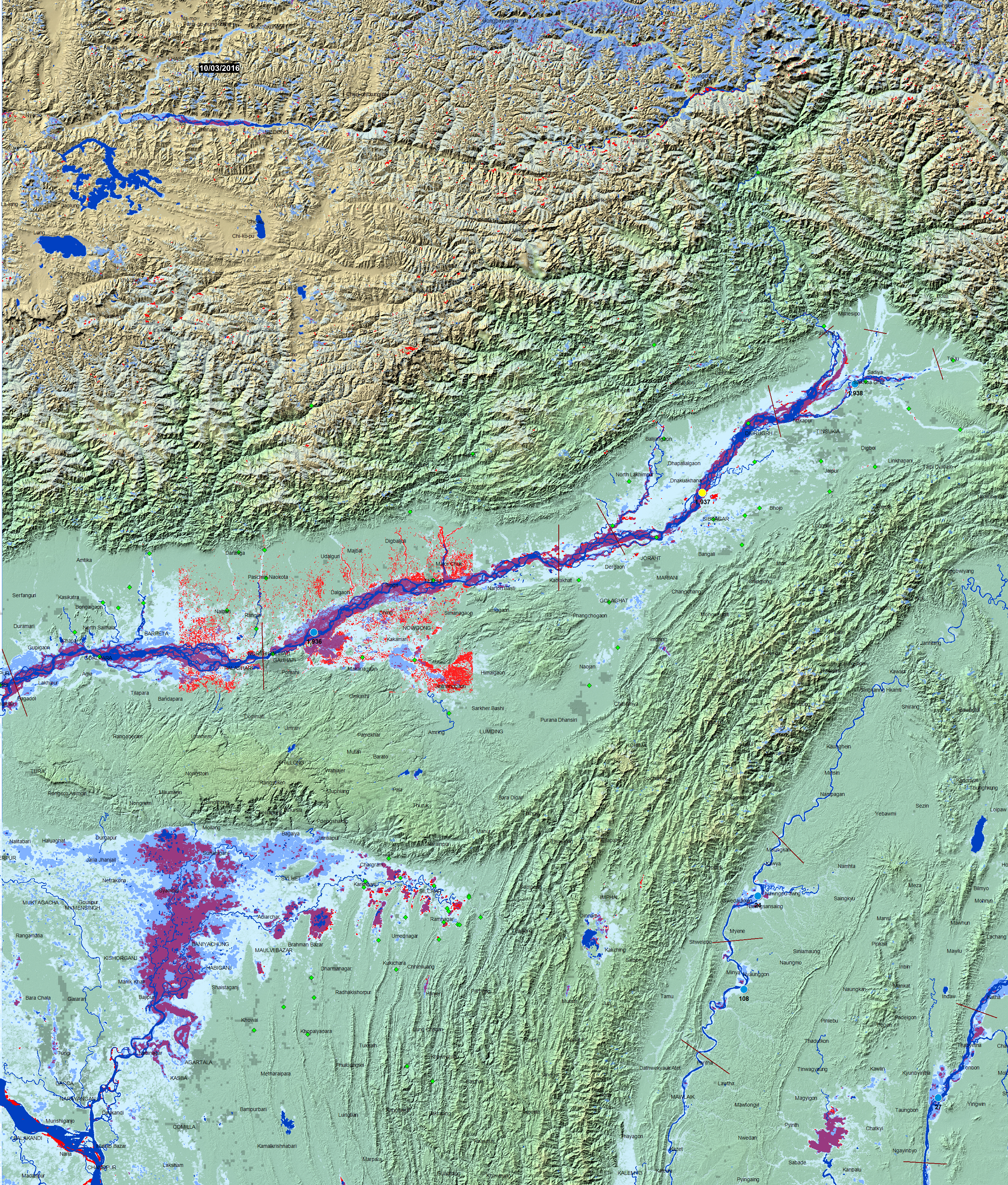
Ganges-Brahmaputra MODIS NRT Current Flood Conditions
Updated Daily at 16:45 Local (Denver) Time.
Red, Major Flooding. Surface water is larger in extent than the Blue reference water.
Blue, Average Annual High Water.
Magenta, Surface water is within limits of the reference water.
Dark Blue, Winter surface water. Winter reference water from the SRTM mission data, February, 2000.
Light Blue. Previously flooded areas imaged by NASA's twin MODIS sensors since January, 2000.
MODIS water mapping information at a spatial resolution of 250 m is from NASA's Terra and Aqua satellites via an automated water classifier. The Flood Observatory accumulates daily files from a special processor at the NASA GSFC over 14 days (running forward, updated each day). This red and magenta layer provides nearly complete geographic coverage even under cloudy conditions. New artificial reservoirs built since 2000 also appear as magenta.
River Watch sites (colored dots): Yellow dots: low flow (<20th percentile discharge for this day of the year, 2003-2013; Blue: normal flow; Purple: moderate flooding (>1.5 yr recurrence interval); Red, major flooding (> 5 yr recurrence interval).
WESTERN GANGES-BRAHMAPUTRA BASIN
CENTRAL GANGES-BRAHMAPUTRA BASIN
EASTERN GANGES-BRAHMAPUTRA BASIN
(Counting started: April 5, 2016)