


![]()
![]()
Updated Daily at 16:45 Local Time (Denver)
The Ganges-Brahmaputra Flood Awareness and Prediction System is a collaborative project led by Dr. Tom Hopson, at the National Center for Atmospheric Research (NCAR), and Dr. Robert Brakenridge, Dartmouth Flood Observatory, University of Colorado, both in Boulder, Colorado, USA.
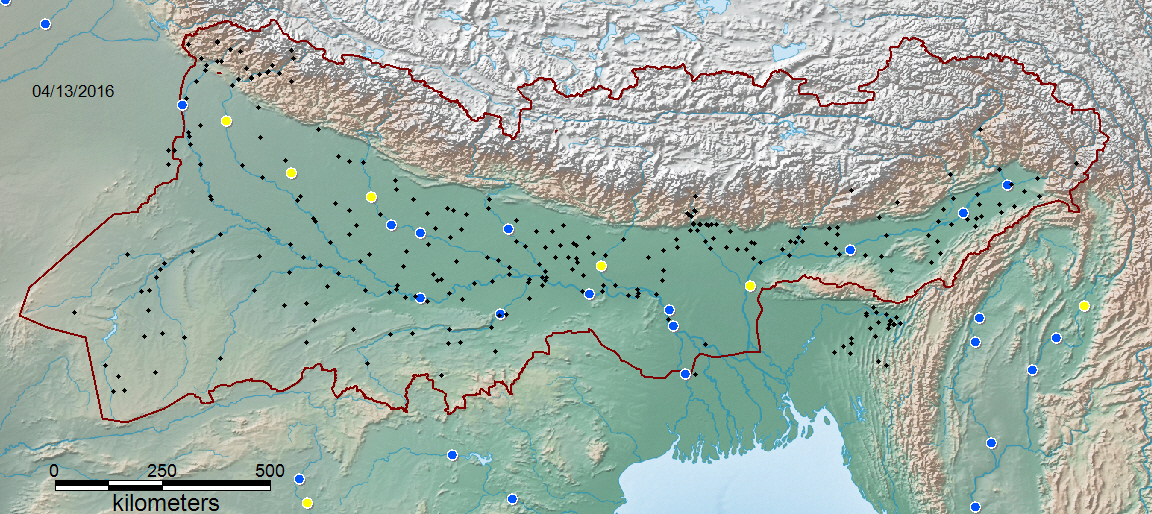
Symbology: Black dots: all forecast points. Colored Dots (clickable): discharge measurement/inundation prediction sites. Yellow dots: low flow (<20th percentile discharge for this day of the year, 2003-2013; Blue: normal flow; Purple: moderate flooding (>1.5 yr recurrence interval); Red, major flooding (> 5 yr recurrence interval).
Co-located river discharge forecasts from the NCAR system are now (April, 2016) being added to each measurement site. A second portal display will show forecast information instead of current status.
Funding: "Development of a Flood Forecasting System for the Ganges and Brahmaputra Basins using Ensemble Weather Forecasts and Satellite-based Precipitation, River Widths and Heights", South Asia Water Initiative, The World Bank.
Data are experimental, are not official weather or streamflow forecasts, and may be subject to intermittent outages. Viewers requiring official river stage observations and forecasts should consult the Indian Central Water Commission at: india-water.gov.in or other national water ministries.The initial processing of the River Watch microwave data is provided by the Joint Research Centre of the European Commission: Technical Report and Data Product Specifications, Global Flood Detection System.
Counting since: April 14, 2016